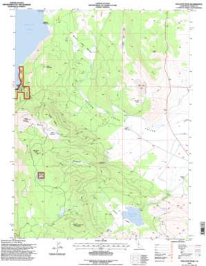
Gallatin Peak Topo Map California
To zoom in, hover over the map of Gallatin Peak
USGS Topo Quad 40120e6 - 1:24,000 scale
| Topo Map Name: | Gallatin Peak |
| USGS Topo Quad ID: | 40120e6 |
| Print Size: | ca. 21 1/4" wide x 27" high |
| Southeast Coordinates: | 40.5° N latitude / 120.625° W longitude |
| Map Center Coordinates: | 40.5625° N latitude / 120.6875° W longitude |
| U.S. State: | CA |
| Filename: | o40120e6.jpg |
| Download Map JPG Image: | Gallatin Peak topo map 1:24,000 scale |
| Map Type: | Topographic |
| Topo Series: | 7.5´ |
| Map Scale: | 1:24,000 |
| Source of Map Images: | United States Geological Survey (USGS) |
| Alternate Map Versions: |
Gallatin Peak CA 1989, updated 1989 Download PDF Buy paper map Gallatin Peak CA 1995, updated 1998 Download PDF Buy paper map Gallatin Peak CA 2012 Download PDF Buy paper map Gallatin Peak CA 2015 Download PDF Buy paper map |
| FStopo: | US Forest Service topo Gallatin Peak is available: Download FStopo PDF Download FStopo TIF |
1:24,000 Topo Quads surrounding Gallatin Peak
> Back to 40120e1 at 1:100,000 scale
> Back to 40120a1 at 1:250,000 scale
> Back to U.S. Topo Maps home
Gallatin Peak topo map: Gazetteer
Gallatin Peak: Areas
Gallatin Burn elevation 2040m 6692′Gallatin Peak: Capes
Miners Point elevation 1558m 5111′Gallatin Peak: Dams
Round Valley 228 Dam elevation 1623m 5324′Gallatin Peak: Flats
Deans Meadow elevation 1956m 6417′Murrers Upper Meadow elevation 1549m 5082′
Gallatin Peak: Lakes
Big Dry Lake elevation 1591m 5219′Colman Lake elevation 1960m 6430′
Lower Dry Lake elevation 1634m 5360′
Mahogany Lake elevation 2056m 6745′
Summit Lake elevation 1580m 5183′
Gallatin Peak: Reservoirs
Round Valley Reservoir elevation 1623m 5324′Gallatin Peak: Ridges
Deans Ridge elevation 2072m 6797′Gallatin Peak: Summits
Black Mountain elevation 1919m 6295′Gallatin Peak elevation 2112m 6929′
Greens Peak elevation 2171m 7122′
Mahogany Peak elevation 2175m 7135′
Gallatin Peak: Valleys
Romstock Canyon elevation 1533m 5029′Round Valley elevation 1623m 5324′
Gallatin Peak digital topo map on disk
Buy this Gallatin Peak topo map showing relief, roads, GPS coordinates and other geographical features, as a high-resolution digital map file on DVD:


