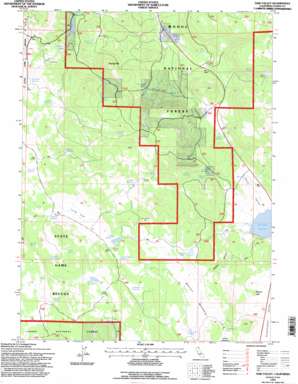
Said Valley Topo Map California
To zoom in, hover over the map of Said Valley
USGS Topo Quad 40120h7 - 1:24,000 scale
| Topo Map Name: | Said Valley |
| USGS Topo Quad ID: | 40120h7 |
| Print Size: | ca. 21 1/4" wide x 27" high |
| Southeast Coordinates: | 40.875° N latitude / 120.75° W longitude |
| Map Center Coordinates: | 40.9375° N latitude / 120.8125° W longitude |
| U.S. State: | CA |
| Filename: | o40120h7.jpg |
| Download Map JPG Image: | Said Valley topo map 1:24,000 scale |
| Map Type: | Topographic |
| Topo Series: | 7.5´ |
| Map Scale: | 1:24,000 |
| Source of Map Images: | United States Geological Survey (USGS) |
| Alternate Map Versions: |
Said Valley CA 1983, updated 1983 Download PDF Buy paper map Said Valley CA 1993, updated 1996 Download PDF Buy paper map Said Valley CA 2012 Download PDF Buy paper map Said Valley CA 2015 Download PDF Buy paper map |
| FStopo: | US Forest Service topo Said Valley is available: Download FStopo PDF Download FStopo TIF |
1:24,000 Topo Quads surrounding Said Valley
> Back to 40120e1 at 1:100,000 scale
> Back to 40120a1 at 1:250,000 scale
> Back to U.S. Topo Maps home
Said Valley topo map: Gazetteer
Said Valley: Areas
Horse Meadow elevation 1716m 5629′Walton Meadow elevation 1717m 5633′
Said Valley: Flats
Long Flat elevation 1773m 5816′Said Valley: Lakes
Mapes Lake elevation 1738m 5702′Said Valley: Reservoirs
Abbott Reservoir elevation 1760m 5774′Acre Foot Reservoir elevation 1738m 5702′
Ambrose Reservoir elevation 1878m 6161′
Boffengers Reservoir elevation 1798m 5898′
Catfish Reservoir elevation 1772m 5813′
Clay Flat Reservoir elevation 1740m 5708′
Drift Fence Reservoir elevation 1742m 5715′
Hatfield Reservoir elevation 1796m 5892′
Hazelton Reservoir elevation 1780m 5839′
Juniper Spring Reservoir elevation 1780m 5839′
Long Flat Reservoir elevation 1769m 5803′
Long Reservoir elevation 1768m 5800′
Spring Hill Reservoir elevation 1750m 5741′
Stratton Reservoir elevation 1695m 5561′
Wing Reservoir elevation 1712m 5616′
Said Valley: Springs
Abbott Spring elevation 1794m 5885′Box Spring elevation 1927m 6322′
Chicken Spring elevation 1816m 5958′
Coon Camp Spring elevation 1727m 5666′
Dago Spring elevation 1848m 6062′
Daisy Dean Spring elevation 1663m 5456′
Four Pine Spring elevation 1955m 6414′
Horse Meadow Spring elevation 1738m 5702′
Indian Spring elevation 1638m 5374′
Italian Spring elevation 1839m 6033′
Juniper Spring elevation 1780m 5839′
Rock Spring elevation 1793m 5882′
Six Mile Spring elevation 1739m 5705′
Spring Hill Spring elevation 1720m 5643′
Stratton Spring elevation 1736m 5695′
Upper McBride Spring elevation 1586m 5203′
Willow Spring elevation 1774m 5820′
Said Valley: Streams
West Fork Willow Creek elevation 1578m 5177′Said Valley: Summits
Bosco Hill elevation 1664m 5459′Hayden Hill elevation 1924m 6312′
Spring Hill elevation 1955m 6414′
Said Valley: Valleys
Said Valley elevation 1633m 5357′Wildcat Canyon elevation 1640m 5380′
Said Valley digital topo map on disk
Buy this Said Valley topo map showing relief, roads, GPS coordinates and other geographical features, as a high-resolution digital map file on DVD:


