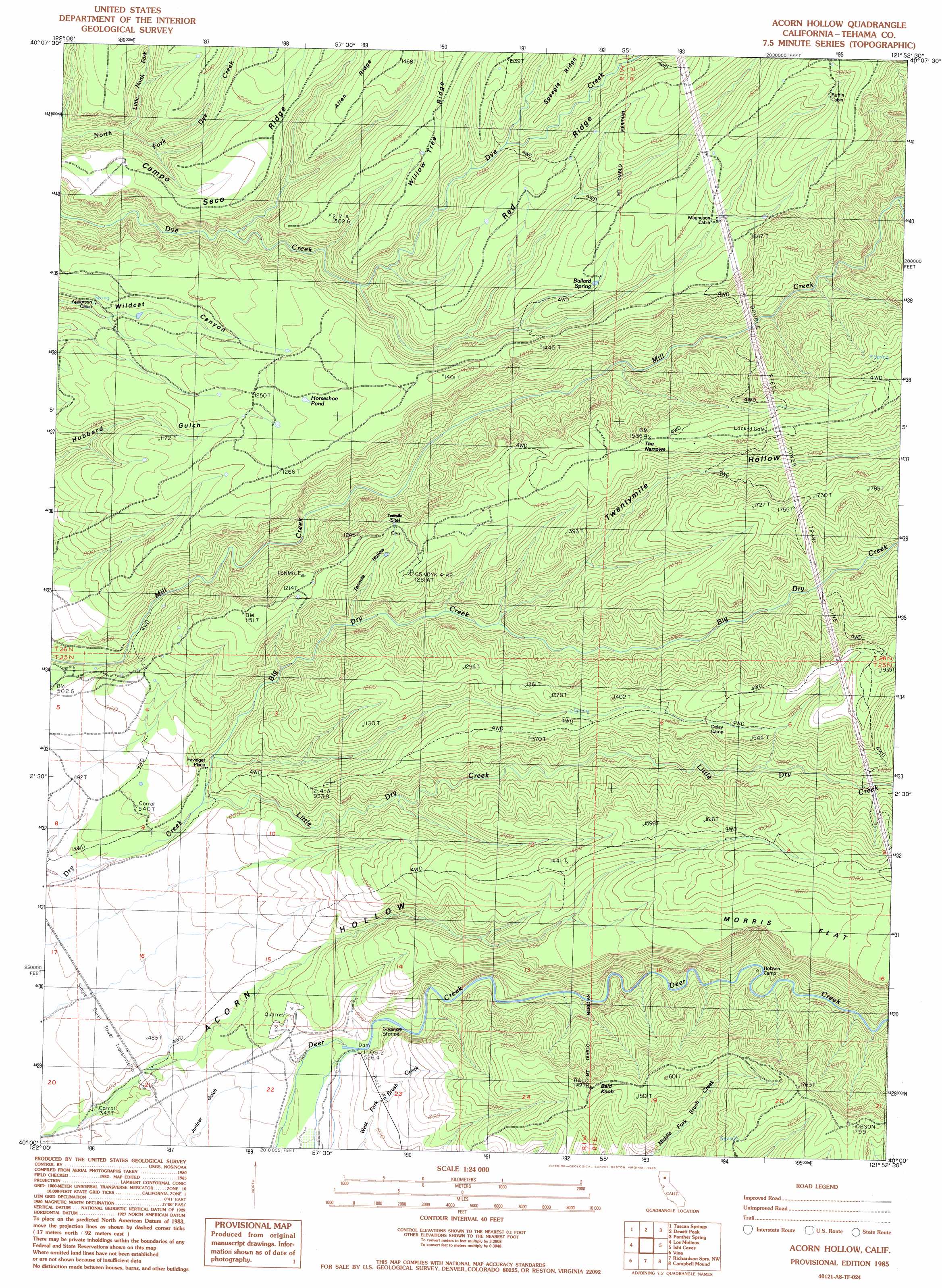
Acorn Hollow Topo Map California
To zoom in, hover over the map of Acorn Hollow
USGS Topo Quad 40121a8 - 1:24,000 scale
| Topo Map Name: | Acorn Hollow |
| USGS Topo Quad ID: | 40121a8 |
| Print Size: | ca. 21 1/4" wide x 27" high |
| Southeast Coordinates: | 40° N latitude / 121.875° W longitude |
| Map Center Coordinates: | 40.0625° N latitude / 121.9375° W longitude |
| U.S. State: | CA |
| Filename: | o40121a8.jpg |
| Download Map JPG Image: | Acorn Hollow topo map 1:24,000 scale |
| Map Type: | Topographic |
| Topo Series: | 7.5´ |
| Map Scale: | 1:24,000 |
| Source of Map Images: | United States Geological Survey (USGS) |
| Alternate Map Versions: |
Acorn Hollow CA 1985, updated 1985 Download PDF Buy paper map Acorn Hollow CA 2012 Download PDF Buy paper map Acorn Hollow CA 2015 Download PDF Buy paper map |
| FStopo: | US Forest Service topo Acorn Hollow is available: Download FStopo PDF Download FStopo TIF |
1:24,000 Topo Quads surrounding Acorn Hollow
Bend |
Dales |
Inskip Hill |
Finley Butte |
Lyonsville |
Red Bluff East |
Tuscan Springs |
Dewitt Peak |
Panther Spring |
Barkley Mountain |
Gerber |
Los Molinos |
Acorn Hollow |
Ishi Caves |
Devils Parade Ground |
Corning |
Vina |
Richardson Springs Nw |
Campbell Mound |
Cohasset |
Kirkwood |
Foster Island |
Nord |
Richardson Springs |
Paradise West |
> Back to 40121a1 at 1:100,000 scale
> Back to 40120a1 at 1:250,000 scale
> Back to U.S. Topo Maps home
Acorn Hollow topo map: Gazetteer
Acorn Hollow: Flats
Morris Flat elevation 457m 1499′Acorn Hollow: Gaps
The Narrows elevation 470m 1541′Acorn Hollow: Lakes
Horseshoe Pond elevation 395m 1295′Acorn Hollow: Populated Places
Favinger Place elevation 179m 587′Tenmile (historical) elevation 334m 1095′
Acorn Hollow: Ridges
Allen Ridge elevation 448m 1469′Campo Seco Ridge elevation 372m 1220′
Red Ridge elevation 568m 1863′
Willow Tree Ridge elevation 453m 1486′
Acorn Hollow: Springs
Ballard Spring elevation 443m 1453′Acorn Hollow: Streams
Big Dry Creek elevation 151m 495′Little Dry Creek elevation 150m 492′
Little Mill Creek elevation 288m 944′
Little North Fork North Fork Dye Creek elevation 242m 793′
Acorn Hollow: Summits
Bald Knob elevation 453m 1486′Acorn Hollow: Valleys
Tenmile Hollow elevation 208m 682′Twentymile Hollow elevation 265m 869′
Acorn Hollow digital topo map on disk
Buy this Acorn Hollow topo map showing relief, roads, GPS coordinates and other geographical features, as a high-resolution digital map file on DVD: