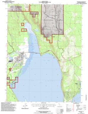
Chester Topo Map California
To zoom in, hover over the map of Chester
USGS Topo Quad 40121c2 - 1:24,000 scale
| Topo Map Name: | Chester |
| USGS Topo Quad ID: | 40121c2 |
| Print Size: | ca. 21 1/4" wide x 27" high |
| Southeast Coordinates: | 40.25° N latitude / 121.125° W longitude |
| Map Center Coordinates: | 40.3125° N latitude / 121.1875° W longitude |
| U.S. State: | CA |
| Filename: | o40121c2.jpg |
| Download Map JPG Image: | Chester topo map 1:24,000 scale |
| Map Type: | Topographic |
| Topo Series: | 7.5´ |
| Map Scale: | 1:24,000 |
| Source of Map Images: | United States Geological Survey (USGS) |
| Alternate Map Versions: |
Chester CA 1979, updated 1979 Download PDF Buy paper map Chester CA 1979, updated 1979 Download PDF Buy paper map Chester CA 1979, updated 1979 Download PDF Buy paper map Chester CA 1979, updated 1984 Download PDF Buy paper map Chester CA 1995, updated 1997 Download PDF Buy paper map Chester CA 1995, updated 1997 Download PDF Buy paper map Chester CA 2012 Download PDF Buy paper map Chester CA 2015 Download PDF Buy paper map |
| FStopo: | US Forest Service topo Chester is available: Download FStopo PDF Download FStopo TIF |
1:24,000 Topo Quads surrounding Chester
> Back to 40121a1 at 1:100,000 scale
> Back to 40120a1 at 1:250,000 scale
> Back to U.S. Topo Maps home
Chester topo map: Gazetteer
Chester: Airports
Chester Airport elevation 1382m 4534′Chester-US Forest Service Heliport elevation 1384m 4540′
Rogers Field elevation 1380m 4527′
Chester: Beaches
Catfish Beach elevation 1375m 4511′Chester: Cliffs
Mud Creek Rim elevation 1563m 5127′Chester: Flats
Johnson Fields elevation 1378m 4520′Chester: Parks
Chester Park elevation 1379m 4524′Chester: Populated Places
Chester elevation 1382m 4534′Foxwood elevation 1460m 4790′
Lake Almanor Country Club elevation 1413m 4635′
Lake Almanor Peninsula elevation 1433m 4701′
Peninsula Village elevation 1418m 4652′
Chester: Post Offices
Chester Post Office elevation 1380m 4527′Chester Post Office (historical) elevation 1382m 4534′
Chester: Reservoirs
Lake Almanor elevation 1373m 4504′Chester: Streams
Bailey Creek elevation 1373m 4504′Benner Creek elevation 1373m 4504′
Johnson Creek elevation 1373m 4504′
Last Chance Creek elevation 1374m 4507′
Mud Creek elevation 1374m 4507′
Chester: Summits
Manzanita Mountain elevation 1790m 5872′Mud Creek Butte elevation 1910m 6266′
Chester: Swamps
Gould Swamp elevation 1373m 4504′Chester digital topo map on disk
Buy this Chester topo map showing relief, roads, GPS coordinates and other geographical features, as a high-resolution digital map file on DVD:


