Inskip Hill Topo Map California
To zoom in, hover over the map of Inskip Hill
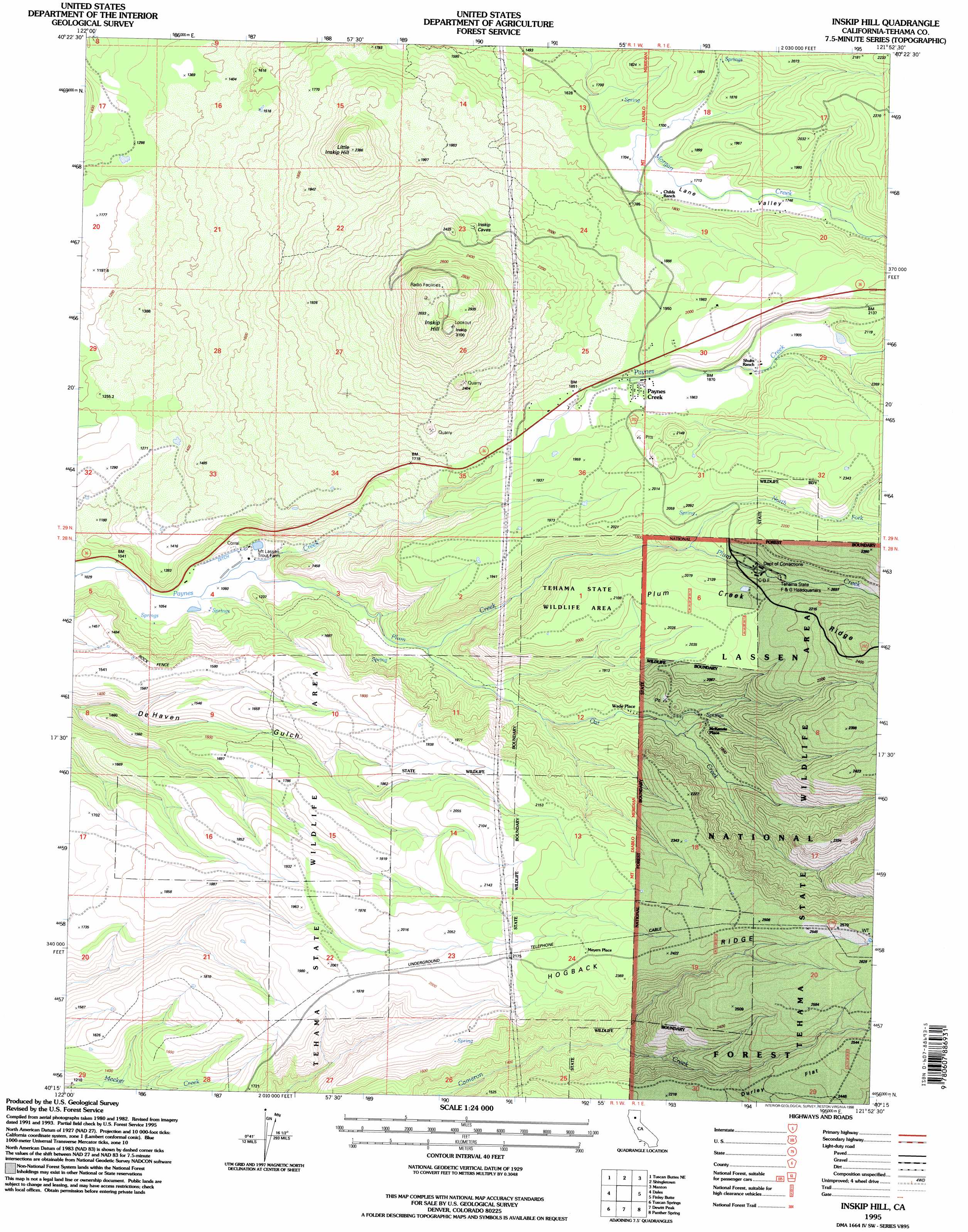
USGS Topo Quad 40121c8 - 1:24,000 scale
| Topo Map Name: | Inskip Hill |
| USGS Topo Quad ID: | 40121c8 |
| Print Size: | ca. 21 1/4" wide x 27" high |
| Southeast Coordinates: | 40.25° N latitude / 121.875° W longitude |
| Map Center Coordinates: | 40.3125° N latitude / 121.9375° W longitude |
| U.S. State: | CA |
| Filename: | o40121c8.jpg |
| Download Map JPG Image: | Inskip Hill topo map 1:24,000 scale |
| Map Type: | Topographic |
| Topo Series: | 7.5´ |
| Map Scale: | 1:24,000 |
| Source of Map Images: | United States Geological Survey (USGS) |
| Alternate Map Versions: |
Inskip Hill CA 1985, updated 1985 Download PDF Buy paper map Inskip Hill CA 1985, updated 1991 Download PDF Buy paper map Inskip Hill CA 1995, updated 1998 Download PDF Buy paper map Inskip Hill CA 2012 Download PDF Buy paper map Inskip Hill CA 2015 Download PDF Buy paper map |
| FStopo: | US Forest Service topo Inskip Hill is available: Download FStopo PDF Download FStopo TIF |
1:24,000 Topo Quads surrounding Inskip Hill
Palo Cedro |
Clough Gulch |
Inwood |
Hagaman Gulch |
Viola |
Balls Ferry |
Tuscan Buttes Ne |
Shingletown |
Manton |
Grays Peak |
Bend |
Dales |
Inskip Hill |
Finley Butte |
Lyonsville |
Red Bluff East |
Tuscan Springs |
Dewitt Peak |
Panther Spring |
Barkley Mountain |
Gerber |
Los Molinos |
Acorn Hollow |
Ishi Caves |
Devils Parade Ground |
> Back to 40121a1 at 1:100,000 scale
> Back to 40120a1 at 1:250,000 scale
> Back to U.S. Topo Maps home
Inskip Hill topo map: Gazetteer
Inskip Hill: Populated Places
McKenzie Place elevation 522m 1712′Meyers Place elevation 702m 2303′
Paynes Creek elevation 564m 1850′
Wade Place elevation 488m 1601′
Inskip Hill: Ridges
Hogback Ridge elevation 785m 2575′Plum Creek Ridge elevation 660m 2165′
Inskip Hill: Streams
North Fork Plum Creek elevation 575m 1886′Oat Creek elevation 394m 1292′
Plum Creek elevation 322m 1056′
Inskip Hill: Summits
Inskip Hill elevation 931m 3054′Little Inskip Hill elevation 720m 2362′
Inskip Hill: Valleys
Lane Valley elevation 518m 1699′Inskip Hill digital topo map on disk
Buy this Inskip Hill topo map showing relief, roads, GPS coordinates and other geographical features, as a high-resolution digital map file on DVD: