Swain Mountain Topo Map California
To zoom in, hover over the map of Swain Mountain
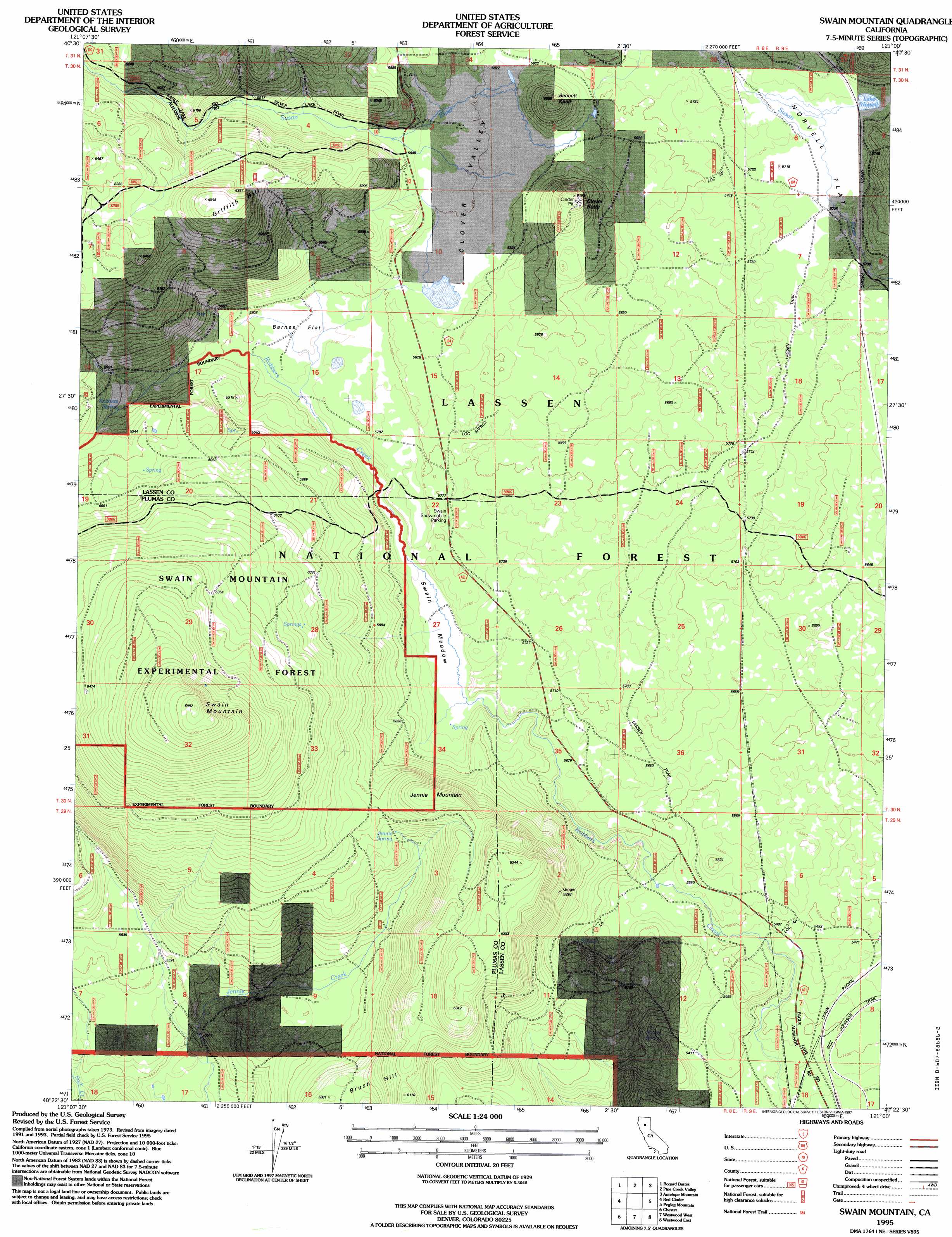
USGS Topo Quad 40121d1 - 1:24,000 scale
| Topo Map Name: | Swain Mountain |
| USGS Topo Quad ID: | 40121d1 |
| Print Size: | ca. 21 1/4" wide x 27" high |
| Southeast Coordinates: | 40.375° N latitude / 121° W longitude |
| Map Center Coordinates: | 40.4375° N latitude / 121.0625° W longitude |
| U.S. State: | CA |
| Filename: | o40121d1.jpg |
| Download Map JPG Image: | Swain Mountain topo map 1:24,000 scale |
| Map Type: | Topographic |
| Topo Series: | 7.5´ |
| Map Scale: | 1:24,000 |
| Source of Map Images: | United States Geological Survey (USGS) |
| Alternate Map Versions: |
Swain Mountain CA 1979, updated 1979 Download PDF Buy paper map Swain Mountain CA 1979, updated 1995 Download PDF Buy paper map Swain Mountain CA 1995, updated 1997 Download PDF Buy paper map Swain Mountain CA 2012 Download PDF Buy paper map Swain Mountain CA 2015 Download PDF Buy paper map |
| FStopo: | US Forest Service topo Swain Mountain is available: Download FStopo PDF Download FStopo TIF |
1:24,000 Topo Quads surrounding Swain Mountain
Swains Hole |
Poison Lake |
Harvey Mountain |
Champs Flat |
Spalding Tract |
Prospect Peak |
Bogard Buttes |
Pine Creek Valley |
Antelope Mountain |
Pikes Point |
Mount Harkness |
Red Cinder |
Swain Mountain |
Pegleg Mountain |
Roop Mountain |
Stover Mountain |
Chester |
Westwood West |
Westwood East |
Fredonyer Pass |
Humbug Valley |
Almanor |
Canyondam |
Greenville |
Moonlight Peak |
> Back to 40121a1 at 1:100,000 scale
> Back to 40120a1 at 1:250,000 scale
> Back to U.S. Topo Maps home
Swain Mountain topo map: Gazetteer
Swain Mountain: Flats
Barnes Flat elevation 1766m 5793′Norvell Flat elevation 1748m 5734′
Swain Meadow elevation 1743m 5718′
Swain Mountain: Forests
Swain Mountain Experimental Forest elevation 1984m 6509′Swain Mountain Experimental Forest elevation 1964m 6443′
Swain Mountain: Lakes
Lake Norvell elevation 1749m 5738′Swain Mountain: Populated Places
Norvell elevation 1750m 5741′Swain Mountain: Springs
Barrel Spring elevation 1668m 5472′Jennie Spring elevation 1815m 5954′
Swain Mountain: Summits
Bennett Knoll elevation 1848m 6062′Brush Hill elevation 1848m 6062′
Clover Butte elevation 1882m 6174′
Griffith Hill elevation 1995m 6545′
Jennie Mountain elevation 1882m 6174′
Swain Mountain elevation 2111m 6925′
Swain Mountain: Trails
Johnson Trail elevation 1647m 5403′Swain Mountain: Valleys
Clover Valley elevation 1773m 5816′Swain Mountain digital topo map on disk
Buy this Swain Mountain topo map showing relief, roads, GPS coordinates and other geographical features, as a high-resolution digital map file on DVD: