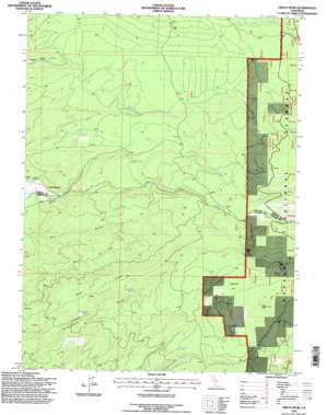
Grays Peak Topo Map California
To zoom in, hover over the map of Grays Peak
USGS Topo Quad 40121d6 - 1:24,000 scale
| Topo Map Name: | Grays Peak |
| USGS Topo Quad ID: | 40121d6 |
| Print Size: | ca. 21 1/4" wide x 27" high |
| Southeast Coordinates: | 40.375° N latitude / 121.625° W longitude |
| Map Center Coordinates: | 40.4375° N latitude / 121.6875° W longitude |
| U.S. State: | CA |
| Filename: | o40121d6.jpg |
| Download Map JPG Image: | Grays Peak topo map 1:24,000 scale |
| Map Type: | Topographic |
| Topo Series: | 7.5´ |
| Map Scale: | 1:24,000 |
| Source of Map Images: | United States Geological Survey (USGS) |
| Alternate Map Versions: |
Grays Peak CA 1985, updated 1985 Download PDF Buy paper map Grays Peak CA 1995, updated 1998 Download PDF Buy paper map Grays Peak CA 2012 Download PDF Buy paper map Grays Peak CA 2015 Download PDF Buy paper map |
| FStopo: | US Forest Service topo Grays Peak is available: Download FStopo PDF Download FStopo TIF |
1:24,000 Topo Quads surrounding Grays Peak
> Back to 40121a1 at 1:100,000 scale
> Back to 40120a1 at 1:250,000 scale
> Back to U.S. Topo Maps home
Grays Peak topo map: Gazetteer
Grays Peak: Flats
Hazen Flat elevation 1708m 5603′Sugarpine Flat elevation 1679m 5508′
Grays Peak: Ridges
Blue Ridge elevation 1518m 4980′Grays Peak: Springs
Blue Ridge Spring elevation 1417m 4648′Cabin Spring elevation 1715m 5626′
Rattlesnake Spring elevation 1528m 5013′
Rock Spring elevation 1368m 4488′
Sugarpine Spring elevation 1546m 5072′
Ward Springs elevation 1269m 4163′
Willow Spring elevation 1785m 5856′
Grays Peak: Streams
North Fork Bailey Creek elevation 1583m 5193′Onion Creek elevation 1145m 3756′
South Fork Bailey Creek elevation 1583m 5193′
South Fork Blue Creek elevation 1583m 5193′
South Fork Digger Creek elevation 1083m 3553′
Grays Peak: Summits
Grays Peak elevation 1930m 6332′Grays Peak digital topo map on disk
Buy this Grays Peak topo map showing relief, roads, GPS coordinates and other geographical features, as a high-resolution digital map file on DVD:


