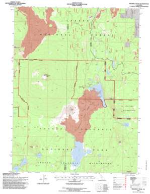
Prospect Peak Topo Map California
To zoom in, hover over the map of Prospect Peak
USGS Topo Quad 40121e3 - 1:24,000 scale
| Topo Map Name: | Prospect Peak |
| USGS Topo Quad ID: | 40121e3 |
| Print Size: | ca. 21 1/4" wide x 27" high |
| Southeast Coordinates: | 40.5° N latitude / 121.25° W longitude |
| Map Center Coordinates: | 40.5625° N latitude / 121.3125° W longitude |
| U.S. State: | CA |
| Filename: | o40121e3.jpg |
| Download Map JPG Image: | Prospect Peak topo map 1:24,000 scale |
| Map Type: | Topographic |
| Topo Series: | 7.5´ |
| Map Scale: | 1:24,000 |
| Source of Map Images: | United States Geological Survey (USGS) |
| Alternate Map Versions: |
Prospect Peak SE CA 1975, updated 1981 Download PDF Buy paper map Prospect Peak CA 1985, updated 1985 Download PDF Buy paper map Prospect Peak CA 1995, updated 1998 Download PDF Buy paper map Prospect Peak CA 2012 Download PDF Buy paper map Prospect Peak CA 2015 Download PDF Buy paper map |
| FStopo: | US Forest Service topo Prospect Peak is available: Download FStopo PDF Download FStopo TIF |
1:24,000 Topo Quads surrounding Prospect Peak
> Back to 40121e1 at 1:100,000 scale
> Back to 40120a1 at 1:250,000 scale
> Back to U.S. Topo Maps home
Prospect Peak topo map: Gazetteer
Prospect Peak: Lakes
Bathtub Lake elevation 1850m 6069′Butte Lake elevation 1845m 6053′
Duck Lake elevation 1838m 6030′
Lower Twin Lake elevation 1993m 6538′
Rainbow Lake elevation 2009m 6591′
Snag Lake elevation 1853m 6079′
Teal Lake elevation 1976m 6482′
Upper Twin Lake elevation 1995m 6545′
Widow Lake elevation 2081m 6827′
Prospect Peak: Lavas
Fantastic Lava Beds elevation 1910m 6266′Prospect Peak: Springs
Cold Spring elevation 1872m 6141′Lost Spring elevation 1855m 6085′
Panther Spring elevation 1876m 6154′
Pole Spring elevation 1823m 5980′
Prospect Peak: Streams
Butte Creek elevation 1845m 6053′Grassy Creek elevation 1853m 6079′
Prospect Peak: Summits
Ash Butte elevation 2306m 7565′Cinder Cone elevation 2041m 6696′
Fairfield Peak elevation 2212m 7257′
Prospect Peak elevation 2538m 8326′
Sunrise Peak elevation 2135m 7004′
Prospect Peak: Trails
Noble Trail elevation 1931m 6335′Prospect Peak digital topo map on disk
Buy this Prospect Peak topo map showing relief, roads, GPS coordinates and other geographical features, as a high-resolution digital map file on DVD:


