Swains Hole Topo Map California
To zoom in, hover over the map of Swains Hole
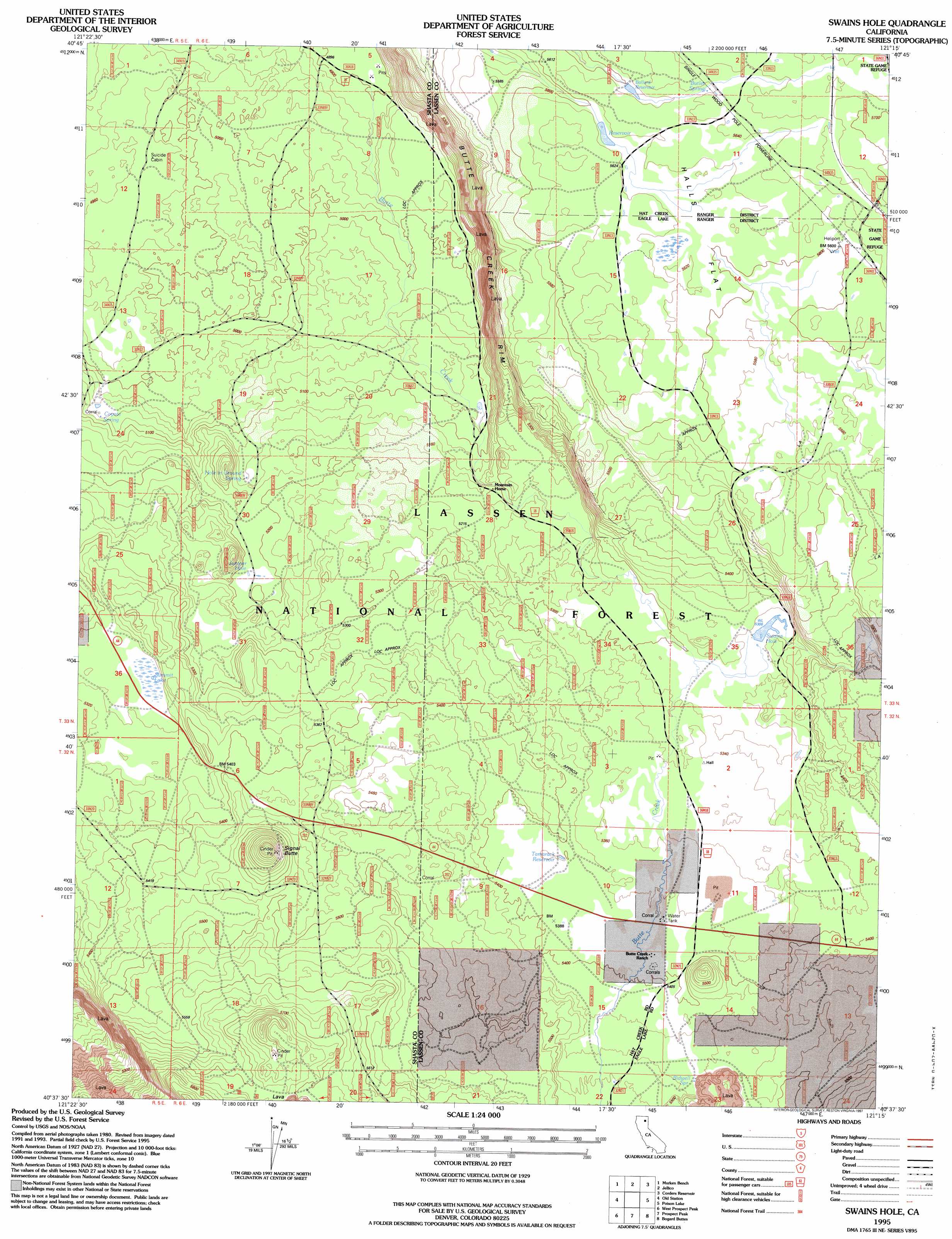
USGS Topo Quad 40121f3 - 1:24,000 scale
| Topo Map Name: | Swains Hole |
| USGS Topo Quad ID: | 40121f3 |
| Print Size: | ca. 21 1/4" wide x 27" high |
| Southeast Coordinates: | 40.625° N latitude / 121.25° W longitude |
| Map Center Coordinates: | 40.6875° N latitude / 121.3125° W longitude |
| U.S. State: | CA |
| Filename: | o40121f3.jpg |
| Download Map JPG Image: | Swains Hole topo map 1:24,000 scale |
| Map Type: | Topographic |
| Topo Series: | 7.5´ |
| Map Scale: | 1:24,000 |
| Source of Map Images: | United States Geological Survey (USGS) |
| Alternate Map Versions: |
Swains Hole CA 1985, updated 1986 Download PDF Buy paper map Swains Hole CA 1995, updated 1997 Download PDF Buy paper map Swains Hole CA 2012 Download PDF Buy paper map Swains Hole CA 2015 Download PDF Buy paper map |
| FStopo: | US Forest Service topo Swains Hole is available: Download FStopo PDF Download FStopo TIF |
1:24,000 Topo Quads surrounding Swains Hole
Cassel |
Hogback Ridge |
Coble Mountain |
Little Valley |
Dixie Peak |
Burney Mountain East |
Murken Bench |
Jellico |
Corders Reservoir |
Straylor Lake |
Thousand Lakes Valley |
Old Station |
Swains Hole |
Poison Lake |
Harvey Mountain |
Manzanita Lake |
West Prospect Peak |
Prospect Peak |
Bogard Buttes |
Pine Creek Valley |
Lassen Peak |
Reading Peak |
Mount Harkness |
Red Cinder |
Swain Mountain |
> Back to 40121e1 at 1:100,000 scale
> Back to 40120a1 at 1:250,000 scale
> Back to U.S. Topo Maps home
Swains Hole topo map: Gazetteer
Swains Hole: Dams
Swains Hole Dam elevation 1621m 5318′Swains Hole: Flats
Halls Flat elevation 1712m 5616′Swains Hole: Lakes
Juniper Hole elevation 1583m 5193′Summit Lake elevation 1630m 5347′
Swains Hole: Reservoirs
Ballard Reservoir elevation 1713m 5620′Bufflehead Reservoir elevation 1714m 5623′
Swains Hole elevation 1621m 5318′
Tamarack Reservoir elevation 1641m 5383′
Swains Hole: Springs
Bidwell Spring elevation 1664m 5459′Butler Spring elevation 1719m 5639′
Coyote Spring elevation 1546m 5072′
Hole in Ground Spring elevation 1573m 5160′
Swains Hole: Streams
Butte Creek elevation 1504m 4934′Swains Hole: Summits
Signal Butte elevation 1759m 5770′Swains Hole digital topo map on disk
Buy this Swains Hole topo map showing relief, roads, GPS coordinates and other geographical features, as a high-resolution digital map file on DVD: