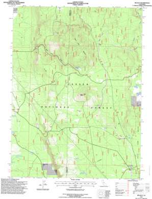
Jellico Topo Map California
To zoom in, hover over the map of Jellico
USGS Topo Quad 40121g3 - 1:24,000 scale
| Topo Map Name: | Jellico |
| USGS Topo Quad ID: | 40121g3 |
| Print Size: | ca. 21 1/4" wide x 27" high |
| Southeast Coordinates: | 40.75° N latitude / 121.25° W longitude |
| Map Center Coordinates: | 40.8125° N latitude / 121.3125° W longitude |
| U.S. State: | CA |
| Filename: | o40121g3.jpg |
| Download Map JPG Image: | Jellico topo map 1:24,000 scale |
| Map Type: | Topographic |
| Topo Series: | 7.5´ |
| Map Scale: | 1:24,000 |
| Source of Map Images: | United States Geological Survey (USGS) |
| Alternate Map Versions: |
Jellico CA 1990, updated 1990 Download PDF Buy paper map Jellico CA 1995, updated 1997 Download PDF Buy paper map Jellico CA 2012 Download PDF Buy paper map Jellico CA 2015 Download PDF Buy paper map |
| FStopo: | US Forest Service topo Jellico is available: Download FStopo PDF Download FStopo TIF |
1:24,000 Topo Quads surrounding Jellico
> Back to 40121e1 at 1:100,000 scale
> Back to 40120a1 at 1:250,000 scale
> Back to U.S. Topo Maps home
Jellico topo map: Gazetteer
Jellico: Cliffs
Butte Creek Rim elevation 1324m 4343′Butte Creek Rim elevation 1653m 5423′
Jellico: Flats
Beaver Creek Wetlands elevation 1556m 5104′Jellico: Populated Places
Halls Flat elevation 1739m 5705′Jellico elevation 1571m 5154′
Jellico: Reservoirs
Bainbridge Reservoir elevation 1499m 4917′Beaver Creek Reservoir elevation 1552m 5091′
Bootleg Reservoir elevation 1698m 5570′
Cone Reservoir elevation 1487m 4878′
Freebe Reservoir elevation 1683m 5521′
Twin Ponds elevation 1488m 4881′
Jellico: Springs
Coble Spring elevation 1510m 4954′Ericksons Spring elevation 1687m 5534′
Jelly Spring elevation 1709m 5606′
Moon Springs elevation 1242m 4074′
Negro Camp Spring elevation 1568m 5144′
Ward Spring elevation 1602m 5255′
Jellico: Summits
Ladder Butte elevation 1731m 5679′Negro Camp Mountain elevation 1728m 5669′
Jellico: Valleys
Negro Camp Gulch elevation 1380m 4527′Jellico digital topo map on disk
Buy this Jellico topo map showing relief, roads, GPS coordinates and other geographical features, as a high-resolution digital map file on DVD:


