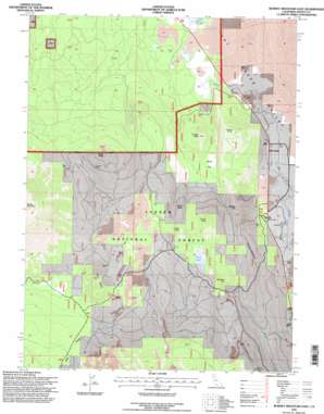
Burney Mountain East Topo Map California
To zoom in, hover over the map of Burney Mountain East
USGS Topo Quad 40121g5 - 1:24,000 scale
| Topo Map Name: | Burney Mountain East |
| USGS Topo Quad ID: | 40121g5 |
| Print Size: | ca. 21 1/4" wide x 27" high |
| Southeast Coordinates: | 40.75° N latitude / 121.5° W longitude |
| Map Center Coordinates: | 40.8125° N latitude / 121.5625° W longitude |
| U.S. State: | CA |
| Filename: | o40121g5.jpg |
| Download Map JPG Image: | Burney Mountain East topo map 1:24,000 scale |
| Map Type: | Topographic |
| Topo Series: | 7.5´ |
| Map Scale: | 1:24,000 |
| Source of Map Images: | United States Geological Survey (USGS) |
| Alternate Map Versions: |
Burney Mountain East CA 1990, updated 1990 Download PDF Buy paper map Burney Mountain East CA 1995, updated 1997 Download PDF Buy paper map Burney Mountain East CA 2012 Download PDF Buy paper map Burney Mountain East CA 2015 Download PDF Buy paper map |
| FStopo: | US Forest Service topo Burney Mountain East is available: Download FStopo PDF Download FStopo TIF |
1:24,000 Topo Quads surrounding Burney Mountain East
> Back to 40121e1 at 1:100,000 scale
> Back to 40120a1 at 1:250,000 scale
> Back to U.S. Topo Maps home
Burney Mountain East topo map: Gazetteer
Burney Mountain East: Flats
Dutch Flat elevation 1153m 3782′Burney Mountain East: Lakes
Cornaz Lake elevation 1361m 4465′Burney Mountain East: Populated Places
Hat Creek elevation 1010m 3313′Burney Mountain East: Post Offices
Hat Creek Post Office elevation 1028m 3372′Burney Mountain East: Springs
Burney Spring elevation 1442m 4730′Cornaz Spring elevation 1389m 4557′
Pot Spring elevation 1426m 4678′
Burney Mountain East: Streams
Honn Creek elevation 1033m 3389′Burney Mountain East: Summits
Brown Butte elevation 1419m 4655′Cinder Butte elevation 1535m 5036′
Cornaz Peak elevation 1623m 5324′
Doyle Butte elevation 1664m 5459′
Dudgen Butte elevation 1321m 4333′
Dutch Butte elevation 1423m 4668′
Opdyke Hill elevation 1418m 4652′
Red Rock Hill elevation 1589m 5213′
Twin Buttes elevation 1484m 4868′
Burney Mountain East: Valleys
Eiler Gulch elevation 1437m 4714′Burney Mountain East digital topo map on disk
Buy this Burney Mountain East topo map showing relief, roads, GPS coordinates and other geographical features, as a high-resolution digital map file on DVD:


