Burney Topo Map California
To zoom in, hover over the map of Burney
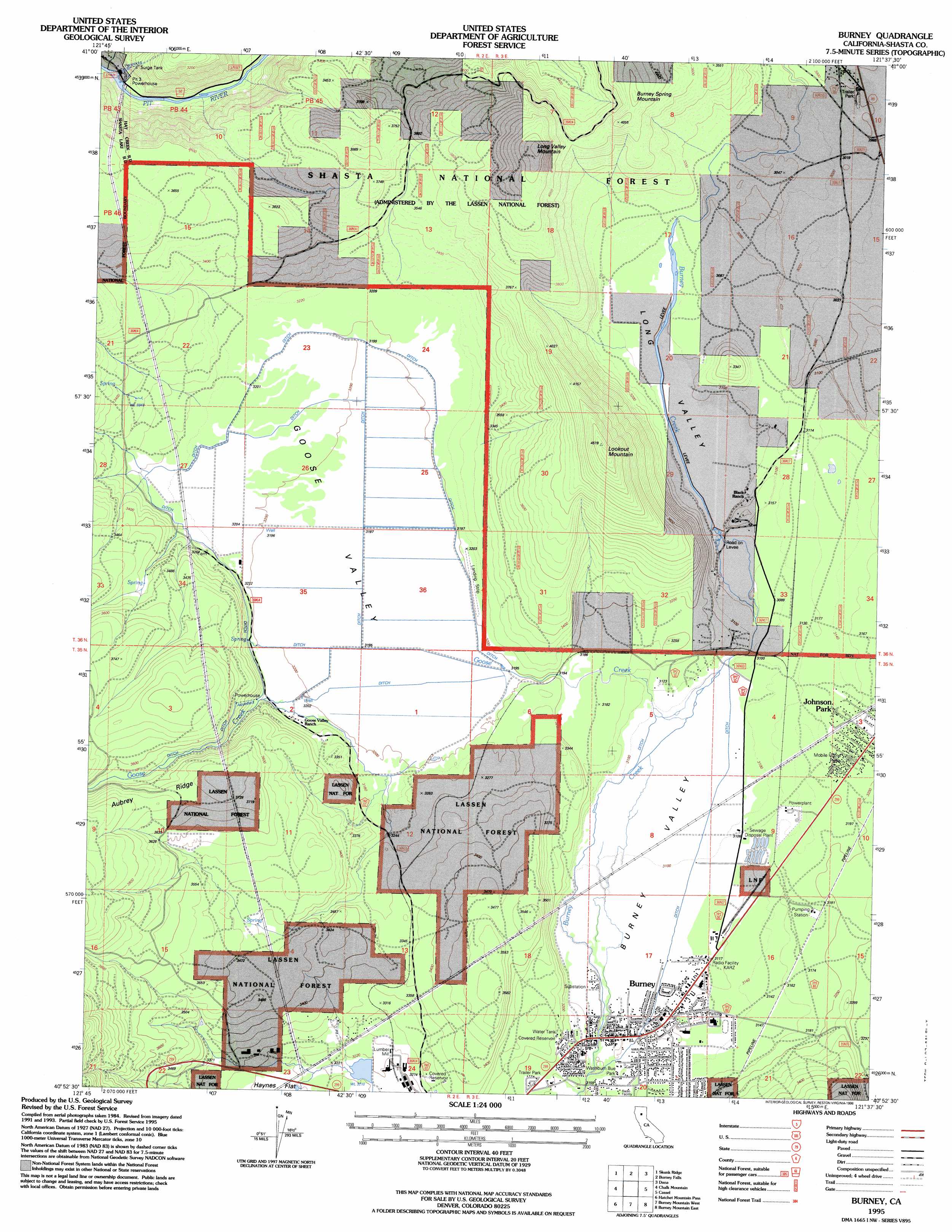
USGS Topo Quad 40121h6 - 1:24,000 scale
| Topo Map Name: | Burney |
| USGS Topo Quad ID: | 40121h6 |
| Print Size: | ca. 21 1/4" wide x 27" high |
| Southeast Coordinates: | 40.875° N latitude / 121.625° W longitude |
| Map Center Coordinates: | 40.9375° N latitude / 121.6875° W longitude |
| U.S. State: | CA |
| Filename: | o40121h6.jpg |
| Download Map JPG Image: | Burney topo map 1:24,000 scale |
| Map Type: | Topographic |
| Topo Series: | 7.5´ |
| Map Scale: | 1:24,000 |
| Source of Map Images: | United States Geological Survey (USGS) |
| Alternate Map Versions: |
Burney CA 1995, updated 1998 Download PDF Buy paper map Burney CA 2012 Download PDF Buy paper map Burney CA 2015 Download PDF Buy paper map |
| FStopo: | US Forest Service topo Burney is available: Download FStopo PDF Download FStopo TIF |
1:24,000 Topo Quads surrounding Burney
Grizzly Peak |
Dead Horse Summit |
Pondosa |
East Of Pondosa |
Timbered Crater |
Big Bend |
Skunk Ridge |
Burney Falls |
Dana |
Fall River Mills |
Roaring Creek |
Chalk Mountain |
Burney |
Cassel |
Hogback Ridge |
Montgomery Creek |
Hatchet Mountain Pass |
Burney Mountain West |
Burney Mountain East |
Murken Bench |
Whitmore |
Miller Mountain |
Jacks Backbone |
Thousand Lakes Valley |
Old Station |
> Back to 40121e1 at 1:100,000 scale
> Back to 40120a1 at 1:250,000 scale
> Back to U.S. Topo Maps home
Burney topo map: Gazetteer
Burney: Airports
Burney Service Center Heliport elevation 951m 3120′Burney: Parks
Burney Civic Park elevation 970m 3182′Washburn Bue Park elevation 960m 3149′
Burney: Populated Places
Burney elevation 952m 3123′Four Corners elevation 913m 2995′
Johnson Park elevation 970m 3182′
Las Colinas Mobile Home Park elevation 970m 3182′
Burney: Post Offices
Burney Post Office elevation 952m 3123′Burney: Ridges
Aubrey Ridge elevation 1196m 3923′Burney: Streams
Goose Creek elevation 945m 3100′Burney: Summits
Burney Spring Mountain elevation 1206m 3956′Long Valley Mountain elevation 1370m 4494′
Lookout Mountain elevation 1369m 4491′
Burney: Valleys
Goose Valley elevation 945m 3100′Long Valley elevation 936m 3070′
Burney digital topo map on disk
Buy this Burney topo map showing relief, roads, GPS coordinates and other geographical features, as a high-resolution digital map file on DVD: