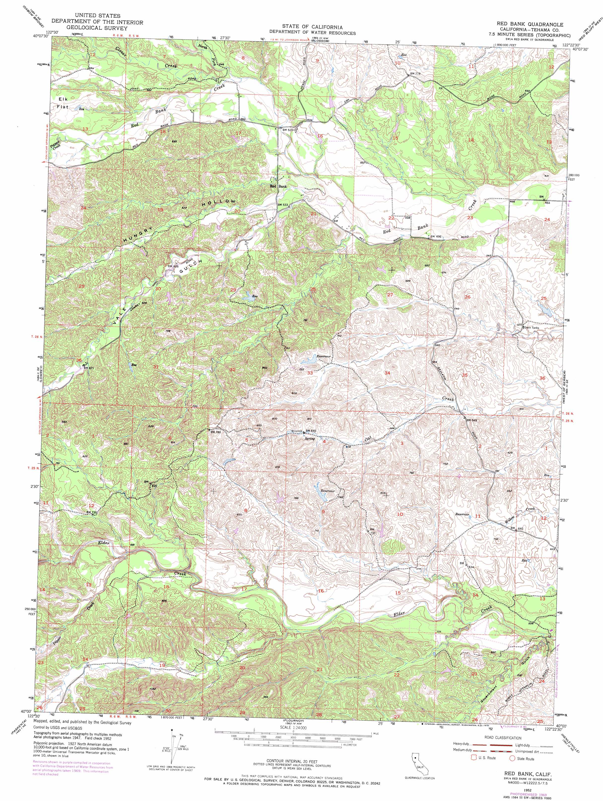
Red Bank Topo Map California
To zoom in, hover over the map of Red Bank
USGS Topo Quad 40122a4 - 1:24,000 scale
| Topo Map Name: | Red Bank |
| USGS Topo Quad ID: | 40122a4 |
| Print Size: | ca. 21 1/4" wide x 27" high |
| Southeast Coordinates: | 40° N latitude / 122.375° W longitude |
| Map Center Coordinates: | 40.0625° N latitude / 122.4375° W longitude |
| U.S. State: | CA |
| Filename: | o40122a4.jpg |
| Download Map JPG Image: | Red Bank topo map 1:24,000 scale |
| Map Type: | Topographic |
| Topo Series: | 7.5´ |
| Map Scale: | 1:24,000 |
| Source of Map Images: | United States Geological Survey (USGS) |
| Alternate Map Versions: |
Red Bank CA 1952, updated 1953 Download PDF Buy paper map Red Bank CA 1952, updated 1970 Download PDF Buy paper map Red Bank CA 2012 Download PDF Buy paper map Red Bank CA 2015 Download PDF Buy paper map |
1:24,000 Topo Quads surrounding Red Bank
Rosewood |
Mitchell Gulch |
Hooker |
Bend |
|
Cold Fork |
Oxbow Bridge |
Blossom |
Red Bluff West |
Red Bluff East |
Raglin Ridge |
Lowrey |
Red Bank |
West Of Gerber |
Gerber |
Riley Ridge |
Paskenta |
Flournoy |
Henleyville |
Corning |
Hall Ridge |
Newville |
Sehorn Creek |
Black Butte Dam |
Kirkwood |
> Back to 40122a1 at 1:100,000 scale
> Back to 40122a1 at 1:250,000 scale
> Back to U.S. Topo Maps home
Red Bank topo map: Gazetteer
Red Bank: Airports
Rancho Tehama Airport elevation 161m 528′Red Bank: Populated Places
Rancho Tehama Reserve elevation 160m 524′Red Bank elevation 164m 538′
Red Bank: Streams
Clover Creek elevation 164m 538′Digger Creek elevation 183m 600′
North Fork Red Bank Creek elevation 162m 531′
Pigpen Creek elevation 181m 593′
Red Bank: Valleys
Government Gulch elevation 147m 482′Hungry Hollow elevation 161m 528′
Vale Gulch elevation 160m 524′
Red Bank digital topo map on disk
Buy this Red Bank topo map showing relief, roads, GPS coordinates and other geographical features, as a high-resolution digital map file on DVD: