Blossom Topo Map California
To zoom in, hover over the map of Blossom
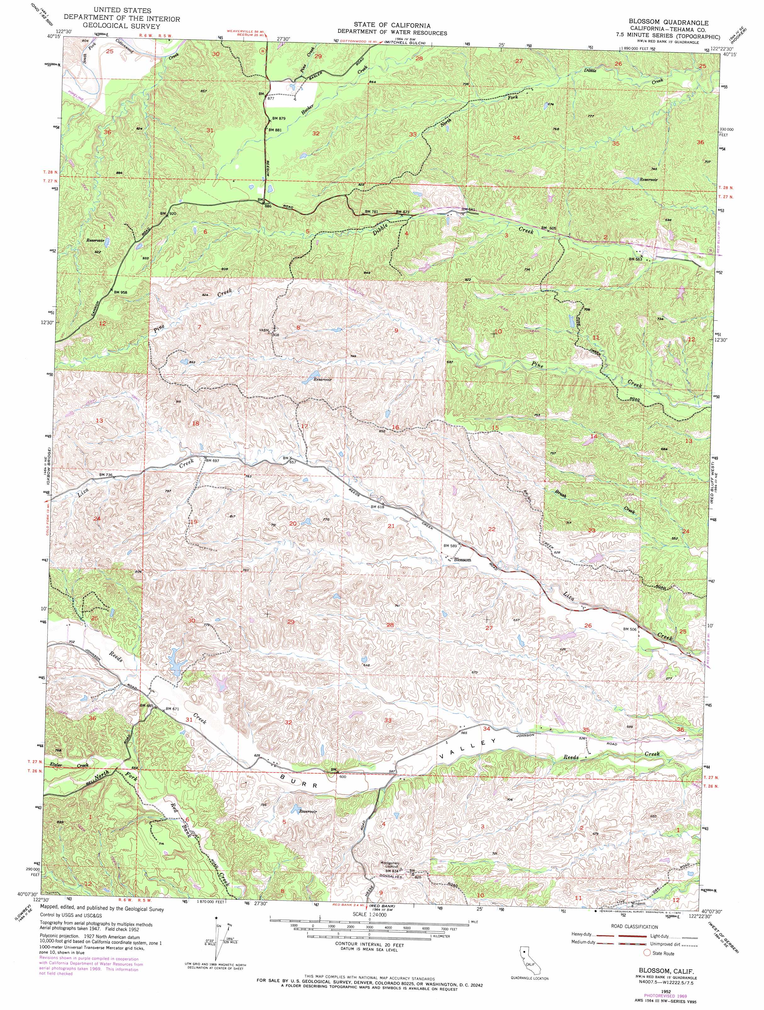
USGS Topo Quad 40122b4 - 1:24,000 scale
| Topo Map Name: | Blossom |
| USGS Topo Quad ID: | 40122b4 |
| Print Size: | ca. 21 1/4" wide x 27" high |
| Southeast Coordinates: | 40.125° N latitude / 122.375° W longitude |
| Map Center Coordinates: | 40.1875° N latitude / 122.4375° W longitude |
| U.S. State: | CA |
| Filename: | o40122b4.jpg |
| Download Map JPG Image: | Blossom topo map 1:24,000 scale |
| Map Type: | Topographic |
| Topo Series: | 7.5´ |
| Map Scale: | 1:24,000 |
| Source of Map Images: | United States Geological Survey (USGS) |
| Alternate Map Versions: |
Blossom CA 1952, updated 1953 Download PDF Buy paper map Blossom CA 1952, updated 1953 Download PDF Buy paper map Blossom CA 1952, updated 1970 Download PDF Buy paper map Blossom CA 1952, updated 1971 Download PDF Buy paper map Blossom CA 1952, updated 1971 Download PDF Buy paper map Blossom CA 2012 Download PDF Buy paper map Blossom CA 2015 Download PDF Buy paper map |
1:24,000 Topo Quads surrounding Blossom
Ono |
Olinda |
Cottonwood |
Balls Ferry |
|
Rosewood |
Mitchell Gulch |
Hooker |
Bend |
|
Cold Fork |
Oxbow Bridge |
Blossom |
Red Bluff West |
Red Bluff East |
Raglin Ridge |
Lowrey |
Red Bank |
West Of Gerber |
Gerber |
Riley Ridge |
Paskenta |
Flournoy |
Henleyville |
Corning |
> Back to 40122a1 at 1:100,000 scale
> Back to 40122a1 at 1:250,000 scale
> Back to U.S. Topo Maps home
Blossom topo map: Gazetteer
Blossom: Streams
Etzler Creek elevation 193m 633′Blossom: Valleys
Burr Valley elevation 147m 482′Blossom digital topo map on disk
Buy this Blossom topo map showing relief, roads, GPS coordinates and other geographical features, as a high-resolution digital map file on DVD: