Bend Topo Map California
To zoom in, hover over the map of Bend
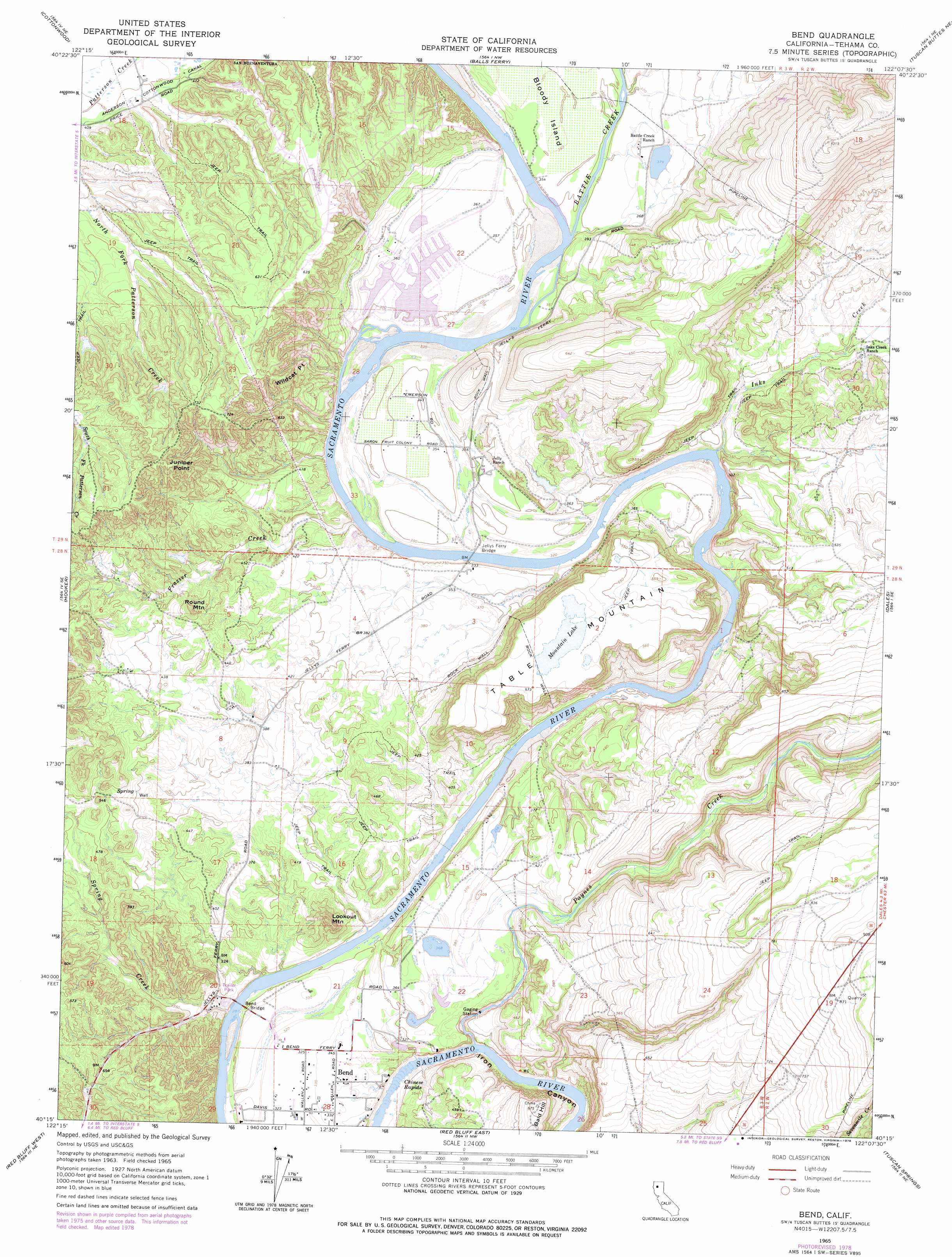
USGS Topo Quad 40122c2 - 1:24,000 scale
| Topo Map Name: | Bend |
| USGS Topo Quad ID: | 40122c2 |
| Print Size: | ca. 21 1/4" wide x 27" high |
| Southeast Coordinates: | 40.25° N latitude / 122.125° W longitude |
| Map Center Coordinates: | 40.3125° N latitude / 122.1875° W longitude |
| U.S. State: | CA |
| Filename: | o40122c2.jpg |
| Download Map JPG Image: | Bend topo map 1:24,000 scale |
| Map Type: | Topographic |
| Topo Series: | 7.5´ |
| Map Scale: | 1:24,000 |
| Source of Map Images: | United States Geological Survey (USGS) |
| Alternate Map Versions: |
Bend CA 1965, updated 1966 Download PDF Buy paper map Bend CA 1965, updated 1966 Download PDF Buy paper map Bend CA 1965, updated 1977 Download PDF Buy paper map Bend CA 1965, updated 1978 Download PDF Buy paper map Bend CA 1965, updated 1978 Download PDF Buy paper map Bend CA 1965, updated 1978 Download PDF Buy paper map Bend CA 2012 Download PDF Buy paper map Bend CA 2015 Download PDF Buy paper map |
1:24,000 Topo Quads surrounding Bend
Redding |
Enterprise |
Palo Cedro |
Clough Gulch |
Inwood |
Olinda |
Cottonwood |
Balls Ferry |
Tuscan Buttes Ne |
Shingletown |
Mitchell Gulch |
Hooker |
Bend |
Dales |
Inskip Hill |
Blossom |
Red Bluff West |
Red Bluff East |
Tuscan Springs |
Dewitt Peak |
Red Bank |
West Of Gerber |
Gerber |
Los Molinos |
Acorn Hollow |
> Back to 40122a1 at 1:100,000 scale
> Back to 40122a1 at 1:250,000 scale
> Back to U.S. Topo Maps home
Bend topo map: Gazetteer
Bend: Bridges
Bend Bridge elevation 86m 282′Jellys Ferry Bridge elevation 95m 311′
Bend: Capes
Juniper Point elevation 233m 764′Wildcat Point elevation 148m 485′
Bend: Crossings
Jellys Ferry (historical) elevation 95m 311′Bend: Islands
Bloody Island elevation 111m 364′Bend: Lakes
Mountain Lake elevation 176m 577′Bend: Populated Places
Bend elevation 102m 334′Bend: Rapids
Chinese Rapids elevation 80m 262′Bend: Streams
Battle Creek elevation 103m 337′Frazier Creek elevation 106m 347′
Inks Creek elevation 94m 308′
Paynes Creek elevation 81m 265′
Spring Creek elevation 90m 295′
Bend: Summits
Bald Hill elevation 177m 580′Lookout Mountain elevation 168m 551′
Round Mountain elevation 171m 561′
Table Mountain elevation 169m 554′
Bend digital topo map on disk
Buy this Bend topo map showing relief, roads, GPS coordinates and other geographical features, as a high-resolution digital map file on DVD: