Ono Topo Map California
To zoom in, hover over the map of Ono
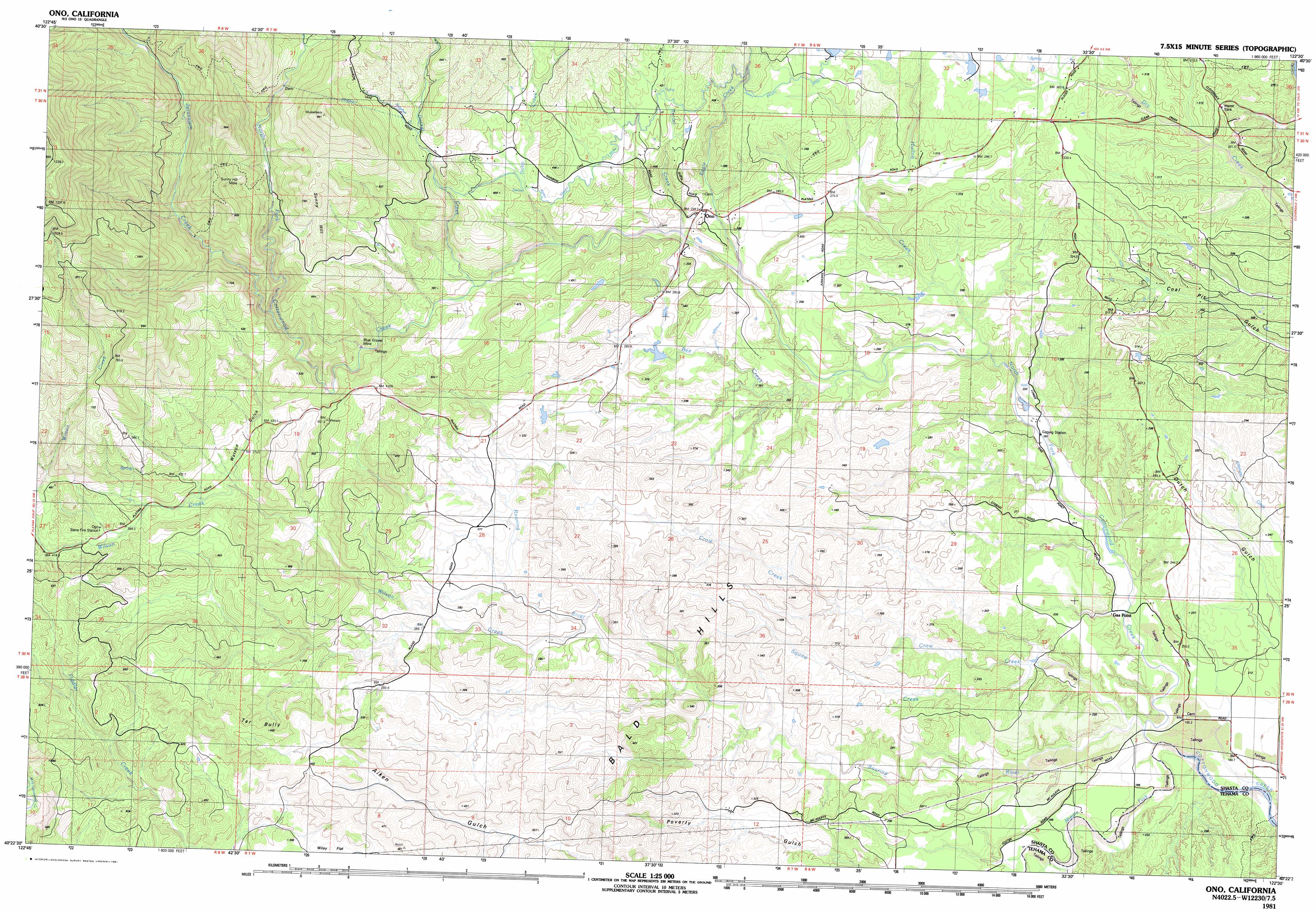
USGS Topo Quad 40122d5 - 1:25,000 scale
| Topo Map Name: | Ono |
| USGS Topo Quad ID: | 40122d5 |
| Print Size: | ca. 39" wide x 24" high |
| Southeast Coordinates: | 40.375° N latitude / 122.5° W longitude |
| Map Center Coordinates: | 40.4375° N latitude / 122.625° W longitude |
| U.S. State: | CA |
| Filename: | k40122d5.jpg |
| Download Map JPG Image: | Ono topo map 1:25,000 scale |
| Map Type: | Topographic |
| Topo Series: | 7.5´x15´ |
| Map Scale: | 1:25,000 |
| Source of Map Images: | United States Geological Survey (USGS) |
| Alternate Map Versions: |
Ono CA 1981, updated 1981 Download PDF Buy paper map Ono CA 1981, updated 1981 Download PDF Buy paper map |
1:24,000 Topo Quads surrounding Ono
Lewiston |
French Gulch |
Whiskeytown |
Shasta Dam |
Project City |
Bully Choop Mountain |
Shasta Bally |
Igo |
Redding |
Enterprise |
Arbuckle Mountain |
Ono |
Olinda |
Cottonwood |
|
Beegum |
Rosewood |
Mitchell Gulch |
Hooker |
|
Tomhead Mountain |
Cold Fork |
Oxbow Bridge |
Blossom |
Red Bluff West |
> Back to 40122a1 at 1:100,000 scale
> Back to 40122a1 at 1:250,000 scale
> Back to U.S. Topo Maps home
Ono topo map: Gazetteer
Ono: Canals
Happy Valley Irrigation Canal elevation 379m 1243′Ono: Mines
Blue Gravel Mine elevation 407m 1335′Sunny Hill Mine elevation 669m 2194′
Ono: Populated Places
Gas Point elevation 183m 600′Ono elevation 294m 964′
Ono: Ridges
Tar Bully elevation 465m 1525′Ono: Streams
Bee Creek elevation 225m 738′Crow Creek elevation 170m 557′
Doby Creek elevation 342m 1122′
Ducket Creek elevation 336m 1102′
Eagle Creek elevation 264m 866′
Huling Creek elevation 230m 754′
Jerusalem Creek elevation 460m 1509′
Middle Fork Cottonwood Creek elevation 165m 541′
Moon Fork Cottonwood Creek elevation 587m 1925′
North Fork Cottonwood Creek elevation 234m 767′
Rector Creek elevation 277m 908′
Roaring River elevation 167m 547′
Squaw Creek elevation 187m 613′
Ono: Valleys
Watson Gulch elevation 408m 1338′Ono digital topo map on disk
Buy this Ono topo map showing relief, roads, GPS coordinates and other geographical features, as a high-resolution digital map file on DVD: