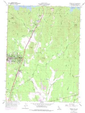
Project City Topo Map California
To zoom in, hover over the map of Project City
USGS Topo Quad 40122f3 - 1:24,000 scale
| Topo Map Name: | Project City |
| USGS Topo Quad ID: | 40122f3 |
| Print Size: | ca. 21 1/4" wide x 27" high |
| Southeast Coordinates: | 40.625° N latitude / 122.25° W longitude |
| Map Center Coordinates: | 40.6875° N latitude / 122.3125° W longitude |
| U.S. State: | CA |
| Filename: | o40122f3.jpg |
| Download Map JPG Image: | Project City topo map 1:24,000 scale |
| Map Type: | Topographic |
| Topo Series: | 7.5´ |
| Map Scale: | 1:24,000 |
| Source of Map Images: | United States Geological Survey (USGS) |
| Alternate Map Versions: |
Project City CA 1957, updated 1958 Download PDF Buy paper map Project City CA 1957, updated 1964 Download PDF Buy paper map Project City CA 1957, updated 1970 Download PDF Buy paper map Project City CA 1957, updated 1975 Download PDF Buy paper map City of Shasta Lake CA 1998, updated 2003 Download PDF Buy paper map City of Shasta Lake CA 2012 Download PDF Buy paper map City of Shasta Lake CA 2015 Download PDF Buy paper map |
| FStopo: | US Forest Service topo City of Shasta Lake is available: Download FStopo PDF Download FStopo TIF |
1:24,000 Topo Quads surrounding Project City
> Back to 40122e1 at 1:100,000 scale
> Back to 40122a1 at 1:250,000 scale
> Back to U.S. Topo Maps home
Project City topo map: Gazetteer
Project City: Airports
Tews Field elevation 227m 744′Project City: Dams
Charles Smith Irrigation 1224 Dam elevation 206m 675′Ross Number 1 1222 Dam elevation 191m 626′
Ross Number 2 1222-002 Dam elevation 189m 620′
Project City: Flats
Sand Flat elevation 208m 682′Project City: Mines
Black Diamond Mine elevation 384m 1259′Project City: Populated Places
Bayha (historical) elevation 290m 951′Central Valley (historical) elevation 247m 810′
Houston (historical) elevation 194m 636′
Lillienthal (historical) elevation 224m 734′
McColl elevation 306m 1003′
Mountain Gate elevation 274m 898′
Mountain Gate Mobile Home Park elevation 278m 912′
Pine Grove elevation 211m 692′
Portal Inn elevation 303m 994′
Project City (historical) elevation 237m 777′
Redding Lakeside Mobile Estates elevation 275m 902′
Shasta Lake elevation 246m 807′
Tunnel Inn elevation 282m 925′
Wonderland Mobile Home Park elevation 290m 951′
Project City: Ridges
Blue Ridge elevation 632m 2073′Saddle Back elevation 712m 2335′
Project City: Streams
Bontabile Creek elevation 326m 1069′Buckeye Creek elevation 191m 626′
Cove Creek elevation 325m 1066′
Deep Hole Creek elevation 207m 679′
East Fork Stillwater Creek elevation 178m 583′
East Valley Creek elevation 193m 633′
Moody Creek elevation 192m 629′
Newtown Creek elevation 192m 629′
Rancheria Creek elevation 247m 810′
Salt Creek elevation 188m 616′
Spring Branch elevation 257m 843′
West Fork Stillwater Creek elevation 178m 583′
Project City: Summits
Bass Mountain elevation 844m 2769′Bear Mountain elevation 796m 2611′
Fish Mountain elevation 434m 1423′
Gray Rocks elevation 723m 2372′
Miller Buttes elevation 306m 1003′
Project City: Valleys
Lick Gulch elevation 325m 1066′Project City digital topo map on disk
Buy this Project City topo map showing relief, roads, GPS coordinates and other geographical features, as a high-resolution digital map file on DVD:


