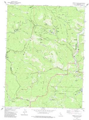
French Gulch Topo Map California
To zoom in, hover over the map of French Gulch
USGS Topo Quad 40122f6 - 1:24,000 scale
| Topo Map Name: | French Gulch |
| USGS Topo Quad ID: | 40122f6 |
| Print Size: | ca. 21 1/4" wide x 27" high |
| Southeast Coordinates: | 40.625° N latitude / 122.625° W longitude |
| Map Center Coordinates: | 40.6875° N latitude / 122.6875° W longitude |
| U.S. State: | CA |
| Filename: | o40122f6.jpg |
| Download Map JPG Image: | French Gulch topo map 1:24,000 scale |
| Map Type: | Topographic |
| Topo Series: | 7.5´ |
| Map Scale: | 1:24,000 |
| Source of Map Images: | United States Geological Survey (USGS) |
| Alternate Map Versions: |
French Gulch CA 1979, updated 1979 Download PDF Buy paper map French Gulch CA 1979, updated 1979 Download PDF Buy paper map French Gulch CA 2012 Download PDF Buy paper map French Gulch CA 2015 Download PDF Buy paper map |
| FStopo: | US Forest Service topo French Gulch is available: Download FStopo PDF Download FStopo TIF |
1:24,000 Topo Quads surrounding French Gulch
> Back to 40122e1 at 1:100,000 scale
> Back to 40122a1 at 1:250,000 scale
> Back to U.S. Topo Maps home
French Gulch topo map: Gazetteer
French Gulch: Falls
Crystal Creek Falls elevation 524m 1719′Whiskeytown Falls elevation 873m 2864′
French Gulch: Gaps
Buckhorn Summit elevation 998m 3274′French Gulch: Mines
Black Tom Mine elevation 773m 2536′Brown Bear Mine elevation 859m 2818′
Brunswick Mine elevation 1019m 3343′
El Dorado Mine elevation 400m 1312′
Franklin Mine elevation 618m 2027′
Milkmaid Mine elevation 575m 1886′
Niagara Mine elevation 1075m 3526′
Niagara Summit Mine elevation 920m 3018′
Philladelphia Mine elevation 719m 2358′
Scorpion Mine elevation 1073m 3520′
Summit Mine elevation 1020m 3346′
Tom Green Mine elevation 1016m 3333′
Washington Mine elevation 758m 2486′
French Gulch: Parks
French Gulch County Park elevation 430m 1410′French Gulch Historic District elevation 457m 1499′
French Gulch: Populated Places
Deadwood elevation 864m 2834′French Gulch elevation 425m 1394′
French Gulch: Ridges
Brunswick Ridge elevation 1095m 3592′Highland Ridge elevation 1101m 3612′
Yankee Billy Ridge elevation 866m 2841′
French Gulch: Streams
Crystal Creek elevation 397m 1302′Mill Creek elevation 383m 1256′
South Fork Deadwood Creek elevation 795m 2608′
Willow Creek elevation 376m 1233′
French Gulch: Valleys
Bear Gulch elevation 548m 1797′Boswell Gulch elevation 669m 2194′
Centennial Gulch elevation 846m 2775′
Church Gulch elevation 784m 2572′
Cline Gulch elevation 433m 1420′
Donnelly Gulch elevation 832m 2729′
Dutch Gulch elevation 483m 1584′
Fivemile Gulch elevation 464m 1522′
Franklin Gulch elevation 619m 2030′
French Gulch elevation 424m 1391′
George Williams Gulch elevation 407m 1335′
Johns Gulch elevation 437m 1433′
Mill Gulch elevation 902m 2959′
Queens Draw elevation 465m 1525′
Right Fork French Gulch elevation 579m 1899′
Sawpit Gulch elevation 487m 1597′
Scorpion Gulch elevation 568m 1863′
Slaughterhouse Gulch elevation 462m 1515′
State Gulch elevation 405m 1328′
Summit Gulch elevation 529m 1735′
Thorne Gulch elevation 830m 2723′
Trail Gulch elevation 568m 1863′
Water Gulch elevation 569m 1866′
Yankee Gulch elevation 447m 1466′
French Gulch digital topo map on disk
Buy this French Gulch topo map showing relief, roads, GPS coordinates and other geographical features, as a high-resolution digital map file on DVD:


