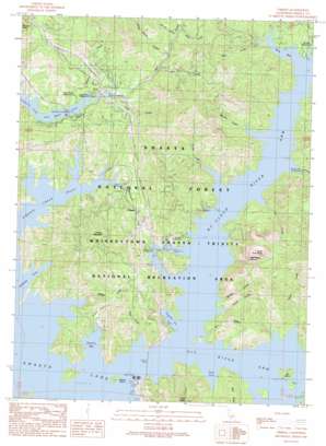
O'Brien Topo Map California
To zoom in, hover over the map of O'Brien
USGS Topo Quad 40122g3 - 1:24,000 scale
| Topo Map Name: | O'Brien |
| USGS Topo Quad ID: | 40122g3 |
| Print Size: | ca. 21 1/4" wide x 27" high |
| Southeast Coordinates: | 40.75° N latitude / 122.25° W longitude |
| Map Center Coordinates: | 40.8125° N latitude / 122.3125° W longitude |
| U.S. State: | CA |
| Filename: | o40122g3.jpg |
| Download Map JPG Image: | O'Brien topo map 1:24,000 scale |
| Map Type: | Topographic |
| Topo Series: | 7.5´ |
| Map Scale: | 1:24,000 |
| Source of Map Images: | United States Geological Survey (USGS) |
| Alternate Map Versions: |
O'Brien CA 1990, updated 1990 Download PDF Buy paper map O'Brien CA 1998, updated 2003 Download PDF Buy paper map O'Brien CA 2012 Download PDF Buy paper map O'Brien CA 2015 Download PDF Buy paper map |
| FStopo: | US Forest Service topo O'Brien is available: Download FStopo PDF Download FStopo TIF |
1:24,000 Topo Quads surrounding O'Brien
> Back to 40122e1 at 1:100,000 scale
> Back to 40122a1 at 1:250,000 scale
> Back to U.S. Topo Maps home
O'Brien topo map: Gazetteer
O'Brien: Airports
Bridge Bay Resort Seaplane Base elevation 325m 1066′O'Brien: Bays
Allie Cove elevation 325m 1066′Bailey Cove elevation 325m 1066′
Halfway Cove elevation 325m 1066′
Hirz Bay elevation 325m 1066′
McCloud River Arm elevation 325m 1066′
O'Brien Creek Inlet elevation 325m 1066′
Packers Bay elevation 325m 1066′
Pit River Arm elevation 325m 1066′
Salt Creek Inlet elevation 325m 1066′
Turntable Bay elevation 325m 1066′
O'Brien: Bridges
Pit River Bridge elevation 325m 1066′O'Brien: Islands
Beaver Island elevation 370m 1213′Ski Island elevation 357m 1171′
O'Brien: Mines
Shasta Iron Mine elevation 513m 1683′O'Brien: Parks
Salt Creek Picnic Area elevation 326m 1069′O'Brien: Populated Places
Baird (historical) elevation 325m 1066′Holiday Harbor Resort elevation 326m 1069′
Lakeview Resort elevation 352m 1154′
O'Brien elevation 376m 1233′
O'Brien: Streams
Azelle Creek elevation 325m 1066′Coal Creek elevation 343m 1125′
Curl Creek elevation 325m 1066′
Dead Horse Creek elevation 356m 1167′
Fall Creek elevation 353m 1158′
Goat Creek elevation 325m 1066′
Greens Creek elevation 330m 1082′
Hirz Creek elevation 325m 1066′
Keluche Creek elevation 325m 1066′
Marble Creek elevation 329m 1079′
McCloud River elevation 325m 1066′
Moss Creek elevation 396m 1299′
Nelson Creek elevation 333m 1092′
Pit River elevation 325m 1066′
Potter Creek elevation 325m 1066′
Ycotto Creek elevation 325m 1066′
O'Brien: Summits
North Gray Rocks elevation 933m 3061′O'Brien Mountain elevation 803m 2634′
O'Brien: Valleys
Lightning Canyon elevation 378m 1240′Packers Gulch elevation 325m 1066′
Waters Gulch elevation 325m 1066′
O'Brien digital topo map on disk
Buy this O'Brien topo map showing relief, roads, GPS coordinates and other geographical features, as a high-resolution digital map file on DVD:


