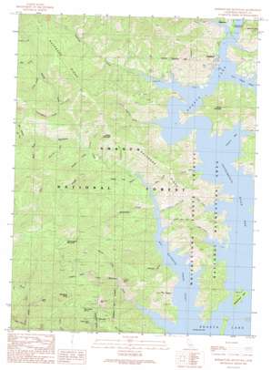
Bohemotash Mountain Topo Map California
To zoom in, hover over the map of Bohemotash Mountain
USGS Topo Quad 40122g4 - 1:24,000 scale
| Topo Map Name: | Bohemotash Mountain |
| USGS Topo Quad ID: | 40122g4 |
| Print Size: | ca. 21 1/4" wide x 27" high |
| Southeast Coordinates: | 40.75° N latitude / 122.375° W longitude |
| Map Center Coordinates: | 40.8125° N latitude / 122.4375° W longitude |
| U.S. State: | CA |
| Filename: | o40122g4.jpg |
| Download Map JPG Image: | Bohemotash Mountain topo map 1:24,000 scale |
| Map Type: | Topographic |
| Topo Series: | 7.5´ |
| Map Scale: | 1:24,000 |
| Source of Map Images: | United States Geological Survey (USGS) |
| Alternate Map Versions: |
Bohemotash Mountain CA 1990, updated 1990 Download PDF Buy paper map Bohemotash Mountain CA 1990, updated 1990 Download PDF Buy paper map Bohemotash Mountain CA 1998, updated 2003 Download PDF Buy paper map Bohemotash Mountain CA 2012 Download PDF Buy paper map Bohemotash Mountain CA 2015 Download PDF Buy paper map |
| FStopo: | US Forest Service topo Bohemotash Mountain is available: Download FStopo PDF Download FStopo TIF |
1:24,000 Topo Quads surrounding Bohemotash Mountain
> Back to 40122e1 at 1:100,000 scale
> Back to 40122a1 at 1:250,000 scale
> Back to U.S. Topo Maps home
Bohemotash Mountain topo map: Gazetteer
Bohemotash Mountain: Bays
Elmore Bay elevation 325m 1066′Sacramento River Arm elevation 325m 1066′
Bohemotash Mountain: Islands
Slaughterhouse Island elevation 374m 1227′Bohemotash Mountain: Mines
Clipper Mine elevation 753m 2470′Friday-Louden Mine elevation 735m 2411′
Golinsky Mine elevation 596m 1955′
Mammoth Mine elevation 891m 2923′
Sutro Mine elevation 1058m 3471′
Bohemotash Mountain: Populated Places
Elmore (historical) elevation 325m 1066′Mabel (historical) elevation 325m 1066′
Morley (historical) elevation 325m 1066′
Sugarloaf elevation 345m 1131′
Bohemotash Mountain: Ridges
Backbone Ridge elevation 777m 2549′Bohemotash Mountain: Springs
Shoemaker Spring elevation 999m 3277′Bohemotash Mountain: Streams
Adler Creek elevation 325m 1066′Alder Creek elevation 325m 1066′
Backbone Creek elevation 326m 1069′
Beartrap Creek elevation 426m 1397′
Big Backbone Creek Inlet elevation 325m 1066′
Big Creek elevation 544m 1784′
Bull Creek elevation 325m 1066′
Charlie Creek elevation 325m 1066′
Cunningham Creek elevation 437m 1433′
Elmore Creek elevation 325m 1066′
Fall Creek elevation 365m 1197′
Jackass Creek elevation 385m 1263′
Lick Creek elevation 764m 2506′
Little Backbone Creek elevation 325m 1066′
Little Sugarloaf Creek elevation 325m 1066′
Lockhart Creek elevation 581m 1906′
Lower Limestone Valley Creek elevation 325m 1066′
North Fork Backbone Creek elevation 407m 1335′
North Fork Little Backbone Creek elevation 486m 1594′
Oak Opening Creek elevation 354m 1161′
Polly Creek elevation 505m 1656′
Ringeye Creek elevation 391m 1282′
Salt Creek elevation 325m 1066′
Shoemaker Gulch elevation 325m 1066′
Sugarloaf Creek elevation 325m 1066′
Upper Limestone Valley Creek elevation 325m 1066′
Bohemotash Mountain: Summits
Bohemotash Mountain elevation 1346m 4416′Elmore Mountain elevation 741m 2431′
Haycock Peak elevation 598m 1961′
Jackass Mountain elevation 802m 2631′
Mammoth Butte elevation 1273m 4176′
Bohemotash Mountain: Valleys
Box Canyon elevation 480m 1574′Buck Gulch elevation 477m 1564′
Dark Canyon elevation 336m 1102′
Doe Gulch elevation 473m 1551′
Limerock Gulch elevation 325m 1066′
Sawmill Gulch elevation 830m 2723′
Shake Tree Gulch elevation 325m 1066′
Wood Gulch elevation 542m 1778′
Bohemotash Mountain digital topo map on disk
Buy this Bohemotash Mountain topo map showing relief, roads, GPS coordinates and other geographical features, as a high-resolution digital map file on DVD:


