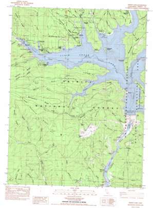
Trinity Dam Topo Map California
To zoom in, hover over the map of Trinity Dam
USGS Topo Quad 40122g7 - 1:24,000 scale
| Topo Map Name: | Trinity Dam |
| USGS Topo Quad ID: | 40122g7 |
| Print Size: | ca. 21 1/4" wide x 27" high |
| Southeast Coordinates: | 40.75° N latitude / 122.75° W longitude |
| Map Center Coordinates: | 40.8125° N latitude / 122.8125° W longitude |
| U.S. State: | CA |
| Filename: | o40122g7.jpg |
| Download Map JPG Image: | Trinity Dam topo map 1:24,000 scale |
| Map Type: | Topographic |
| Topo Series: | 7.5´ |
| Map Scale: | 1:24,000 |
| Source of Map Images: | United States Geological Survey (USGS) |
| Alternate Map Versions: |
Trinity Dam CA 1982, updated 1982 Download PDF Buy paper map Trinity Dam CA 1998, updated 2003 Download PDF Buy paper map Trinity Dam CA 1998, updated 2003 Download PDF Buy paper map Trinity Dam CA 2012 Download PDF Buy paper map Trinity Dam CA 2015 Download PDF Buy paper map |
| FStopo: | US Forest Service topo Trinity Dam is available: Download FStopo PDF Download FStopo TIF |
1:24,000 Topo Quads surrounding Trinity Dam
> Back to 40122e1 at 1:100,000 scale
> Back to 40122a1 at 1:250,000 scale
> Back to U.S. Topo Maps home
Trinity Dam topo map: Gazetteer
Trinity Dam: Dams
Trinity Dam elevation 721m 2365′Trinity Dam: Flats
Chicken Flat elevation 736m 2414′Hayward Flat elevation 737m 2417′
Red Flat elevation 939m 3080′
Trinity Dam: Islands
Ridgeville Islands elevation 724m 2375′Trinity Dam: Mines
After All Mine elevation 810m 2657′Bales and Van Matre Mine elevation 670m 2198′
Batham Dredge Mine elevation 723m 2372′
Beaudry Mine elevation 723m 2372′
Boarding House Mine elevation 759m 2490′
Bonanza Mine elevation 723m 2372′
Buckeye Mine elevation 763m 2503′
Cement and Mule Creek Mine elevation 723m 2372′
Cunningham Mine elevation 698m 2290′
Eastman Mine elevation 612m 2007′
Fairview Dredge Mine elevation 723m 2372′
Fairview Mine elevation 865m 2837′
Humboldt Mine elevation 723m 2372′
Ingleside Mine elevation 723m 2372′
Lewiston Dredge Mine elevation 584m 1916′
Little Anna Mine elevation 841m 2759′
Little Elsie Mine elevation 806m 2644′
Minersville Mine elevation 723m 2372′
Red Hill Mine elevation 723m 2372′
Rising Sun Mine elevation 707m 2319′
Rowles Mine elevation 735m 2411′
Slate Creek Mine elevation 785m 2575′
Thompson Divide Dredge Mine elevation 723m 2372′
Tolly Hill Mine elevation 784m 2572′
Unity Mine elevation 723m 2372′
Woodrat Mine elevation 870m 2854′
Trinity Dam: Populated Places
Cedar Stock elevation 744m 2440′Estrellita elevation 748m 2454′
Fairview elevation 732m 2401′
Minersville (historical) elevation 723m 2372′
Pinewood Cove elevation 784m 2572′
Ridgeville elevation 778m 2552′
Trinity Dam: Reservoirs
Trinity Lake elevation 721m 2365′Trinity Dam: Ridges
Baxter Ridge elevation 983m 3225′Buckeye Ridge elevation 1022m 3353′
Montgomery Ridge elevation 977m 3205′
Tannery Ridge elevation 982m 3221′
Telephone Ridge elevation 912m 2992′
Trinity Dam: Springs
Clark Spring elevation 755m 2477′Trinity Dam: Streams
Buckeye Creek elevation 723m 2372′Digger Creek elevation 759m 2490′
Little Mule Creek elevation 746m 2447′
Mule Creek elevation 723m 2372′
Slate Creek elevation 723m 2372′
Stoney Creek elevation 723m 2372′
Stuart Fork elevation 723m 2372′
Trinity Dam: Summits
Pettijohn Mountain elevation 1083m 3553′Trinity Dam: Valleys
Baxter Gulch elevation 692m 2270′Bear Gulch elevation 613m 2011′
Buck Gulch elevation 739m 2424′
China Gulch elevation 660m 2165′
Cummings Creek elevation 733m 2404′
Deer Gulch elevation 706m 2316′
Digger Gulch elevation 723m 2372′
Dutch Gulch elevation 723m 2372′
Eastman Gulch elevation 593m 1945′
Farley Gulch elevation 723m 2372′
Ferry Gulch elevation 608m 1994′
Haylock Gulch elevation 723m 2372′
Irish Gulch elevation 740m 2427′
Italian Gulch elevation 723m 2372′
Little Roycroft Gulch elevation 617m 2024′
Mooney Gulch elevation 613m 2011′
Posey Gulch elevation 628m 2060′
Ragged Gulch elevation 723m 2372′
Rich Gulch elevation 746m 2447′
Roycroft Gulch elevation 614m 2014′
Sawmill Gulch elevation 723m 2372′
Shady Gulch elevation 723m 2372′
Smith Gulch elevation 723m 2372′
Tannery Gulch elevation 723m 2372′
Whitney Gulch elevation 758m 2486′
Trinity Dam digital topo map on disk
Buy this Trinity Dam topo map showing relief, roads, GPS coordinates and other geographical features, as a high-resolution digital map file on DVD:


