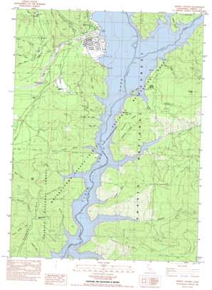
Trinity Center Topo Map California
To zoom in, hover over the map of Trinity Center
USGS Topo Quad 40122h6 - 1:24,000 scale
| Topo Map Name: | Trinity Center |
| USGS Topo Quad ID: | 40122h6 |
| Print Size: | ca. 21 1/4" wide x 27" high |
| Southeast Coordinates: | 40.875° N latitude / 122.625° W longitude |
| Map Center Coordinates: | 40.9375° N latitude / 122.6875° W longitude |
| U.S. State: | CA |
| Filename: | o40122h6.jpg |
| Download Map JPG Image: | Trinity Center topo map 1:24,000 scale |
| Map Type: | Topographic |
| Topo Series: | 7.5´ |
| Map Scale: | 1:24,000 |
| Source of Map Images: | United States Geological Survey (USGS) |
| Alternate Map Versions: |
Trinity Center CA 1982, updated 1982 Download PDF Buy paper map Trinity Center CA 1982, updated 1986 Download PDF Buy paper map Trinity Center CA 1998, updated 2003 Download PDF Buy paper map Trinity Center CA 1998, updated 2003 Download PDF Buy paper map Trinity Center CA 2012 Download PDF Buy paper map Trinity Center CA 2015 Download PDF Buy paper map |
| FStopo: | US Forest Service topo Trinity Center is available: Download FStopo PDF Download FStopo TIF |
1:24,000 Topo Quads surrounding Trinity Center
> Back to 40122e1 at 1:100,000 scale
> Back to 40122a1 at 1:250,000 scale
> Back to U.S. Topo Maps home
Trinity Center topo map: Gazetteer
Trinity Center: Airports
Trinity Center Airport elevation 736m 2414′Trinity Center: Flats
Gratten Flat elevation 865m 2837′Trinity Center: Islands
Irish Isles elevation 723m 2372′Trinity Center: Populated Places
Bragdon (historical) elevation 722m 2368′Trinity Center elevation 748m 2454′
Trinity Center: Post Offices
Trinity Center Post Office elevation 760m 2493′Trinity Center: Ridges
Feeny Ridge elevation 1239m 4064′Linton Ridge elevation 1216m 3989′
Rackerby Ridge elevation 963m 3159′
Trinity Center: Springs
Jackass Spring elevation 766m 2513′Trinity Center: Streams
Coffee Ditch elevation 891m 2923′Foster Creek elevation 782m 2565′
Gratten Creek elevation 818m 2683′
Nelson Creek elevation 722m 2368′
North Fork Swift Creek elevation 786m 2578′
Rancheria Creek elevation 753m 2470′
Star Creek elevation 844m 2769′
Star Creek elevation 837m 2746′
Swift Creek elevation 740m 2427′
Trinity Center: Summits
Billys Peak elevation 1224m 4015′Bowerman Peak elevation 1228m 4028′
Jackass Peak elevation 1312m 4304′
Manzanita Butte elevation 799m 2621′
Usher Hill elevation 985m 3231′
Trinity Center: Valleys
Billie Gulch elevation 1029m 3375′Bragdon Gulch elevation 722m 2368′
Bridge Gulch elevation 722m 2368′
Clawton Gulch elevation 722m 2368′
Feeny Gulch elevation 722m 2368′
Freethy Gulch elevation 722m 2368′
Gibson Gulch elevation 722m 2368′
Hay Gulch elevation 722m 2368′
Moore Gulch elevation 722m 2368′
Moss Gulch elevation 724m 2375′
North Twin Gulch elevation 722m 2368′
Packer Gulch elevation 722m 2368′
Pansy Gulch elevation 918m 3011′
Parry Gulch elevation 897m 2942′
Rackerby Gulch elevation 722m 2368′
Sawmill Gulch elevation 722m 2368′
South Clawton Gulch elevation 722m 2368′
South Twin Gulch elevation 724m 2375′
Tough Gus Gulch elevation 868m 2847′
White Oak Gulch elevation 722m 2368′
Trinity Center digital topo map on disk
Buy this Trinity Center topo map showing relief, roads, GPS coordinates and other geographical features, as a high-resolution digital map file on DVD:


