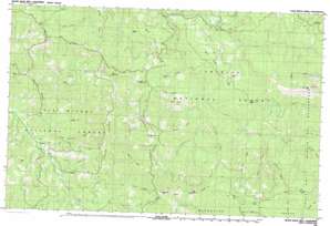
Black Rock Mountain Topo Map California
To zoom in, hover over the map of Black Rock Mountain
USGS Topo Quad 40123b1 - 1:25,000 scale
| Topo Map Name: | Black Rock Mountain |
| USGS Topo Quad ID: | 40123b1 |
| Print Size: | ca. 39" wide x 24" high |
| Southeast Coordinates: | 40.125° N latitude / 123° W longitude |
| Map Center Coordinates: | 40.1875° N latitude / 123.125° W longitude |
| U.S. State: | CA |
| Filename: | k40123b1.jpg |
| Download Map JPG Image: | Black Rock Mountain topo map 1:25,000 scale |
| Map Type: | Topographic |
| Topo Series: | 7.5´x15´ |
| Map Scale: | 1:25,000 |
| Source of Map Images: | United States Geological Survey (USGS) |
| Alternate Map Versions: |
Black Rock Mtn CA 1981, updated 1981 Download PDF Buy paper map |
| FStopo: | US Forest Service topo Black Rock Mountain is available: Download FStopo PDF Download FStopo TIF |
1:24,000 Topo Quads surrounding Black Rock Mountain
> Back to 40123a1 at 1:100,000 scale
> Back to 40122a1 at 1:250,000 scale
> Back to U.S. Topo Maps home
Black Rock Mountain topo map: Gazetteer
Black Rock Mountain: Flats
Cleveland Meadow elevation 1107m 3631′Fern Glade elevation 1397m 4583′
Penney Glades elevation 1199m 3933′
Black Rock Mountain: Gaps
Cedar Gap elevation 1394m 4573′West Low Gap elevation 1377m 4517′
Black Rock Mountain: Lakes
Black Rock Lake elevation 1894m 6213′Black Rock Mountain: Mines
Bonanza Mine elevation 1153m 3782′Lucky Sunday Mine elevation 1012m 3320′
Black Rock Mountain: Pillars
Hermit Rock elevation 1429m 4688′Tombstone Rock elevation 1550m 5085′
Black Rock Mountain: Populated Places
Payne elevation 945m 3100′Penney elevation 1043m 3421′
Black Rock Mountain: Ridges
Bierce Ridge elevation 1263m 4143′Brooks Ridge elevation 1664m 5459′
Buck Ridge elevation 1415m 4642′
Cobb Ridge elevation 1132m 3713′
Collins Ridge elevation 1385m 4543′
Grouse Ridge elevation 1397m 4583′
Horsehead Ridge elevation 1491m 4891′
Mule Ridge elevation 1530m 5019′
Penney Ridge elevation 1514m 4967′
Powell Ridge elevation 1701m 5580′
Rainbow Ridge elevation 1469m 4819′
Skylight Ridge elevation 1865m 6118′
Stockton Ridge elevation 1772m 5813′
Swim Ridge elevation 1295m 4248′
Trough Ridge elevation 1310m 4297′
Van Horn Ridge elevation 1201m 3940′
Wilcox Ridge elevation 1286m 4219′
Black Rock Mountain: Springs
Happy Camp Spring elevation 1545m 5068′Water Spout Spring elevation 1230m 4035′
Waterspout elevation 1245m 4084′
Black Rock Mountain: Streams
Dark Canyon Creek elevation 951m 3120′East Fork South Fork Trinity River elevation 906m 2972′
North Fork Mud River elevation 883m 2896′
Prospect Creek elevation 904m 2965′
Shell Mountain Creek elevation 983m 3225′
South Fork Mad River elevation 888m 2913′
Trout Creek elevation 934m 3064′
Black Rock Mountain: Summits
Big Hunter elevation 1533m 5029′Black Rock Mountain elevation 2366m 7762′
Blue Slide elevation 1704m 5590′
Horsehead Mountain elevation 1697m 5567′
Low Mountain elevation 1303m 4274′
North Kelsey Peak elevation 1498m 4914′
South Kelsey Peak elevation 1553m 5095′
Van Horn Peak elevation 1094m 3589′
Black Rock Mountain: Trails
Humboldt Trail elevation 1866m 6122′Black Rock Mountain: Valleys
Clover Gulch elevation 898m 2946′Little Clover Gulch elevation 888m 2913′
Low Mountain Gulch elevation 896m 2939′
Mule Gulch elevation 1156m 3792′
Raspberry Gulch elevation 1036m 3398′
Secret Gulch elevation 883m 2896′
Black Rock Mountain digital topo map on disk
Buy this Black Rock Mountain topo map showing relief, roads, GPS coordinates and other geographical features, as a high-resolution digital map file on DVD:


