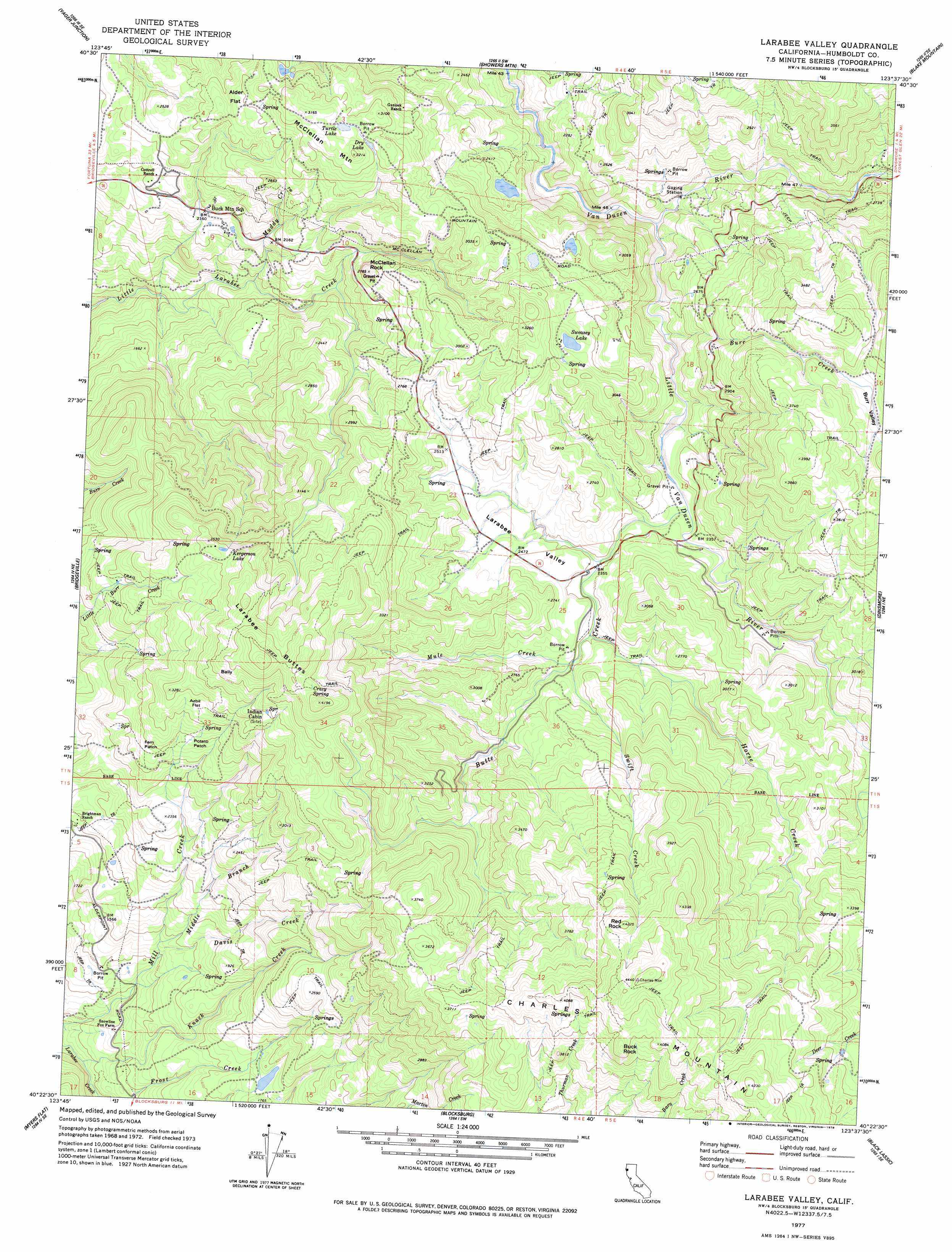
Larabee Valley Topo Map California
To zoom in, hover over the map of Larabee Valley
USGS Topo Quad 40123d6 - 1:24,000 scale
| Topo Map Name: | Larabee Valley |
| USGS Topo Quad ID: | 40123d6 |
| Print Size: | ca. 21 1/4" wide x 27" high |
| Southeast Coordinates: | 40.375° N latitude / 123.625° W longitude |
| Map Center Coordinates: | 40.4375° N latitude / 123.6875° W longitude |
| U.S. State: | CA |
| Filename: | o40123d6.jpg |
| Download Map JPG Image: | Larabee Valley topo map 1:24,000 scale |
| Map Type: | Topographic |
| Topo Series: | 7.5´ |
| Map Scale: | 1:24,000 |
| Source of Map Images: | United States Geological Survey (USGS) |
| Alternate Map Versions: |
Larabee Valley CA 1977, updated 1978 Download PDF Buy paper map Larabee Valley CA 2012 Download PDF Buy paper map Larabee Valley CA 2015 Download PDF Buy paper map |
1:24,000 Topo Quads surrounding Larabee Valley
Iaqua Buttes |
Mad River Buttes |
Board Camp Mountain |
Sims Mountain |
Hyampom Mountain |
Owl Creek |
Yager Junction |
Showers Mountain |
Blake Mountain |
Hyampom |
Redcrest |
Bridgeville |
Larabee Valley |
Dinsmore |
Sportshaven |
Weott |
Myers Flat |
Blocksburg |
Black Lassic |
Ruth Lake |
Ettersburg |
Miranda |
Fort Seward |
Alderpoint |
Zenia |
> Back to 40123a1 at 1:100,000 scale
> Back to 40122a1 at 1:250,000 scale
> Back to U.S. Topo Maps home
Larabee Valley topo map: Gazetteer
Larabee Valley: Areas
Fern Patch elevation 832m 2729′Potato Patch elevation 845m 2772′
Larabee Valley: Flats
Alder Flat elevation 834m 2736′Azbil Flat elevation 940m 3083′
Larabee Valley: Lakes
Dry Lake elevation 915m 3001′Kergerson Lake elevation 1047m 3435′
Sweasey Lake elevation 863m 2831′
Turtle Lake elevation 938m 3077′
Larabee Valley: Pillars
Buck Rock elevation 1272m 4173′Red Rock elevation 1285m 4215′
Larabee Valley: Springs
Crazy Spring elevation 1189m 3900′Larabee Valley: Streams
Burr Creek elevation 666m 2185′Butte Creek elevation 697m 2286′
Davis Creek elevation 413m 1354′
Horse Creek elevation 732m 2401′
Knack Creek elevation 264m 866′
Little Van Duzen River elevation 597m 1958′
Middle Branch Mill Creek elevation 453m 1486′
Muddy Creek elevation 524m 1719′
Mule Creek elevation 735m 2411′
Swift Creek elevation 735m 2411′
Thompson Creek elevation 766m 2513′
Larabee Valley: Summits
Bally elevation 1131m 3710′Larabee Buttes elevation 1187m 3894′
McClellan Mountain elevation 958m 3143′
McClellan Rock elevation 812m 2664′
Larabee Valley: Valleys
Burr Valley elevation 1042m 3418′Larabee Valley elevation 734m 2408′
Larabee Valley digital topo map on disk
Buy this Larabee Valley topo map showing relief, roads, GPS coordinates and other geographical features, as a high-resolution digital map file on DVD: