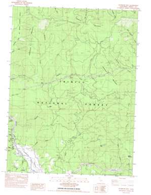
Hyampom Mountain Topo Map California
To zoom in, hover over the map of Hyampom Mountain
USGS Topo Quad 40123f4 - 1:24,000 scale
| Topo Map Name: | Hyampom Mountain |
| USGS Topo Quad ID: | 40123f4 |
| Print Size: | ca. 21 1/4" wide x 27" high |
| Southeast Coordinates: | 40.625° N latitude / 123.375° W longitude |
| Map Center Coordinates: | 40.6875° N latitude / 123.4375° W longitude |
| U.S. State: | CA |
| Filename: | o40123f4.jpg |
| Download Map JPG Image: | Hyampom Mountain topo map 1:24,000 scale |
| Map Type: | Topographic |
| Topo Series: | 7.5´ |
| Map Scale: | 1:24,000 |
| Source of Map Images: | United States Geological Survey (USGS) |
| Alternate Map Versions: |
Hyampom Mtn. CA 1982, updated 1982 Download PDF Buy paper map Hyampom Mountain CA 1998, updated 2003 Download PDF Buy paper map Hyampom Mountain CA 2012 Download PDF Buy paper map Hyampom Mountain CA 2015 Download PDF Buy paper map |
| FStopo: | US Forest Service topo Hyampom Mountain is available: Download FStopo PDF Download FStopo TIF |
1:24,000 Topo Quads surrounding Hyampom Mountain
> Back to 40123e1 at 1:100,000 scale
> Back to 40122a1 at 1:250,000 scale
> Back to U.S. Topo Maps home
Hyampom Mountain topo map: Gazetteer
Hyampom Mountain: Airports
Hyampom Airport elevation 381m 1250′Hyampom Mountain: Pillars
Salmon Rock elevation 423m 1387′Hyampom Mountain: Populated Places
Wigdon Place elevation 725m 2378′Hyampom Mountain: Streams
Allen Creek elevation 881m 2890′Bear Creek elevation 479m 1571′
Big Creek elevation 372m 1220′
Buckhorn Creek elevation 779m 2555′
Clark Creek elevation 1037m 3402′
Corral Creek elevation 503m 1650′
Eltapom Creek elevation 370m 1213′
Grassy Flat Creek elevation 460m 1509′
Kerlin Creek elevation 386m 1266′
Middle Creek elevation 383m 1256′
Mill Creek elevation 381m 1250′
Pelletreau Creek elevation 380m 1246′
Walker Creek elevation 432m 1417′
Hyampom Mountain: Summits
Chaparral Mountain elevation 1597m 5239′Hyampom Mountain elevation 1323m 4340′
Rays Peak elevation 1161m 3809′
Underwood Mountain elevation 1489m 4885′
Hyampom Mountain: Valleys
Hyampom Valley elevation 374m 1227′Young Gulch elevation 519m 1702′
Hyampom Mountain digital topo map on disk
Buy this Hyampom Mountain topo map showing relief, roads, GPS coordinates and other geographical features, as a high-resolution digital map file on DVD:


