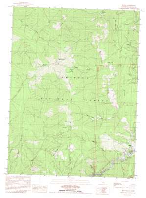
Helena Topo Map California
To zoom in, hover over the map of Helena
USGS Topo Quad 40123g2 - 1:24,000 scale
| Topo Map Name: | Helena |
| USGS Topo Quad ID: | 40123g2 |
| Print Size: | ca. 21 1/4" wide x 27" high |
| Southeast Coordinates: | 40.75° N latitude / 123.125° W longitude |
| Map Center Coordinates: | 40.8125° N latitude / 123.1875° W longitude |
| U.S. State: | CA |
| Filename: | o40123g2.jpg |
| Download Map JPG Image: | Helena topo map 1:24,000 scale |
| Map Type: | Topographic |
| Topo Series: | 7.5´ |
| Map Scale: | 1:24,000 |
| Source of Map Images: | United States Geological Survey (USGS) |
| Alternate Map Versions: |
Helena CA 1982, updated 1982 Download PDF Buy paper map Helena CA 1998, updated 2003 Download PDF Buy paper map Helena CA 2012 Download PDF Buy paper map Helena CA 2015 Download PDF Buy paper map |
| FStopo: | US Forest Service topo Helena is available: Download FStopo PDF Download FStopo TIF |
1:24,000 Topo Quads surrounding Helena
> Back to 40123e1 at 1:100,000 scale
> Back to 40122a1 at 1:250,000 scale
> Back to U.S. Topo Maps home
Helena topo map: Gazetteer
Helena: Crossings
Waldorf Crossing elevation 586m 1922′Helena: Flats
Blacks Flat elevation 600m 1968′Digger Pine Flat elevation 773m 2536′
Raymond Flat elevation 681m 2234′
Helena: Mines
Yellowstone Mine elevation 589m 1932′Helena: Parks
Helena Historic District elevation 427m 1400′Helena: Populated Places
Helena elevation 425m 1394′Helena: Post Offices
Helena Post Office (historical) elevation 436m 1430′Helena: Ridges
Manzanita Ridge elevation 1343m 4406′Treloar Ridge elevation 1077m 3533′
Helena: Springs
Buck Spring elevation 1673m 5488′Helena: Streams
Eagle Creek elevation 401m 1315′East Fork North Fork Trinity River elevation 429m 1407′
Indian Creek elevation 637m 2089′
Miller Creek elevation 411m 1348′
North Fork Trinity River elevation 413m 1354′
Helena: Summits
Twin Sisters Mountain elevation 1793m 5882′Helena: Valleys
Baxter Gulch elevation 601m 1971′Cutthroat Gulch elevation 433m 1420′
Logan Gulch elevation 442m 1450′
Mosquito Hollow elevation 1067m 3500′
North Fork Gulch elevation 496m 1627′
Squaw Gulch elevation 632m 2073′
Helena digital topo map on disk
Buy this Helena topo map showing relief, roads, GPS coordinates and other geographical features, as a high-resolution digital map file on DVD:


