Denny Topo Map California
To zoom in, hover over the map of Denny
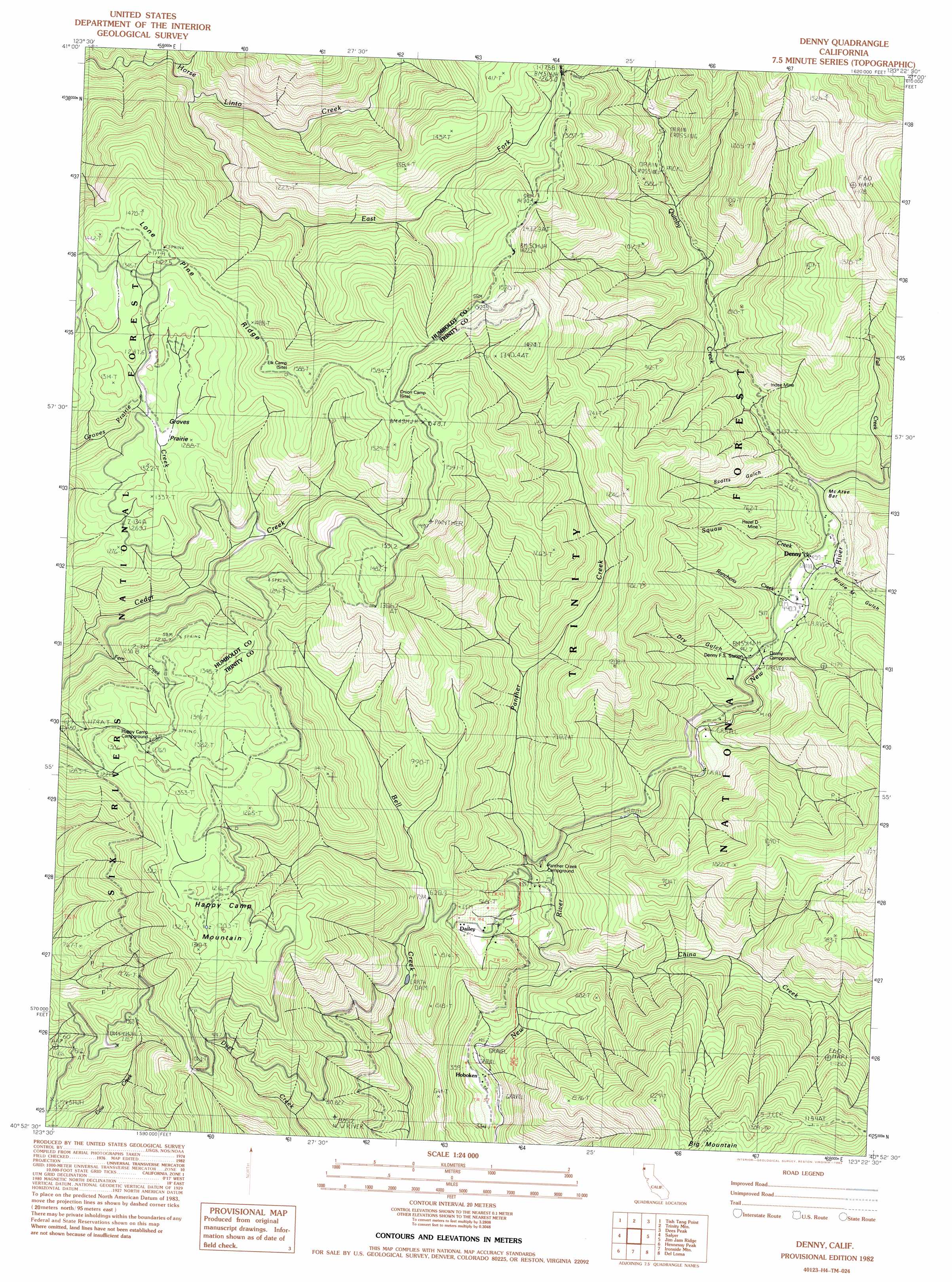
USGS Topo Quad 40123h4 - 1:24,000 scale
| Topo Map Name: | Denny |
| USGS Topo Quad ID: | 40123h4 |
| Print Size: | ca. 21 1/4" wide x 27" high |
| Southeast Coordinates: | 40.875° N latitude / 123.375° W longitude |
| Map Center Coordinates: | 40.9375° N latitude / 123.4375° W longitude |
| U.S. State: | CA |
| Filename: | o40123h4.jpg |
| Download Map JPG Image: | Denny topo map 1:24,000 scale |
| Map Type: | Topographic |
| Topo Series: | 7.5´ |
| Map Scale: | 1:24,000 |
| Source of Map Images: | United States Geological Survey (USGS) |
| Alternate Map Versions: |
Denny CA 1982, updated 1982 Download PDF Buy paper map Denny CA 1998, updated 2003 Download PDF Buy paper map Denny CA 2012 Download PDF Buy paper map Denny CA 2015 Download PDF Buy paper map |
| FStopo: | US Forest Service topo Denny is available: Download FStopo PDF Download FStopo TIF |
1:24,000 Topo Quads surrounding Denny
Weitchpec |
Hopkins Butte |
Salmon Mountain |
Youngs Peak |
Cecilville |
Hoopa |
Tish Tang Point |
Trinity Mountain |
Dees Peak |
Cecil Lake |
Willow Creek |
Salyer |
Denny |
Jim Jam Ridge |
Thurston Peaks |
Grouse Mountain |
Hennessy Peak |
Ironside Mountain |
Del Loma |
Helena |
Board Camp Mountain |
Sims Mountain |
Hyampom Mountain |
Big Bar |
Hayfork Bally |
> Back to 40123e1 at 1:100,000 scale
> Back to 40122a1 at 1:250,000 scale
> Back to U.S. Topo Maps home
Denny topo map: Gazetteer
Denny: Areas
Groves Prairie elevation 1263m 4143′Denny: Bars
McAtee Bar elevation 502m 1646′Denny: Mines
Hazel D Mine elevation 597m 1958′Index Mine elevation 701m 2299′
Denny: Populated Places
Denny elevation 451m 1479′Hoboken elevation 330m 1082′
Quinby elevation 489m 1604′
Denny: Streams
China Creek elevation 338m 1108′East Fork Horse Linto Creek elevation 1106m 3628′
Fall Creek elevation 453m 1486′
Fern Creek elevation 855m 2805′
Panther Creek elevation 357m 1171′
Quinby Creek elevation 426m 1397′
Rancheria Creek elevation 424m 1391′
Squaw Creek elevation 438m 1437′
Denny: Summits
Big Mountain elevation 1303m 4274′Happy Camp Mountain elevation 1284m 4212′
Denny: Valleys
Birdie M Gulch elevation 473m 1551′Dry Gulch elevation 460m 1509′
Scotts Gulch elevation 484m 1587′
Denny digital topo map on disk
Buy this Denny topo map showing relief, roads, GPS coordinates and other geographical features, as a high-resolution digital map file on DVD: