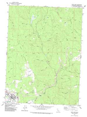
Blue Lake Topo Map California
To zoom in, hover over the map of Blue Lake
USGS Topo Quad 40123h8 - 1:24,000 scale
| Topo Map Name: | Blue Lake |
| USGS Topo Quad ID: | 40123h8 |
| Print Size: | ca. 21 1/4" wide x 27" high |
| Southeast Coordinates: | 40.875° N latitude / 123.875° W longitude |
| Map Center Coordinates: | 40.9375° N latitude / 123.9375° W longitude |
| U.S. State: | CA |
| Filename: | o40123h8.jpg |
| Download Map JPG Image: | Blue Lake topo map 1:24,000 scale |
| Map Type: | Topographic |
| Topo Series: | 7.5´ |
| Map Scale: | 1:24,000 |
| Source of Map Images: | United States Geological Survey (USGS) |
| Alternate Map Versions: |
Blue Lake CA 1979, updated 1979 Download PDF Buy paper map Blue Lake CA 1979, updated 1979 Download PDF Buy paper map Blue Lake CA 1979, updated 1979 Download PDF Buy paper map Blue Lake CA 2012 Download PDF Buy paper map Blue Lake CA 2015 Download PDF Buy paper map |
1:24,000 Topo Quads surrounding Blue Lake
> Back to 40123e1 at 1:100,000 scale
> Back to 40122a1 at 1:250,000 scale
> Back to U.S. Topo Maps home
Blue Lake topo map: Gazetteer
Blue Lake: Areas
Fawn Prairie elevation 718m 2355′Long Prairie elevation 548m 1797′
Miller Prairie elevation 396m 1299′
Round Prairie elevation 820m 2690′
Blue Lake: Capes
Poverty Point elevation 614m 2014′Blue Lake: Parks
Gymkhana Field elevation 25m 82′Perigot Park elevation 25m 82′
Blue Lake: Populated Places
Blue Lake elevation 40m 131′Blue Lake: Post Offices
Blue Lake Post Office elevation 29m 95′Blue Lake: Ridges
Tip Top Ridge elevation 673m 2208′Wiregrass Ridge elevation 1028m 3372′
Blue Lake: Streams
Bald Mountain Creek elevation 148m 485′Canyon Creek elevation 220m 721′
Denman Creek elevation 180m 590′
Dolf Creek elevation 238m 780′
East Fork North Fork Mad River elevation 220m 721′
Gosinta Creek elevation 172m 564′
Jackson Creek elevation 191m 626′
Jiggs Creek elevation 98m 321′
Krueger Creek elevation 195m 639′
Long Prairie Creek elevation 184m 603′
Mule Creek elevation 187m 613′
Pine Creek elevation 153m 501′
Pollock Creek elevation 149m 488′
Powers Creek elevation 28m 91′
Quarry Creek elevation 24m 78′
Railroad Creek elevation 212m 695′
Tyson Creek elevation 242m 793′
Blue Lake: Summits
Liscom Hill elevation 623m 2043′Blue Lake: Swamps
The Basin elevation 259m 849′Blue Lake digital topo map on disk
Buy this Blue Lake topo map showing relief, roads, GPS coordinates and other geographical features, as a high-resolution digital map file on DVD:


