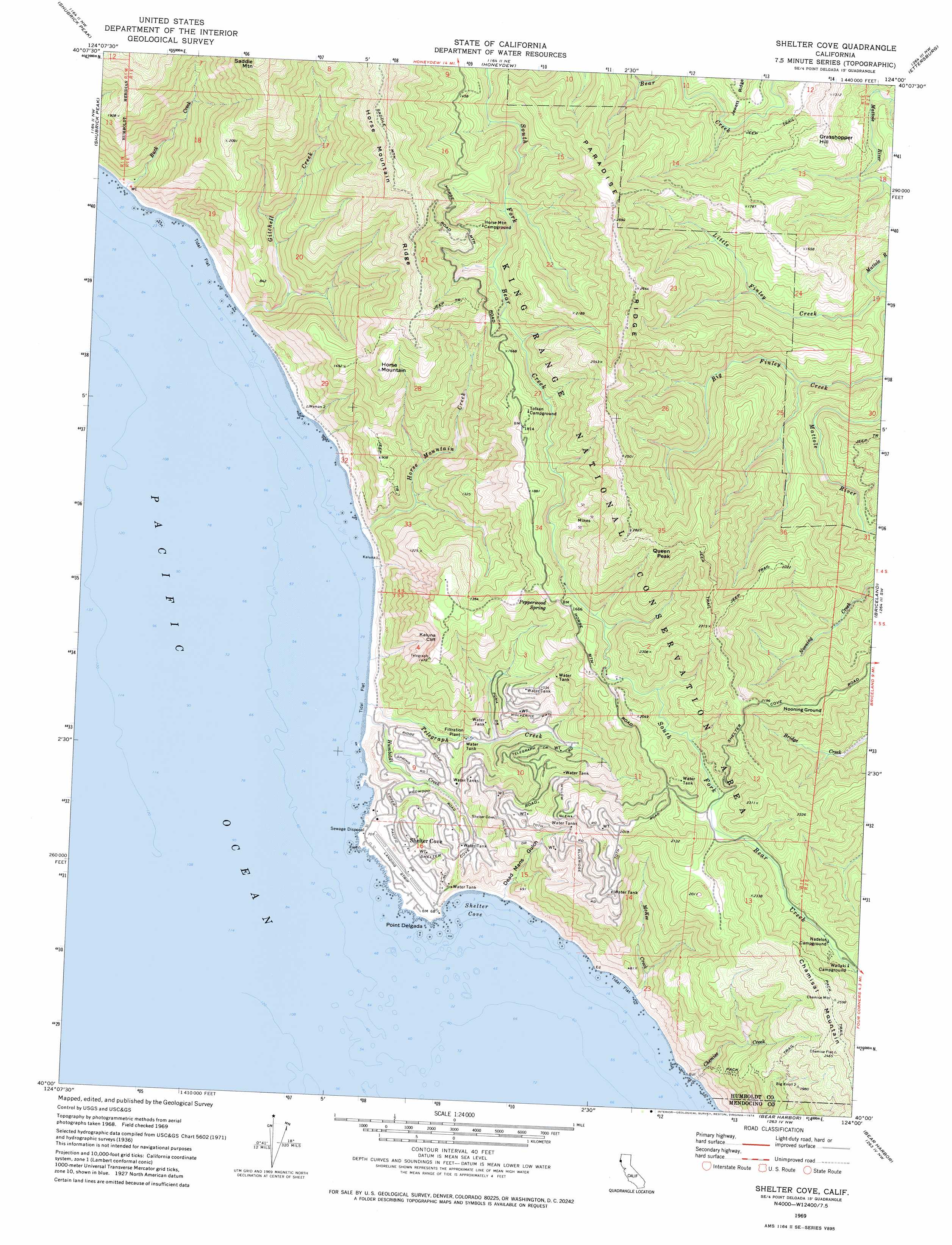
Shelter Cove Topo Map California
To zoom in, hover over the map of Shelter Cove
USGS Topo Quad 40124a1 - 1:24,000 scale
| Topo Map Name: | Shelter Cove |
| USGS Topo Quad ID: | 40124a1 |
| Print Size: | ca. 21 1/4" wide x 27" high |
| Southeast Coordinates: | 40° N latitude / 124° W longitude |
| Map Center Coordinates: | 40.0625° N latitude / 124.0625° W longitude |
| U.S. State: | CA |
| Filename: | o40124a1.jpg |
| Download Map JPG Image: | Shelter Cove topo map 1:24,000 scale |
| Map Type: | Topographic |
| Topo Series: | 7.5´ |
| Map Scale: | 1:24,000 |
| Source of Map Images: | United States Geological Survey (USGS) |
| Alternate Map Versions: |
Shelter Cove CA 1969, updated 1974 Download PDF Buy paper map Shelter Cove CA 1969, updated 1974 Download PDF Buy paper map Shelter Cove CA 1997, updated 1999 Download PDF Buy paper map Shelter Cove CA 2012 Download PDF Buy paper map Shelter Cove CA 2015 Download PDF Buy paper map |
1:24,000 Topo Quads surrounding Shelter Cove
Petrolia |
Buckeye Mountain |
Bull Creek |
Weott |
Myers Flat |
Cooskie Creek |
Shubrick Peak |
Honeydew |
Ettersburg |
Miranda |
Shelter Cove |
Briceland |
Garberville |
||
Bear Harbor |
Piercy |
|||
Mistake Point |
Hales Grove |
> Back to 40124a1 at 1:100,000 scale
> Back to 40124a1 at 1:250,000 scale
> Back to U.S. Topo Maps home
Shelter Cove topo map: Gazetteer
Shelter Cove: Airports
Shelter Cove Airport elevation 18m 59′Shelter Cove: Bays
Shelter Cove elevation 0m 0′Shelter Cove: Capes
Point Delgada elevation 2m 6′Shelter Cove: Cliffs
Kaluna Cliff elevation 331m 1085′Shelter Cove: Flats
Nooning Ground elevation 638m 2093′Shelter Cove: Populated Places
Shelter Cove elevation 42m 137′Shelter Cove: Ridges
Horse Mountain Ridge elevation 834m 2736′Paradise Ridge elevation 761m 2496′
Shelter Cove: Springs
Pepperwood Spring elevation 489m 1604′Shelter Cove: Streams
Big Finley Creek elevation 219m 718′Buck Creek elevation -1m -4′
Chemise Creek elevation 0m 0′
Gitchell Creek elevation 0m 0′
Horse Mountain Creek elevation 0m 0′
Humboldt Creek elevation 0m 0′
Little Finley Creek elevation 209m 685′
McKee Creek elevation 0m 0′
Telegraph Creek elevation 0m 0′
Shelter Cove: Summits
Chamisal Mountain elevation 785m 2575′Grasshopper Hill elevation 429m 1407′
Horse Mountain elevation 553m 1814′
Queen Peak elevation 861m 2824′
Shelter Cove: Valleys
Dead Mans Gulch elevation 28m 91′Shelter Cove digital topo map on disk
Buy this Shelter Cove topo map showing relief, roads, GPS coordinates and other geographical features, as a high-resolution digital map file on DVD: