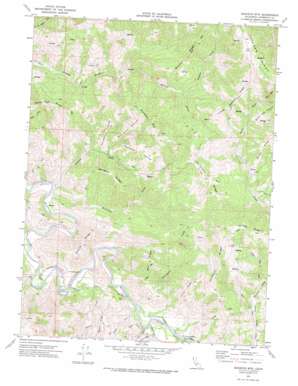
Buckeye Mountain Topo Map California
To zoom in, hover over the map of Buckeye Mountain
USGS Topo Quad 40124c2 - 1:24,000 scale
| Topo Map Name: | Buckeye Mountain |
| USGS Topo Quad ID: | 40124c2 |
| Print Size: | ca. 21 1/4" wide x 27" high |
| Southeast Coordinates: | 40.25° N latitude / 124.125° W longitude |
| Map Center Coordinates: | 40.3125° N latitude / 124.1875° W longitude |
| U.S. State: | CA |
| Filename: | o40124c2.jpg |
| Download Map JPG Image: | Buckeye Mountain topo map 1:24,000 scale |
| Map Type: | Topographic |
| Topo Series: | 7.5´ |
| Map Scale: | 1:24,000 |
| Source of Map Images: | United States Geological Survey (USGS) |
| Alternate Map Versions: |
Buckeye Mtn CA 1970, updated 1974 Download PDF Buy paper map Buckeye Mountain CA 2012 Download PDF Buy paper map Buckeye Mountain CA 2015 Download PDF Buy paper map |
1:24,000 Topo Quads surrounding Buckeye Mountain
> Back to 40124a1 at 1:100,000 scale
> Back to 40124a1 at 1:250,000 scale
> Back to U.S. Topo Maps home
Buckeye Mountain topo map: Gazetteer
Buckeye Mountain: Flats
Cow Pasture Opening elevation 315m 1033′Devils Hole Prairie elevation 882m 2893′
Homestead Opening elevation 541m 1774′
Wire Fence Opening elevation 550m 1804′
Buckeye Mountain: Parks
Arthur W Way County Memorial Park elevation 52m 170′Buckeye Mountain: Ridges
Brushy Ridge elevation 783m 2568′Burgess Ridge elevation 402m 1318′
Coon Ridge elevation 260m 853′
Damon Ridge elevation 293m 961′
Everts Ridge elevation 296m 971′
Green Ridge elevation 758m 2486′
Horse Ridge elevation 381m 1250′
Little Rainbow Ridge elevation 733m 2404′
Long Ridge elevation 622m 2040′
Mail Ridge elevation 503m 1650′
Parkhurst Ridge elevation 706m 2316′
Rainbow Ridge elevation 884m 2900′
Van Choick Ridge elevation 673m 2208′
Buckeye Mountain: Streams
Conklin Creek elevation 25m 82′Devils Creek elevation 340m 1115′
Granny Creek elevation 56m 183′
Indian Creek elevation 34m 111′
Long Ridge Creek elevation 135m 442′
McGinnis Creek elevation 31m 101′
Pritchard Creek elevation 56m 183′
Saunders Creek elevation 62m 203′
Squaw Creek elevation 44m 144′
Sulphur Creek elevation 331m 1085′
Buckeye Mountain: Summits
Buckeye Mountain elevation 783m 2568′Buckeye Mountain: Valleys
Cook Gulch elevation 65m 213′Devils Hole elevation 662m 2171′
Buckeye Mountain digital topo map on disk
Buy this Buckeye Mountain topo map showing relief, roads, GPS coordinates and other geographical features, as a high-resolution digital map file on DVD:


