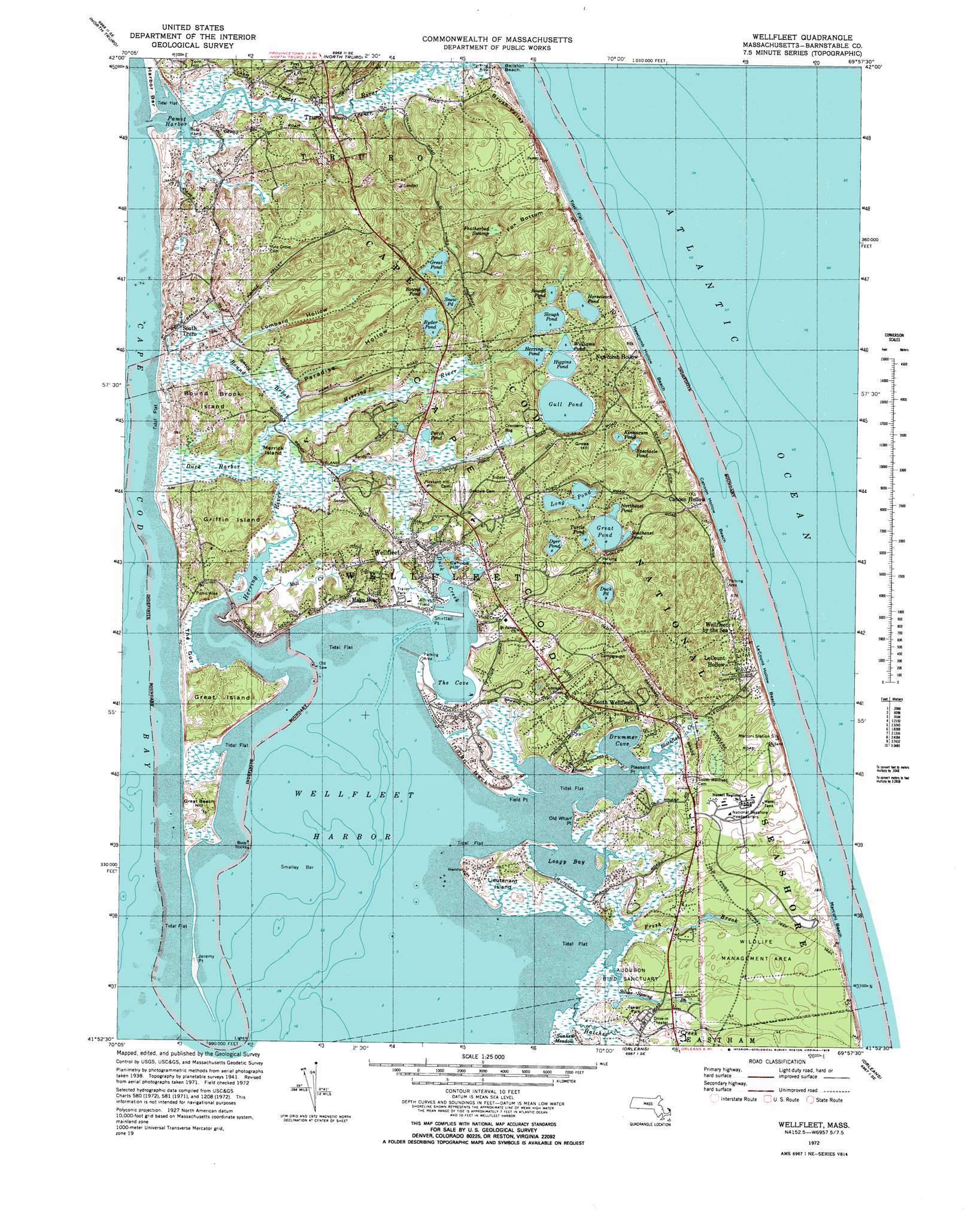
Wellfleet Topo Map Massachusetts
To zoom in, hover over the map of Wellfleet
USGS Topo Quad 41069h8 - 1:25,000 scale
| Topo Map Name: | Wellfleet |
| USGS Topo Quad ID: | 41069h8 |
| Print Size: | ca. 21 1/4" wide x 27" high |
| Southeast Coordinates: | 41.875° N latitude / 69.875° W longitude |
| Map Center Coordinates: | 41.9375° N latitude / 69.9375° W longitude |
| U.S. State: | MA |
| Filename: | l41069h8.jpg |
| Download Map JPG Image: | Wellfleet topo map 1:25,000 scale |
| Map Type: | Topographic |
| Topo Series: | 7.5´ |
| Map Scale: | 1:25,000 |
| Source of Map Images: | United States Geological Survey (USGS) |
| Alternate Map Versions: |
1:24,000 Topo Quads surrounding Wellfleet
Provincetown |
North Truro |
|||
Wellfleet |
||||
Orleans |
||||
Dennis |
Harwich |
Chatham |
> Back to 41069e1 at 1:100,000 scale
> Back to 41068a1 at 1:250,000 scale
> Back to U.S. Topo Maps home
Wellfleet topo map: Gazetteer
Wellfleet: Bays
Drummer Cove elevation 0m 0′Wellfleet: Beaches
Cahoon Hollow Beach elevation 8m 26′Maguire Landing Beach elevation 3m 9′
Marconi Beach elevation 4m 13′
Newcomb Hollow Beach elevation 3m 9′
White Crest Beach elevation 15m 49′
Wellfleet: Capes
Pleasant Point elevation 4m 13′Wellfleet: Lakes
Kinnacum Pond elevation 3m 9′Northeast Pond elevation 2m 6′
Southeast Pond elevation 0m 0′
Spectacle Pond elevation 1m 3′
Wellfleet: Populated Places
Cahoon Hollow elevation 26m 85′Fresh Brook elevation 10m 32′
Le Count Hollow (historical) elevation 24m 78′
Newcomb Hollow elevation 11m 36′
South Wellfleet elevation 11m 36′
Wellfleet by the Sea elevation 22m 72′
Wellfleet: Ranges
Camp Wellfleet Dunes elevation 15m 49′Wellfleet: Streams
Fresh Brook elevation 11m 36′Fresh Brook elevation 0m 0′
Silver Spring Brook elevation 2m 6′
Wellfleet: Swamps
Blackfish Creek Marshes elevation 3m 9′Loagy Bay Marshes elevation 3m 9′
Wellfleet digital topo map on disk
Buy this Wellfleet topo map showing relief, roads, GPS coordinates and other geographical features, as a high-resolution digital map file on DVD:
Maine, New Hampshire, Rhode Island & Eastern Massachusetts
Buy digital topo maps: Maine, New Hampshire, Rhode Island & Eastern Massachusetts