Nantucket Topo Map Massachusetts
To zoom in, hover over the map of Nantucket
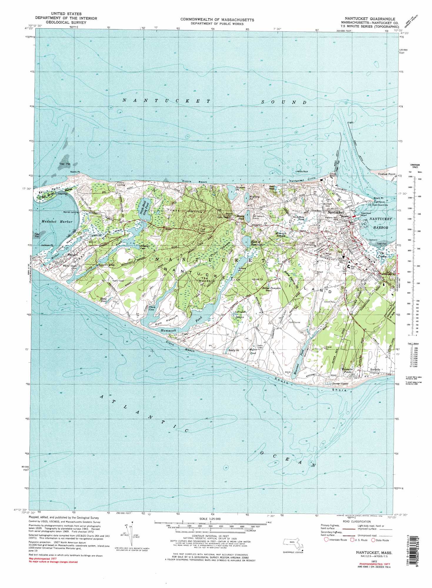
USGS Topo Quad 41070b1 - 1:25,000 scale
| Topo Map Name: | Nantucket |
| USGS Topo Quad ID: | 41070b1 |
| Print Size: | ca. 21 1/4" wide x 27" high |
| Southeast Coordinates: | 41.125° N latitude / 70° W longitude |
| Map Center Coordinates: | 41.1875° N latitude / 70.0625° W longitude |
| U.S. State: | MA |
| Filename: | l41070b1.jpg |
| Download Map JPG Image: | Nantucket topo map 1:25,000 scale |
| Map Type: | Topographic |
| Topo Series: | 7.5´ |
| Map Scale: | 1:25,000 |
| Source of Map Images: | United States Geological Survey (USGS) |
| Alternate Map Versions: |
1:24,000 Topo Quads surrounding Nantucket
Tuckernuck Island |
Great Point |
|||
Nantucket |
Siasconset |
|||
> Back to 41070a1 at 1:100,000 scale
> Back to 41070a1 at 1:250,000 scale
> Back to U.S. Topo Maps home
Nantucket topo map: Gazetteer
Nantucket: Bars
Miacomet Rip elevation 0m 0′Nantucket: Beaches
Madequecham Beach elevation 1m 3′Miacomet Beach elevation 0m 0′
Nobadeer Beach elevation 0m 0′
South Shore elevation 0m 0′
Surfside Beach elevation 0m 0′
Surfside Beach elevation 3m 9′
Nantucket: Lakes
Madequecham Pond elevation 3m 9′Miacomet Pond elevation 0m 0′
Wigwam Pond (historical) elevation 2m 6′
Nantucket: Populated Places
Long Josephs Point elevation 7m 22′Surfside elevation 4m 13′
Nantucket: Swamps
Weweeder Ponds elevation 4m 13′Nantucket: Valleys
Chappomiss Valley elevation 4m 13′Forked Pond Valley elevation 0m 0′
Madequecham Valley elevation 0m 0′
Nobadeer Valley elevation 1m 3′
Wigwam Valley elevation 0m 0′
Nantucket digital topo map on disk
Buy this Nantucket topo map showing relief, roads, GPS coordinates and other geographical features, as a high-resolution digital map file on DVD:
Maine, New Hampshire, Rhode Island & Eastern Massachusetts
Buy digital topo maps: Maine, New Hampshire, Rhode Island & Eastern Massachusetts