Cuttyhunk Topo Map Massachusetts
To zoom in, hover over the map of Cuttyhunk
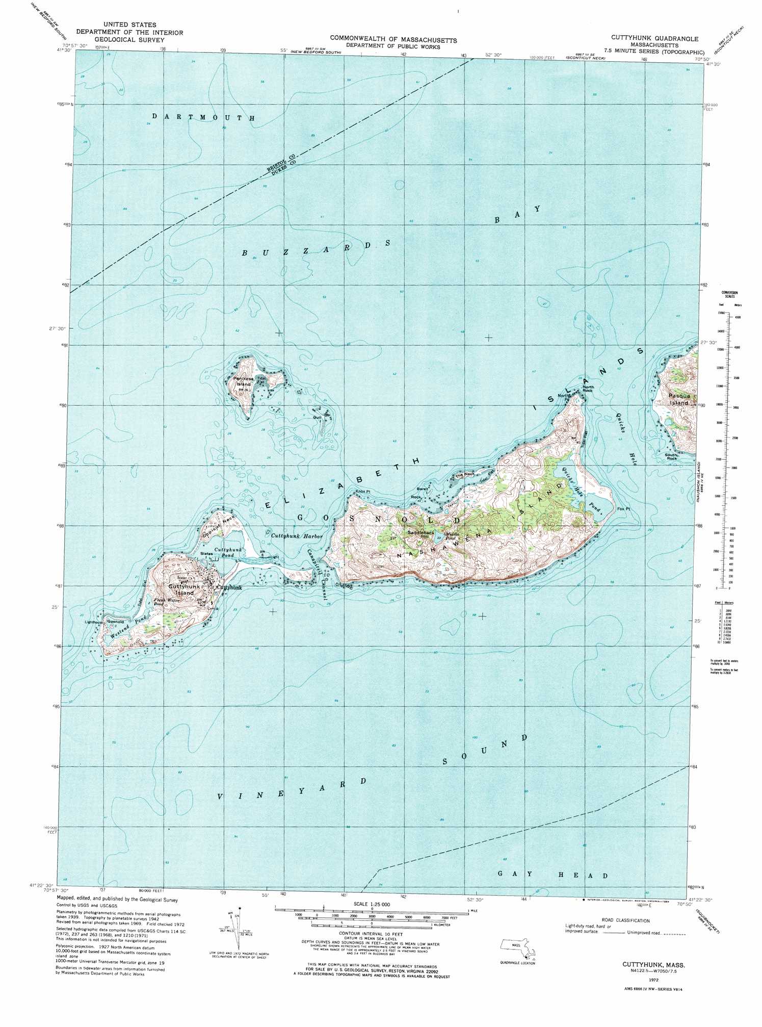
USGS Topo Quad 41070d7 - 1:25,000 scale
| Topo Map Name: | Cuttyhunk |
| USGS Topo Quad ID: | 41070d7 |
| Print Size: | ca. 21 1/4" wide x 27" high |
| Southeast Coordinates: | 41.375° N latitude / 70.75° W longitude |
| Map Center Coordinates: | 41.4375° N latitude / 70.8125° W longitude |
| U.S. State: | MA |
| Filename: | l41070d7.jpg |
| Download Map JPG Image: | Cuttyhunk topo map 1:25,000 scale |
| Map Type: | Topographic |
| Topo Series: | 7.5´ |
| Map Scale: | 1:25,000 |
| Source of Map Images: | United States Geological Survey (USGS) |
| Alternate Map Versions: |
1:24,000 Topo Quads surrounding Cuttyhunk
Fall River East |
New Bedford North |
Marion |
Onset |
Pocasset |
Westport |
New Bedford South |
Sconticut Neck |
Woods Hole |
Falmouth |
Sakonnet Point |
Cuttyhunk |
Nauson Island |
Vineyard Haven |
|
Squibnocket |
Tisbury Great Pond |
|||
> Back to 41070a1 at 1:100,000 scale
> Back to 41070a1 at 1:250,000 scale
> Back to U.S. Topo Maps home
Cuttyhunk topo map: Gazetteer
Cuttyhunk: Bars
Felix Ledge elevation 0m 0′Felix Ledge elevation 0m 0′
Cuttyhunk: Bays
French Watering Place elevation 1m 3′Kettle Cove elevation 0m 0′
Tarpaulin Cove elevation 0m 0′
Cuttyhunk: Beaches
Crescent Beach elevation 0m 0′Silver Beach elevation 0m 0′
West Beach elevation 0m 0′
Cuttyhunk: Capes
Fox Point elevation 0m 0′Naushon Point elevation 0m 0′
North Point elevation 0m 0′
Rams Head elevation 3m 9′
Cuttyhunk: Channels
Quicks Hole elevation 0m 0′Cuttyhunk: Cliffs
South Bluff elevation 1m 3′Cuttyhunk: Guts
Robinsons Hole elevation 0m 0′Vineyard Sound elevation 0m 0′
Cuttyhunk: Islands
Elizabeth Islands elevation 0m 0′Lone Rock elevation 0m 0′
Nashawena Island elevation 20m 65′
Naushon Island elevation 13m 42′
North Rock elevation 0m 0′
Pasque Island elevation 22m 72′
South Rock elevation 0m 0′
Cuttyhunk: Lakes
Blaney Pond elevation 3m 9′Quicks Hole Pond elevation 0m 0′
Westend Pond elevation 2m 6′
Cuttyhunk: Woods
Black Woods elevation 32m 104′Ramshead Woods elevation 25m 82′
Cuttyhunk digital topo map on disk
Buy this Cuttyhunk topo map showing relief, roads, GPS coordinates and other geographical features, as a high-resolution digital map file on DVD:
Maine, New Hampshire, Rhode Island & Eastern Massachusetts
Buy digital topo maps: Maine, New Hampshire, Rhode Island & Eastern Massachusetts