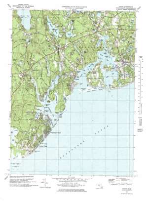
Cotuit Topo Map Massachusetts
To zoom in, hover over the map of Cotuit
USGS Topo Quad 41070e4 - 1:25,000 scale
| Topo Map Name: | Cotuit |
| USGS Topo Quad ID: | 41070e4 |
| Print Size: | ca. 21 1/4" wide x 27" high |
| Southeast Coordinates: | 41.5° N latitude / 70.375° W longitude |
| Map Center Coordinates: | 41.5625° N latitude / 70.4375° W longitude |
| U.S. State: | MA |
| Filename: | l41070e4.jpg |
| Download Map JPG Image: | Cotuit topo map 1:25,000 scale |
| Map Type: | Topographic |
| Topo Series: | 7.5´ |
| Map Scale: | 1:25,000 |
| Source of Map Images: | United States Geological Survey (USGS) |
| Alternate Map Versions: |
1:24,000 Topo Quads surrounding Cotuit
Wareham |
Sagamore |
|||
Onset |
Pocasset |
Sandwich |
Dennis |
|
Woods Hole |
Falmouth |
Cotuit |
Hyannis |
|
Nauson Island |
Vineyard Haven |
|||
Squibnocket |
Tisbury Great Pond |
Edgartown |
Tuckernuck Island |
> Back to 41070e1 at 1:100,000 scale
> Back to 41070a1 at 1:250,000 scale
> Back to U.S. Topo Maps home
Cotuit topo map: Gazetteer
Cotuit: Airports
Cotuit Heliport elevation 11m 36′Seapuit Heliport elevation 8m 26′
Cotuit: Bars
Eldridge Shoal elevation 0m 0′Lone Rock elevation 0m 0′
Popponesset Beach elevation 0m 0′
Succonnesset Shoal elevation 0m 0′
Wreck Shoal elevation 0m 0′
Cotuit: Bays
Anns Cove elevation 0m 0′Anns Cove elevation 0m 0′
Cotuit Bay elevation 0m 0′
Eel River elevation 0m 0′
Ockway Bay elevation 0m 0′
Pinquickset Cove elevation 1m 3′
Popponesset Bay elevation 0m 0′
Shoestring Bay elevation 12m 39′
Tims Cove elevation 0m 0′
West Bay elevation 0m 0′
Cotuit: Beaches
Oyster Harbors Beach elevation 0m 0′Cotuit: Capes
Bluff Point elevation 0m 0′Crocker Neck elevation 11m 36′
Daniels Island elevation 3m 9′
Great Neck elevation 8m 26′
Handy Point elevation 0m 0′
Little Island elevation 4m 13′
Mashpee Neck elevation 9m 29′
Meadow Point elevation 3m 9′
Noisy Point elevation 0m 0′
Pocknett Neck elevation 7m 22′
Punkhorn Point elevation 0m 0′
Ryefield Point elevation 0m 0′
Sampsons Island elevation 2m 6′
Succonnesset Point elevation 4m 13′
Tims Point elevation 0m 0′
Wianno Head elevation 10m 32′
Cotuit: Channels
Popponesset Creek elevation 0m 0′Simons Narrows elevation 0m 0′
Cotuit: Guts
Seapuit River elevation 5m 16′Cotuit: Harbors
Cotuit Anchorage elevation 0m 0′Cotuit: Islands
Dead Neck elevation 1m 3′Gooseberry Island elevation 1m 3′
Little Thatch Island elevation 0m 0′
Osterville Grand Island elevation 8m 26′
Popponesset Island elevation 5m 16′
Thatch Island elevation 4m 13′
Cotuit: Lakes
Dean Pond elevation 0m 0′Flat Pond elevation -2m -7′
Jehu Pond elevation 0m 0′
Jim Pond elevation 2m 6′
Lewis Pond elevation 9m 29′
Lily Pond elevation 0m 0′
Neck Pond elevation 2m 6′
Parker Pond elevation 3m 9′
Rushy Marsh Pond elevation -2m -7′
Witch Pond elevation 4m 13′
Cotuit: Parks
Lowell Park elevation 15m 49′Poppenesset Bird Sanctuary elevation 0m 0′
Sampsons Island Sanctuary elevation 0m 0′
Cotuit: Populated Places
Cotuit elevation 7m 22′Cotuit Highlands elevation 12m 39′
Mashpee Neck elevation 12m 39′
Maushop Village elevation 8m 26′
New Seabury elevation 8m 26′
Oyster Harbors elevation 7m 22′
Pine Tree Corner elevation 15m 49′
Popponesset elevation 5m 16′
Popponesset Beach elevation 6m 19′
Popponesset Island elevation 0m 0′
Rock Landing elevation 2m 6′
Seabrook elevation 5m 16′
South Mashpee elevation 5m 16′
Wianno elevation 7m 22′
Cotuit: Streams
Abigails Brook elevation 2m 6′Little River elevation 0m 0′
Mashpee River elevation 0m 0′
Quaker Run elevation 3m 9′
Santuit River elevation 0m 0′
Cotuit: Summits
Wills Hill elevation 1m 3′Cotuit: Swamps
Flat Pond Marshes elevation 0m 0′Fullers Marsh elevation 8m 26′
Great River Marshes elevation 0m 0′
Holly Marsh elevation 0m 0′
Cotuit digital topo map on disk
Buy this Cotuit topo map showing relief, roads, GPS coordinates and other geographical features, as a high-resolution digital map file on DVD:
Maine, New Hampshire, Rhode Island & Eastern Massachusetts
Buy digital topo maps: Maine, New Hampshire, Rhode Island & Eastern Massachusetts


