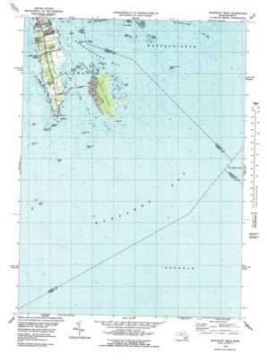
Sconticut Neck Topo Map Massachusetts
To zoom in, hover over the map of Sconticut Neck
USGS Topo Quad 41070e7 - 1:25,000 scale
| Topo Map Name: | Sconticut Neck |
| USGS Topo Quad ID: | 41070e7 |
| Print Size: | ca. 21 1/4" wide x 27" high |
| Southeast Coordinates: | 41.5° N latitude / 70.75° W longitude |
| Map Center Coordinates: | 41.5625° N latitude / 70.8125° W longitude |
| U.S. State: | MA |
| Filename: | l41070e7.jpg |
| Download Map JPG Image: | Sconticut Neck topo map 1:25,000 scale |
| Map Type: | Topographic |
| Topo Series: | 7.5´ |
| Map Scale: | 1:25,000 |
| Source of Map Images: | United States Geological Survey (USGS) |
| Alternate Map Versions: |
Sconticut Neck MA 1975, updated 1978 Download PDF Buy paper map Sconticut Neck MA 1977, updated 1981 Download PDF Buy paper map |
1:24,000 Topo Quads surrounding Sconticut Neck
> Back to 41070e1 at 1:100,000 scale
> Back to 41070a1 at 1:250,000 scale
> Back to U.S. Topo Maps home
Sconticut Neck topo map: Gazetteer
Sconticut Neck: Bars
Mosher Ledge elevation 0m 0′Negro Ledge elevation 0m 0′
Point May elevation 0m 0′
Puppy Rocks elevation 0m 0′
Seal Island Rocks elevation 0m 0′
Sconticut Neck: Bays
Nasketucket Bay elevation 0m 0′North Cove elevation 0m 0′
Round Cove elevation 0m 0′
Sconticut Neck: Capes
North Point elevation 0m 0′Rocky Point elevation 0m 0′
Sconticut Neck elevation 5m 16′
Wilbur Point elevation 0m 0′
Sconticut Neck: Islands
Angelica Rock elevation 0m 0′Black Rock elevation 0m 0′
Cormorant Rock elevation 0m 0′
Fish Island elevation 0m 0′
Gull Island elevation 0m 0′
Henrietta Rock elevation 0m 0′
Knapp Rock elevation 0m 0′
Little Black Rock elevation 0m 0′
Long Island elevation 0m 0′
Nye Ledge elevation 0m 0′
Old Kelick Rock elevation 0m 0′
Packet Rock elevation 0m 0′
Pea Island elevation 0m 0′
Ram Island elevation 0m 0′
Round Island elevation 0m 0′
Seal Island elevation 0m 0′
West Island elevation 0m 0′
West Island Ledge elevation 0m 0′
Whale Rock elevation 0m 0′
White Rock elevation 0m 0′
Sconticut Neck: Populated Places
Silver Shell Beach elevation 1m 3′Wigwam Beach elevation 1m 3′
Winsegansett Heights elevation 1m 3′
Sconticut Neck: Swamps
Sconticut Neck Marshes elevation 0m 0′West Island Marshes elevation 0m 0′
Sconticut Neck digital topo map on disk
Buy this Sconticut Neck topo map showing relief, roads, GPS coordinates and other geographical features, as a high-resolution digital map file on DVD:
Maine, New Hampshire, Rhode Island & Eastern Massachusetts
Buy digital topo maps: Maine, New Hampshire, Rhode Island & Eastern Massachusetts


