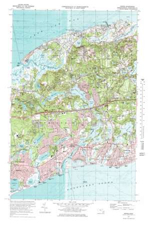
Dennis Topo Map Massachusetts
To zoom in, hover over the map of Dennis
USGS Topo Quad 41070f2 - 1:25,000 scale
| Topo Map Name: | Dennis |
| USGS Topo Quad ID: | 41070f2 |
| Print Size: | ca. 21 1/4" wide x 27" high |
| Southeast Coordinates: | 41.625° N latitude / 70.125° W longitude |
| Map Center Coordinates: | 41.6875° N latitude / 70.1875° W longitude |
| U.S. State: | MA |
| Filename: | l41070f2.jpg |
| Download Map JPG Image: | Dennis topo map 1:25,000 scale |
| Map Type: | Topographic |
| Topo Series: | 7.5´ |
| Map Scale: | 1:25,000 |
| Source of Map Images: | United States Geological Survey (USGS) |
| Alternate Map Versions: |
1:24,000 Topo Quads surrounding Dennis
Wellfleet |
||||
Orleans |
||||
Sandwich |
Dennis |
Harwich |
Chatham |
|
Cotuit |
Hyannis |
Monomoy Point |
||
> Back to 41070e1 at 1:100,000 scale
> Back to 41070a1 at 1:250,000 scale
> Back to U.S. Topo Maps home
Dennis topo map: Gazetteer
Dennis: Bars
Dogfish Bar elevation 0m 0′Kill Pond Bar elevation 0m 0′
Dennis: Bays
Grand Cove elevation 0m 0′Kelleys Bay elevation 0m 0′
Swamp Cove elevation 3m 9′
Dennis: Beaches
Bass River Beach elevation 22m 72′Chapin Memorial Beach elevation 3m 9′
Englewood Beach elevation 0m 0′
Glendon Road Beach elevation 2m 6′
Grays Beach elevation 0m 0′
Haigis Beach elevation 6m 19′
Mayflower Beach elevation 4m 13′
Parkers River Beach elevation 3m 9′
Salt Box Beach elevation 9m 29′
Sea Gull Beach elevation 2m 6′
Sea Street Beach elevation 0m 0′
Thachers Beach elevation 3m 9′
Dennis: Capes
Davis Beach elevation 1m 3′Parkers Neck elevation 3m 9′
Point of Rocks elevation 6m 19′
Wrinkle Point elevation 3m 9′
Dennis: Crossings
Interchange Eight elevation 16m 52′Interchange Nine elevation 13m 42′
Dennis: Dams
Bass River Breakwater elevation 0m 0′Dennis: Harbors
Bass Hole elevation 0m 0′Dennis: Islands
Great Island elevation 3m 9′Little Island elevation 1m 3′
Stage Island elevation 2m 6′
Dennis: Isthmuses
Walkers Narrows (historical) elevation 6m 19′Dennis: Lakes
Aunt Pattys Pond elevation 9m 29′Bakers Pond elevation 10m 32′
Bassetts Lot Pond elevation 12m 39′
Big Sandy Pond elevation 3m 9′
Cedar Pond elevation 24m 78′
Clam Pools elevation 1m 3′
Clay Pond elevation 8m 26′
Crowell Pond elevation 3m 9′
Dinahs Pond elevation 2m 6′
Duck Pond elevation 7m 22′
Eagle Pond elevation 7m 22′
Elishas Pond elevation 3m 9′
Flax Pond elevation 9m 29′
Flax Pond elevation 0m 0′
Follins Pond elevation 2m 6′
Fresh Pond elevation 0m 0′
Fund Pond elevation 10m 32′
Grassy Pond elevation 6m 19′
Greenough Pond elevation 6m 19′
Halfway Pond elevation 4m 13′
Horse Pond elevation 3m 9′
Howes Pond elevation 8m 26′
Jabinettes Pond elevation 6m 19′
James Pond elevation 0m 0′
Kelleys Pond elevation 0m 0′
Labans Pond elevation 0m 0′
Lewis Pond elevation 0m 0′
Lily Pond elevation 0m 0′
Little Sandy Pond elevation 7m 22′
Littlefields Pond elevation 8m 26′
Long Pond elevation 0m 0′
Matthews Pond elevation 0m 0′
Mill Pond elevation 0m 0′
Miller Pond elevation 7m 22′
Northern Simmons Pond elevation 7m 22′
Perch Pond elevation 7m 22′
Pine Pond elevation 6m 19′
Plashes Pond elevation 3m 9′
Round Pond elevation 9m 29′
Run Pond elevation 6m 19′
Scargo Lake elevation 3m 9′
Seine Pond elevation 0m 0′
Simmons Ponds elevation 8m 26′
Slough Pond elevation 6m 19′
Southern Simmons Pond elevation 7m 22′
Swan Pond elevation 0m 0′
The Plashes elevation 3m 9′
Uncle Stephans Pond elevation 0m 0′
Walkers Pond elevation 6m 19′
White Pond elevation 6m 19′
Dennis: Populated Places
Bass River elevation 3m 9′Dennis elevation 5m 16′
Dennis Port elevation 6m 19′
East Dennis elevation 8m 26′
Englewood elevation 5m 16′
New Boston elevation 9m 29′
North Dennis elevation 4m 13′
South Dennis elevation 10m 32′
South Yarmouth elevation 6m 19′
West Dennis elevation 3m 9′
West Yarmouth elevation 6m 19′
Yarmouth elevation 10m 32′
Yarmouth Port elevation 16m 52′
Dennis: Post Offices
Yarmouth Farms Post Office (historical) elevation 8m 26′Dennis: Reservoirs
Cat Swamp Pond elevation 4m 13′Little Greenough Pond elevation 7m 22′
Miss Thatchers Pond elevation 3m 9′
Muddy Pond elevation 12m 39′
Dennis: Streams
Bass River elevation 0m 0′Chase Garden Creek elevation 0m 0′
Clays Creek elevation 2m 6′
Hamblins Brook elevation 2m 6′
Muddy Creek elevation 0m 0′
Parkers River elevation 0m 0′
Pine Island Creek elevation 0m 0′
Plashes Brook elevation 3m 9′
Sesuit Creek elevation 0m 0′
Swan Pond River elevation 0m 0′
Thornton Brook elevation 6m 19′
Weir Creek elevation 1m 3′
Weir Creek elevation 0m 0′
Whites Brook elevation 0m 0′
Dennis: Summits
Black Ball Hill elevation 45m 147′German hill elevation 30m 98′
Hokum Rock elevation 34m 111′
Prospect Hill elevation 21m 68′
Scargo Hill elevation 22m 72′
Dennis: Swamps
Bass Hole Marshes elevation 3m 9′Black Flats elevation 2m 6′
Parkers River Marshes elevation 2m 6′
Sesuit Creek Marshes elevation 2m 6′
Dennis digital topo map on disk
Buy this Dennis topo map showing relief, roads, GPS coordinates and other geographical features, as a high-resolution digital map file on DVD:
Maine, New Hampshire, Rhode Island & Eastern Massachusetts
Buy digital topo maps: Maine, New Hampshire, Rhode Island & Eastern Massachusetts


