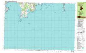
Sakonnet Point Topo Map Massachusetts
To zoom in, hover over the map of Sakonnet Point
USGS Topo Quad 41071d1 - 1:25,000 scale
| Topo Map Name: | Sakonnet Point |
| USGS Topo Quad ID: | 41071d1 |
| Print Size: | ca. 39" wide x 24" high |
| Southeast Coordinates: | 41.375° N latitude / 71° W longitude |
| Map Center Coordinates: | 41.4375° N latitude / 71.125° W longitude |
| U.S. States: | MA, RI |
| Filename: | k41071d1.jpg |
| Download Map JPG Image: | Sakonnet Point topo map 1:25,000 scale |
| Map Type: | Topographic |
| Topo Series: | 7.5´x15´ |
| Map Scale: | 1:25,000 |
| Source of Map Images: | United States Geological Survey (USGS) |
| Alternate Map Versions: |
Sakonnet Point RI 1984, updated 1984 Download PDF Buy paper map |
1:24,000 Topo Quads surrounding Sakonnet Point
Bristol |
Fall River East |
New Bedford North |
Marion |
|
Prudence Island |
Westport |
New Bedford South |
Sconticut Neck |
|
Newport |
Sakonnet Point |
Cuttyhunk |
||
> Back to 41071a1 at 1:100,000 scale
> Back to 41070a1 at 1:250,000 scale
> Back to U.S. Topo Maps home
Sakonnet Point topo map: Gazetteer
Sakonnet Point: Bars
Chickadee Ledge elevation 0m 0′Cormorant Reef elevation 0m 0′
Dolphin Rock elevation 0m 0′
Elisha Ledge elevation 0m 0′
Flint Point Ledge elevation 0m 0′
Hen and Chickens elevation 0m 0′
Newet Rocks elevation 0m 0′
Pinetree Ground elevation 0m 0′
Schyler Ledge elevation 0m 0′
Twomile Ledge elevation 0m 0′
Sakonnet Point: Bays
Church Cove elevation 0m 0′Little Pond Cove elevation 0m 0′
Rhode Island Sound elevation 0m 0′
Sakonnet Harbor elevation 0m 0′
Sakonnet Point: Beaches
Navy Beach elevation 0m 0′Sakonnet Point: Benches
Elisha Ledge elevation 0m 0′Sakonnet Point: Capes
Breakwater Point elevation 1m 3′Briggs Point elevation 3m 9′
Chase Point elevation 1m 3′
Church Point elevation 0m 0′
Flint Point elevation 0m 0′
Gooseberry Neck elevation 4m 13′
Mill Point elevation 1m 3′
Quicksand Point elevation 9m 29′
Sachuest Point elevation 1m 3′
Sakonnet Point elevation 0m 0′
Stony Point elevation 1m 3′
Stony Point elevation 0m 0′
Warren Point elevation 0m 0′
Woods Castle elevation 2m 6′
Sakonnet Point: Flats
Browing Ledge elevation 0m 0′Sakonnet Point: Islands
Bar Rock elevation 0m 0′Briggs Rock elevation 0m 0′
East Island elevation 5m 16′
Flat Rock elevation 0m 0′
Gumbys Head elevation 0m 0′
Hicks Rock elevation 0m 0′
Inner Church Ledge elevation 0m 0′
Inner Mayo Ledge elevation 0m 0′
Joe Burris Ledge elevation 0m 0′
Kibby Ground elevation 0m 0′
Little Cormorant Rock elevation 0m 0′
Little South West Rock elevation 0m 0′
Long Rock elevation 0m 0′
Lumber Rock elevation 0m 0′
Markham Ledge elevation 0m 0′
Old Cock elevation -3m -10′
Old Whale Rock elevation 0m 0′
Palmer Ledge elevation 0m 0′
South West Rock elevation 0m 0′
The Wildcat elevation -3m -10′
Tripp Ledge elevation 0m 0′
Twomile Rock elevation 0m 0′
West Island elevation 5m 16′
Sakonnet Point: Lakes
Long Pond elevation 1m 3′Round Pond elevation 1m 3′
Tunipus Pond elevation 1m 3′
Watch House Pond elevation 2m 6′
Sakonnet Point: Parks
Sachuest Point National Wildlife Refuge elevation 9m 29′Sakonnet Point: Pillars
Box Rock (historical) elevation 0m 0′Church Rocks elevation 0m 0′
Cormorant Rock elevation 0m 0′
Creek Rock (historical) elevation 2m 6′
Cullywaugh Rocks elevation 0m 0′
Flat Rock elevation 0m 0′
Flint Rock elevation 0m 0′
Halfway Rock elevation 0m 0′
Island Rocks elevation 3m 9′
Long Pond Rock elevation 1m 3′
Sakonnet Point: Populated Places
Bahia Corner elevation 22m 72′Sachuest elevation 8m 26′
Sakonnet elevation 1m 3′
Sakonnet Point: Streams
Dundery Brook elevation 1m 3′Maidford River elevation 0m 0′
Sakonnet River elevation 0m 0′
Sisson Brook elevation 1m 3′
Sakonnet Point: Swamps
Briggs Marsh elevation 1m 3′Sakonnet Point: Woods
Wilbours Woods elevation 5m 16′Sakonnet Point digital topo map on disk
Buy this Sakonnet Point topo map showing relief, roads, GPS coordinates and other geographical features, as a high-resolution digital map file on DVD:
Maine, New Hampshire, Rhode Island & Eastern Massachusetts
Buy digital topo maps: Maine, New Hampshire, Rhode Island & Eastern Massachusetts


