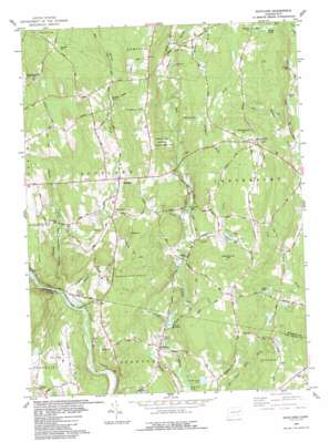
Scotland Topo Map Connecticut
To zoom in, hover over the map of Scotland
USGS Topo Quad 41072f1 - 1:24,000 scale
| Topo Map Name: | Scotland |
| USGS Topo Quad ID: | 41072f1 |
| Print Size: | ca. 21 1/4" wide x 27" high |
| Southeast Coordinates: | 41.625° N latitude / 72° W longitude |
| Map Center Coordinates: | 41.6875° N latitude / 72.0625° W longitude |
| U.S. State: | CT |
| Filename: | o41072f1.jpg |
| Download Map JPG Image: | Scotland topo map 1:24,000 scale |
| Map Type: | Topographic |
| Topo Series: | 7.5´ |
| Map Scale: | 1:24,000 |
| Source of Map Images: | United States Geological Survey (USGS) |
| Alternate Map Versions: |
Scotland CT 1953, updated 1959 Download PDF Buy paper map Scotland CT 1953, updated 1967 Download PDF Buy paper map Scotland CT 1953, updated 1971 Download PDF Buy paper map Scotland CT 1983, updated 1984 Download PDF Buy paper map Scotland CT 2012 Download PDF Buy paper map Scotland CT 2015 Download PDF Buy paper map |
1:24,000 Topo Quads surrounding Scotland
> Back to 41072e1 at 1:100,000 scale
> Back to 41072a1 at 1:250,000 scale
> Back to U.S. Topo Maps home
Scotland topo map: Gazetteer
Scotland: Bridges
Church Bridge elevation 76m 249′Scotland: Dams
Hanover Reservoir Dam elevation 56m 183′Lisbon Pond Dam elevation 88m 288′
Scotland Dam elevation 60m 196′
Scotland: Lakes
Bates Pond elevation 94m 308′Fort Ned Pond elevation 82m 269′
Wright Pond elevation 132m 433′
Scotland: Parks
Hickory Grove Roadside Park elevation 87m 285′Scotland: Populated Places
Hanover elevation 56m 183′Scotland elevation 85m 278′
Westminster elevation 157m 515′
Scotland: Post Offices
Hanover Post Office elevation 63m 206′Scotland Post Office elevation 89m 291′
Scotland: Reservoirs
Hanover Reservoir elevation 56m 183′Kimball Pond elevation 111m 364′
Lisbon Pond elevation 88m 288′
Parker Pond elevation 101m 331′
Scotland: Streams
Adams Brook elevation 41m 134′Bates Brook elevation 76m 249′
Beaver Brook elevation 54m 177′
Burnham Brook elevation 100m 328′
Clover Brook elevation 93m 305′
Coffey Brook elevation 94m 308′
Colburn Brook elevation 118m 387′
Deane Brook elevation 118m 387′
Downing Brook elevation 86m 282′
John Brook elevation 72m 236′
Merrick Brook elevation 46m 150′
Monty Brook elevation 78m 255′
Peck Brook elevation 76m 249′
Smith Brook elevation 66m 216′
Waldo Brook elevation 31m 101′
Scotland: Summits
Parish Hill elevation 200m 656′Pautipaug Hill elevation 118m 387′
Pudding Hill elevation 171m 561′
Westminster Hill elevation 187m 613′
Woodchuck Hill elevation 163m 534′
Scotland digital topo map on disk
Buy this Scotland topo map showing relief, roads, GPS coordinates and other geographical features, as a high-resolution digital map file on DVD:
New York, Vermont, Connecticut & Western Massachusetts
Buy digital topo maps: New York, Vermont, Connecticut & Western Massachusetts


