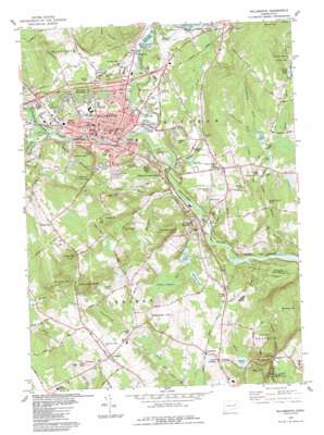
Willimantic Topo Map Connecticut
To zoom in, hover over the map of Willimantic
USGS Topo Quad 41072f2 - 1:24,000 scale
| Topo Map Name: | Willimantic |
| USGS Topo Quad ID: | 41072f2 |
| Print Size: | ca. 21 1/4" wide x 27" high |
| Southeast Coordinates: | 41.625° N latitude / 72.125° W longitude |
| Map Center Coordinates: | 41.6875° N latitude / 72.1875° W longitude |
| U.S. State: | CT |
| Filename: | o41072f2.jpg |
| Download Map JPG Image: | Willimantic topo map 1:24,000 scale |
| Map Type: | Topographic |
| Topo Series: | 7.5´ |
| Map Scale: | 1:24,000 |
| Source of Map Images: | United States Geological Survey (USGS) |
| Alternate Map Versions: |
Willimantic CT 1953, updated 1959 Download PDF Buy paper map Willimantic CT 1953, updated 1966 Download PDF Buy paper map Willimantic CT 1953, updated 1971 Download PDF Buy paper map Willimantic CT 1984, updated 1984 Download PDF Buy paper map Willimantic CT 2012 Download PDF Buy paper map Willimantic CT 2015 Download PDF Buy paper map |
1:24,000 Topo Quads surrounding Willimantic
> Back to 41072e1 at 1:100,000 scale
> Back to 41072a1 at 1:250,000 scale
> Back to U.S. Topo Maps home
Willimantic topo map: Gazetteer
Willimantic: Airports
Nasin Heliport elevation 72m 236′Windham Airport elevation 72m 236′
Windham Hospital Heliport elevation 99m 324′
Willimantic: Bends
Crotch of the River elevation 47m 154′Willimantic: Bridges
Willimantic Footbridge elevation 74m 242′Willimantic: Dams
Beaver Brook Pond Dam elevation 100m 328′Bibbens Pond Dam elevation 91m 298′
Big Pond Dam elevation 79m 259′
Frog Pond Dam elevation 80m 262′
Gagers Pond Dam elevation 64m 209′
Indian Hollow Pond Dam elevation 53m 173′
Mansure Pond Dam elevation 112m 367′
Potash Pond Dam elevation 85m 278′
Spencer Pond Dam elevation 91m 298′
Willimantic Reservoir Dam elevation 58m 190′
Willimantic: Flats
Susquehanna Plains elevation 67m 219′Willimantic: Gaps
Ayers Gap elevation 51m 167′Willimantic: Lakes
Frog Pond elevation 80m 262′Gagers Pond elevation 64m 209′
Indian Hollow Pond elevation 53m 173′
Lockes Pond elevation 100m 328′
Lymans Pond elevation 71m 232′
Wetherbee Pond elevation 65m 213′
Willimantic: Parks
Burdick Park elevation 79m 259′Guild Field elevation 90m 295′
Lautor Park elevation 61m 200′
Lebanon Green Historic District elevation 126m 413′
Lebanon Town Common elevation 124m 406′
Main Street Historic District elevation 73m 239′
Memorial Park elevation 77m 252′
Pomeroy State Park elevation 140m 459′
South Ridge Park elevation 204m 669′
Trumbull Park elevation 123m 403′
Windham Green elevation 87m 285′
Young Field elevation 90m 295′
Willimantic: Populated Places
Conantville elevation 62m 203′Johnson Park elevation 84m 275′
Lebanon elevation 120m 393′
North Franklin elevation 87m 285′
North Windham elevation 84m 275′
South Windham elevation 50m 164′
Village Hill elevation 194m 636′
Williams Crossing elevation 71m 232′
Willimantic elevation 68m 223′
Windham elevation 86m 282′
Willimantic: Post Offices
Lebanon Post Office elevation 118m 387′North Franklin Post Office elevation 87m 285′
Willimantic Post Office elevation 84m 275′
Windham Post Office elevation 87m 285′
Willimantic: Reservoirs
Beaver Brook Pond elevation 100m 328′Bibbens Pond elevation 91m 298′
Bibbins Pond elevation 98m 321′
Big Pond elevation 79m 259′
Eatons Pond elevation 77m 252′
Hayward Pond elevation 101m 331′
Lake Marie elevation 87m 285′
Potash Pond elevation 85m 278′
Spencer Pond elevation 91m 298′
Willimantic Reservoir elevation 58m 190′
Willimantic: Streams
Bailey Brook elevation 39m 127′Ballymahack Brook elevation 87m 285′
Burgess Brook elevation 80m 262′
Chestnut Hill Brook elevation 87m 285′
Cold Brook elevation 42m 137′
Conantville Brook elevation 52m 170′
Hop River elevation 80m 262′
Indian Hollow Brook elevation 42m 137′
Jordan Brook elevation 51m 167′
Larrabe Brook elevation 49m 160′
Mountain Brook elevation 47m 154′
Natchaug River elevation 42m 137′
Obwebetuck Brook elevation 49m 160′
Pigeon Swamp Brook elevation 80m 262′
Potash Brook elevation 50m 164′
Pottens Brook elevation 71m 232′
Sawmill Brook elevation 51m 167′
Tenmile River elevation 77m 252′
Willimantic: Summits
Avery Hill elevation 148m 485′Babcock Hill elevation 147m 482′
Beaver Hill elevation 169m 554′
Bush Hill elevation 152m 498′
Commons Hill elevation 167m 547′
Cooley Hill elevation 127m 416′
Gates Hill elevation 204m 669′
Hosmer Mountain elevation 146m 479′
Kick Hill elevation 160m 524′
Miller Hill elevation 109m 357′
Mullin Hill elevation 112m 367′
Obwebetuck Hill elevation 185m 606′
Owunnegunset Hill elevation 168m 551′
Pleasure Hill elevation 172m 564′
Sweet Hill elevation 183m 600′
Tinsdale Hill elevation 107m 351′
Willimantic: Swamps
Pigeon Swamp elevation 90m 295′Willimantic digital topo map on disk
Buy this Willimantic topo map showing relief, roads, GPS coordinates and other geographical features, as a high-resolution digital map file on DVD:
New York, Vermont, Connecticut & Western Massachusetts
Buy digital topo maps: New York, Vermont, Connecticut & Western Massachusetts


