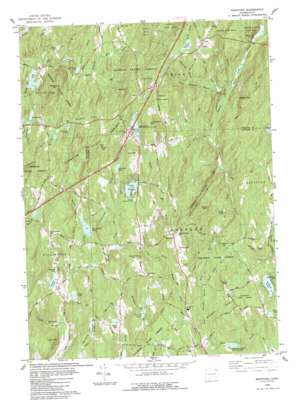
Westford Topo Map Connecticut
To zoom in, hover over the map of Westford
USGS Topo Quad 41072h2 - 1:24,000 scale
| Topo Map Name: | Westford |
| USGS Topo Quad ID: | 41072h2 |
| Print Size: | ca. 21 1/4" wide x 27" high |
| Southeast Coordinates: | 41.875° N latitude / 72.125° W longitude |
| Map Center Coordinates: | 41.9375° N latitude / 72.1875° W longitude |
| U.S. State: | CT |
| Filename: | o41072h2.jpg |
| Download Map JPG Image: | Westford topo map 1:24,000 scale |
| Map Type: | Topographic |
| Topo Series: | 7.5´ |
| Map Scale: | 1:24,000 |
| Source of Map Images: | United States Geological Survey (USGS) |
| Alternate Map Versions: |
Westford CT 1952, updated 1959 Download PDF Buy paper map Westford CT 1952, updated 1965 Download PDF Buy paper map Westford CT 1952, updated 1971 Download PDF Buy paper map Westford CT 1983, updated 1984 Download PDF Buy paper map Westford CT 2012 Download PDF Buy paper map Westford CT 2015 Download PDF Buy paper map |
1:24,000 Topo Quads surrounding Westford
> Back to 41072e1 at 1:100,000 scale
> Back to 41072a1 at 1:250,000 scale
> Back to U.S. Topo Maps home
Westford topo map: Gazetteer
Westford: Airports
Westford Airstrip elevation 269m 882′Westford: Dams
Ashford Lake Dam elevation 201m 659′Bigelow Pond Dam elevation 196m 643′
Bissonnette Pond Dam elevation 204m 669′
Goss Brook Dam elevation 155m 508′
Lake Chaffee Dam elevation 262m 859′
Morey Pond Dam elevation 307m 1007′
New Pond Dam elevation 252m 826′
Pinneys Pond Dam Number 1 elevation 263m 862′
Stafford Springs Reservoir Number 2 Dam elevation 297m 974′
Westford: Forests
Natchaug State Forest elevation 181m 593′Westford: Lakes
Drobney Pond elevation 175m 574′Myers Pond elevation 188m 616′
Stowell Pond elevation 213m 698′
Westford: Parks
Bigelow State Park elevation 215m 705′Tinkerville Brook Reserve elevation 253m 830′
Westford: Populated Places
Union elevation 296m 971′Westford elevation 217m 711′
Westford: Reservoirs
Armitage Pond elevation 276m 905′Ashford Lake elevation 201m 659′
Bigelow Pond elevation 196m 643′
Bissonnette Pond elevation 204m 669′
Boy Scout Pond elevation 155m 508′
Buck Pond elevation 169m 554′
Buckley Pond elevation 279m 915′
Gaines Pond elevation 178m 583′
Goss Pond elevation 152m 498′
Kinney Pond elevation 219m 718′
Lake Chaffee elevation 262m 859′
Mathews Pond elevation 253m 830′
Morey Pond elevation 307m 1007′
Morse Reservoir elevation 229m 751′
New Pond elevation 254m 833′
Paine Pond elevation 203m 666′
Pinneys Pond elevation 263m 862′
Sabo Pond elevation 184m 603′
Stafford Springs Reservoir Number 2 elevation 297m 974′
Taylor Pond elevation 158m 518′
Upper Pond elevation 277m 908′
Zaicek Pond elevation 185m 606′
Westford: Streams
Basset Brook elevation 123m 403′Boston Hollow Road Brook elevation 199m 652′
Bush Meadow Brook elevation 190m 623′
Cedar Swamp Brook elevation 224m 734′
Curtis Brook elevation 145m 475′
East Branch Mount Hope River elevation 122m 400′
Gulf Brook elevation 188m 616′
Hammond Brook elevation 134m 439′
Kidder Brook elevation 185m 606′
Lead Mine Brook elevation 191m 626′
North Chism Brook elevation 159m 521′
Scranton Brook elevation 240m 787′
South Chism Brook elevation 141m 462′
Stickney Hill Brook elevation 266m 872′
Stiles Brook elevation 161m 528′
Urda Brook elevation 189m 620′
Westford: Summits
Bald Hill elevation 371m 1217′Buell Hill elevation 197m 646′
Coye Hill elevation 331m 1085′
Grass Hill elevation 250m 820′
Hedgehog Hill elevation 354m 1161′
Holt Mountain elevation 217m 711′
Horse Hill elevation 214m 702′
Lead Mine Hill elevation 361m 1184′
Sharpe Hill elevation 268m 879′
Sky Hill elevation 331m 1085′
Snow Hill elevation 362m 1187′
Spooner Hill elevation 208m 682′
Stickney Hill elevation 371m 1217′
Turkey Hill elevation 271m 889′
Walker Mountain elevation 325m 1066′
Wenberg Hill elevation 245m 803′
Westford Hill elevation 290m 951′
Westford: Valleys
Boston Hollow elevation 207m 679′Westford digital topo map on disk
Buy this Westford topo map showing relief, roads, GPS coordinates and other geographical features, as a high-resolution digital map file on DVD:
New York, Vermont, Connecticut & Western Massachusetts
Buy digital topo maps: New York, Vermont, Connecticut & Western Massachusetts


