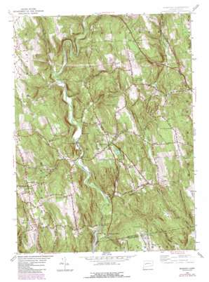
Roxbury Topo Map Connecticut
To zoom in, hover over the map of Roxbury
USGS Topo Quad 41073e3 - 1:24,000 scale
| Topo Map Name: | Roxbury |
| USGS Topo Quad ID: | 41073e3 |
| Print Size: | ca. 21 1/4" wide x 27" high |
| Southeast Coordinates: | 41.5° N latitude / 73.25° W longitude |
| Map Center Coordinates: | 41.5625° N latitude / 73.3125° W longitude |
| U.S. State: | CT |
| Filename: | o41073e3.jpg |
| Download Map JPG Image: | Roxbury topo map 1:24,000 scale |
| Map Type: | Topographic |
| Topo Series: | 7.5´ |
| Map Scale: | 1:24,000 |
| Source of Map Images: | United States Geological Survey (USGS) |
| Alternate Map Versions: |
Roxbury CT 1955, updated 1958 Download PDF Buy paper map Roxbury CT 1955, updated 1970 Download PDF Buy paper map Roxbury CT 1955, updated 1972 Download PDF Buy paper map Roxbury CT 1955, updated 1984 Download PDF Buy paper map Roxbury CT 2012 Download PDF Buy paper map Roxbury CT 2015 Download PDF Buy paper map |
1:24,000 Topo Quads surrounding Roxbury
> Back to 41073e1 at 1:100,000 scale
> Back to 41072a1 at 1:250,000 scale
> Back to U.S. Topo Maps home
Roxbury topo map: Gazetteer
Roxbury: Airports
Canterbury Farm Airport elevation 131m 429′Good Hill Farm Airport elevation 277m 908′
Roxbury: Bridges
Minor Bridge elevation 85m 278′Roxbury: Dams
Lake Hayward Dam elevation 144m 472′Levys Pond Dam elevation 259m 849′
Wyant Pond Dam elevation 281m 921′
Roxbury: Falls
Roxbury Falls elevation 73m 239′Roxbury: Forests
Chestnut Lands elevation 321m 1053′Roxbury: Islands
Paquabaug elevation 94m 308′Roxbury: Parks
Brian E Tierney Preserve elevation 149m 488′Bridgwater Green elevation 201m 659′
Hodge Park elevation 93m 305′
Lilly Preserve elevation 202m 662′
Mine Hill Preserve elevation 182m 597′
Natalie White Preserve elevation 210m 688′
River Road Reserve elevation 83m 272′
Roxbury Center Historic District elevation 166m 544′
Roxbury: Populated Places
Bridgewater elevation 206m 675′Horse Heaven elevation 258m 846′
Roxbury elevation 165m 541′
Roxbury Falls elevation 88m 288′
Roxbury Station elevation 94m 308′
Roxbury: Post Offices
Bridgewater Post Office elevation 201m 659′Roxbury Post Office elevation 168m 551′
Roxbury: Reservoirs
Lake Hayward elevation 144m 472′Levys Pond elevation 259m 849′
Wyant Pond elevation 281m 921′
Roxbury: Streams
Battle Swamp Brook elevation 120m 393′Camp Brook elevation 59m 193′
Fenn Brook elevation 99m 324′
Hop Brook elevation 86m 282′
Jacks Brook elevation 79m 259′
Kirby Brook elevation 133m 436′
Little Jacks Brook elevation 107m 351′
Moosehorn Brook elevation 94m 308′
Pierce Brook elevation 85m 278′
Roxbury Brook elevation 162m 531′
Second Hill Brook elevation 104m 341′
Turrill Brook elevation 69m 226′
Walker Brook elevation 113m 370′
Weller Brook elevation 86m 282′
Roxbury: Summits
Booth Hill elevation 257m 843′Botsford Hill elevation 267m 875′
Bronson Mountain elevation 255m 836′
Bulkeley Hill elevation 208m 682′
Good Hill elevation 292m 958′
Grassy Hill elevation 256m 839′
Greenleaf Hill elevation 282m 925′
Horse Hill elevation 236m 774′
Hut Hill elevation 236m 774′
Mine Hill elevation 267m 875′
Moosehorn Hill elevation 264m 866′
Painter Hill elevation 324m 1062′
Raven Rock elevation 207m 679′
Rucum Hill elevation 251m 823′
Second Hill elevation 285m 935′
Sentry Hill elevation 164m 538′
Steep Rock elevation 209m 685′
Roxbury digital topo map on disk
Buy this Roxbury topo map showing relief, roads, GPS coordinates and other geographical features, as a high-resolution digital map file on DVD:
New York, Vermont, Connecticut & Western Massachusetts
Buy digital topo maps: New York, Vermont, Connecticut & Western Massachusetts


