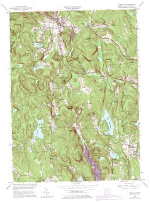
Norfolk Topo Map Connecticut
To zoom in, hover over the map of Norfolk
USGS Topo Quad 41073h2 - 1:24,000 scale
| Topo Map Name: | Norfolk |
| USGS Topo Quad ID: | 41073h2 |
| Print Size: | ca. 21 1/4" wide x 27" high |
| Southeast Coordinates: | 41.875° N latitude / 73.125° W longitude |
| Map Center Coordinates: | 41.9375° N latitude / 73.1875° W longitude |
| U.S. State: | CT |
| Filename: | o41073h2.jpg |
| Download Map JPG Image: | Norfolk topo map 1:24,000 scale |
| Map Type: | Topographic |
| Topo Series: | 7.5´ |
| Map Scale: | 1:24,000 |
| Source of Map Images: | United States Geological Survey (USGS) |
| Alternate Map Versions: |
Norfolk CT 1956, updated 1958 Download PDF Buy paper map Norfolk CT 1956, updated 1965 Download PDF Buy paper map Norfolk CT 1956, updated 1976 Download PDF Buy paper map Norfolk CT 1956, updated 1976 Download PDF Buy paper map Norfolk CT 1965, updated 1971 Download PDF Buy paper map Norfolk CT 2012 Download PDF Buy paper map Norfolk CT 2015 Download PDF Buy paper map |
1:24,000 Topo Quads surrounding Norfolk
> Back to 41073e1 at 1:100,000 scale
> Back to 41072a1 at 1:250,000 scale
> Back to U.S. Topo Maps home
Norfolk topo map: Gazetteer
Norfolk: Dams
Bigelow Pond Dam elevation 404m 1325′Dam Number 6 elevation 404m 1325′
Hoover Pond Dam elevation 410m 1345′
Mathews Pond Dam elevation 389m 1276′
Norfolk Brook Dam elevation 399m 1309′
North Pond Dam elevation 445m 1459′
North Pond Dikes elevation 446m 1463′
Ouleout Lake Dam elevation 322m 1056′
Park Pond Dam elevation 345m 1131′
Park Pond Dike elevation 352m 1154′
Spaulding Pond Dam elevation 420m 1377′
Tobey Pond Dam elevation 386m 1266′
Wampee Pond Dam elevation 403m 1322′
West Side Dam elevation 363m 1190′
Winchester Club Pond Dam elevation 401m 1315′
Winchester Lake Dam elevation 386m 1266′
Wood Creek Dam elevation 357m 1171′
Norfolk: Lakes
Crissey Pond elevation 465m 1525′Norfolk: Parks
Bigelow Park elevation 427m 1400′Dennis Hill State Park elevation 496m 1627′
Hillside Gardens elevation 407m 1335′
John A Minetto State Park elevation 399m 1309′
Maasser Park elevation 401m 1315′
Norfolk Historic District elevation 374m 1227′
Norfolk Village Green elevation 383m 1256′
Norfolk: Populated Places
Grantville elevation 372m 1220′Kelly Corner elevation 454m 1489′
Norfolk elevation 351m 1151′
North Goshen elevation 420m 1377′
South Norfolk elevation 351m 1151′
Turkey Cobble elevation 430m 1410′
Winchester Center elevation 404m 1325′
Norfolk: Post Offices
Norfolk Post Office elevation 383m 1256′Norfolk: Reservoirs
Beckley Pond elevation 394m 1292′Beecher Pond elevation 387m 1269′
Bigelow Pond elevation 404m 1325′
Camp Pond elevation 443m 1453′
Case Pond elevation 291m 954′
Dolphin Pond elevation 454m 1489′
Ghilds Pond elevation 427m 1400′
Gillette Reservoir elevation 422m 1384′
Hoover Pond elevation 410m 1345′
Hurlbut Pond elevation 389m 1276′
Lake Winchester elevation 381m 1250′
Norfolk Brook Reservoir elevation 399m 1309′
North Pond elevation 446m 1463′
North Pond elevation 445m 1459′
Ouleout Lake elevation 322m 1056′
Park Pond elevation 345m 1131′
Park Pond elevation 352m 1154′
Phelps Pond elevation 370m 1213′
Pond Hill Pond elevation 426m 1397′
Silas Hall Pond elevation 391m 1282′
Smith Pond elevation 369m 1210′
Spaulding Pond elevation 420m 1377′
Tobey Pond elevation 386m 1266′
Wampee Pond elevation 403m 1322′
Westside Reservoir elevation 363m 1190′
Winchester Club Pond elevation 401m 1315′
Winchester Lake elevation 386m 1266′
Wood Creek Reservoir elevation 357m 1171′
Norfolk: Streams
Beckley Pond Brook elevation 355m 1164′Fox Brook elevation 336m 1102′
Norfolk Brook elevation 365m 1197′
Spaulding Brook elevation 349m 1145′
Tobey Pond Brook elevation 362m 1187′
Wood Creek elevation 349m 1145′
Norfolk: Summits
Burr Mountain elevation 425m 1394′Chestnut Hill elevation 470m 1541′
Dennis Hill elevation 496m 1627′
Dutton Mountain elevation 506m 1660′
Flagg Hill elevation 470m 1541′
Fox Hill elevation 441m 1446′
Grant Hill elevation 442m 1450′
Mount Ouleout elevation 433m 1420′
Parker Hill elevation 432m 1417′
Pine Mountain elevation 484m 1587′
Rebekahs Hill elevation 374m 1227′
Riggs Hill elevation 480m 1574′
Tibbals Hill elevation 403m 1322′
Norfolk: Swamps
Beckley Bog elevation 392m 1286′Grant Swamp elevation 356m 1167′
Great Bear Swamp elevation 457m 1499′
Hall Meadow elevation 276m 905′
Wildcat Swamp elevation 440m 1443′
Norfolk digital topo map on disk
Buy this Norfolk topo map showing relief, roads, GPS coordinates and other geographical features, as a high-resolution digital map file on DVD:
New York, Vermont, Connecticut & Western Massachusetts
Buy digital topo maps: New York, Vermont, Connecticut & Western Massachusetts


