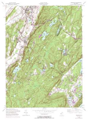
Franklin Topo Map New Jersey
To zoom in, hover over the map of Franklin
USGS Topo Quad 41074a5 - 1:24,000 scale
| Topo Map Name: | Franklin |
| USGS Topo Quad ID: | 41074a5 |
| Print Size: | ca. 21 1/4" wide x 27" high |
| Southeast Coordinates: | 41° N latitude / 74.5° W longitude |
| Map Center Coordinates: | 41.0625° N latitude / 74.5625° W longitude |
| U.S. State: | NJ |
| Filename: | o41074a5.jpg |
| Download Map JPG Image: | Franklin topo map 1:24,000 scale |
| Map Type: | Topographic |
| Topo Series: | 7.5´ |
| Map Scale: | 1:24,000 |
| Source of Map Images: | United States Geological Survey (USGS) |
| Alternate Map Versions: |
Franklin NJ 1954, updated 1956 Download PDF Buy paper map Franklin NJ 1954, updated 1961 Download PDF Buy paper map Franklin NJ 1954, updated 1970 Download PDF Buy paper map Franklin NJ 1954, updated 1974 Download PDF Buy paper map Franklin NJ 1954, updated 1984 Download PDF Buy paper map Franklin NJ 1954, updated 1984 Download PDF Buy paper map Franklin NJ 2011 Download PDF Buy paper map Franklin NJ 2014 Download PDF Buy paper map Franklin NJ 2016 Download PDF Buy paper map |
1:24,000 Topo Quads surrounding Franklin
> Back to 41074a1 at 1:100,000 scale
> Back to 41074a1 at 1:250,000 scale
> Back to U.S. Topo Maps home
Franklin topo map: Gazetteer
Franklin: Dams
Blue Heron Lake Dam elevation 352m 1154′Cozy Lake Dam elevation 238m 780′
Deer Trail Lake Dam elevation 336m 1102′
Fox Trail Lake Dam elevation 346m 1135′
Franklin Pond Dam elevation 160m 524′
Heaters Pond Dam elevation 293m 961′
Lake Gerard Dam elevation 312m 1023′
Lake Sonoma Dam elevation 170m 557′
Lake Stockholm Dam elevation 336m 1102′
Morris Lake Dam elevation 281m 921′
Oak Ridge Reservoir Dam elevation 244m 800′
Rock Island Lake Dam elevation 378m 1240′
Silver Lake Dam elevation 324m 1062′
Sparta Lake Dam elevation 337m 1105′
Sunset Lake Dam elevation 324m 1062′
Franklin: Lakes
Arapaho Lake elevation 337m 1105′Beaver Lake elevation 311m 1020′
Collins Pond elevation 366m 1200′
Edison Pond elevation 361m 1184′
Hawthorne Lake elevation 311m 1020′
Lake Acquackanonk elevation 370m 1213′
Lake Gerard elevation 312m 1023′
Lake Hartung elevation 277m 908′
Lake Saginaw elevation 299m 980′
Mitt Pond elevation 249m 816′
Mud Pond elevation 199m 652′
Rock Lodge Pond elevation 361m 1184′
Ryker Lake elevation 324m 1062′
Franklin: Parks
Edison Acres Park elevation 336m 1102′Sparta Glen Park elevation 274m 898′
Franklin: Populated Places
Beaver Lake elevation 305m 1000′Edison elevation 376m 1233′
Franklin elevation 187m 613′
Holland elevation 352m 1154′
Hopewell elevation 333m 1092′
Mahola elevation 344m 1128′
Milton elevation 253m 830′
Ogdensburg elevation 206m 675′
Petersburg elevation 244m 800′
Russia elevation 288m 944′
South Ogdensburg elevation 190m 623′
Stockholm elevation 315m 1033′
Franklin: Ranges
Sparta Mountains elevation 375m 1230′Franklin: Reservoirs
Blue Heron Lake elevation 352m 1154′Cozy Lake elevation 238m 780′
Deer Trail Lake elevation 336m 1102′
Fawn Lake elevation 344m 1128′
Fox Trail Lake elevation 346m 1135′
Franklin Pond elevation 160m 524′
Glen Lake elevation 281m 921′
Green Ridge Lake elevation 368m 1207′
Heaters Pond elevation 293m 961′
Lake Stockholm elevation 336m 1102′
Lake Swannanoa elevation 231m 757′
Moosepac Pond elevation 244m 800′
Morris Lake elevation 281m 921′
Newton Reservoir elevation 281m 921′
Oak Ridge Reservoir elevation 244m 800′
Rock Island Lake elevation 378m 1240′
Silver Lake elevation 324m 1062′
Sparta Lake elevation 337m 1105′
Summit Lake elevation 307m 1007′
Sunset Lake elevation 324m 1062′
Tamarack Lake elevation 313m 1026′
Upper Sunset Lake elevation 332m 1089′
Weldon Brook Lake elevation 342m 1122′
White Rock Lake elevation 265m 869′
Franklin: Streams
Franklin Pond Creek elevation 160m 524′Pacock Brook elevation 297m 974′
Russia Brook elevation 283m 928′
Wildcat Branch elevation 152m 498′
Franklin: Summits
Bowling Green Mountain elevation 420m 1377′Mount Paul elevation 368m 1207′
Sterling Hill elevation 254m 833′
Franklin: Swamps
Pine Swamp elevation 378m 1240′Franklin: Valleys
Sparta Glen elevation 217m 711′Franklin digital topo map on disk
Buy this Franklin topo map showing relief, roads, GPS coordinates and other geographical features, as a high-resolution digital map file on DVD:
New York, Vermont, Connecticut & Western Massachusetts
Buy digital topo maps: New York, Vermont, Connecticut & Western Massachusetts


