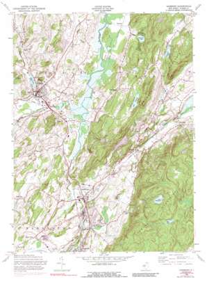
Hamburg Topo Map New Jersey
To zoom in, hover over the map of Hamburg
USGS Topo Quad 41074b5 - 1:24,000 scale
| Topo Map Name: | Hamburg |
| USGS Topo Quad ID: | 41074b5 |
| Print Size: | ca. 21 1/4" wide x 27" high |
| Southeast Coordinates: | 41.125° N latitude / 74.5° W longitude |
| Map Center Coordinates: | 41.1875° N latitude / 74.5625° W longitude |
| U.S. State: | NJ |
| Filename: | o41074b5.jpg |
| Download Map JPG Image: | Hamburg topo map 1:24,000 scale |
| Map Type: | Topographic |
| Topo Series: | 7.5´ |
| Map Scale: | 1:24,000 |
| Source of Map Images: | United States Geological Survey (USGS) |
| Alternate Map Versions: |
Hamburg NJ 1954, updated 1956 Download PDF Buy paper map Hamburg NJ 1954, updated 1965 Download PDF Buy paper map Hamburg NJ 1954, updated 1974 Download PDF Buy paper map Hamburg NJ 1954, updated 1990 Download PDF Buy paper map Hamburg NJ 2011 Download PDF Buy paper map Hamburg NJ 2014 Download PDF Buy paper map Hamburg NJ 2016 Download PDF Buy paper map |
1:24,000 Topo Quads surrounding Hamburg
> Back to 41074a1 at 1:100,000 scale
> Back to 41074a1 at 1:250,000 scale
> Back to U.S. Topo Maps home
Hamburg topo map: Gazetteer
Hamburg: Airports
Great Gorge Country Club Incorporated Heliport elevation 170m 557′Sussex Airport elevation 121m 396′
Hamburg: Dams
Clove River Dam elevation 128m 419′Glenwood Lake Dam elevation 244m 800′
Lake Pochung Dam elevation 245m 803′
Lake Wildwood Dam elevation 379m 1243′
Mud Pond Dam elevation 378m 1240′
Hamburg: Lakes
Clove Acres Lake elevation 128m 419′Lake Pochung elevation 244m 800′
Lake Wildwood elevation 378m 1240′
Panorama Lake elevation 305m 1000′
Hamburg: Parks
Hamburg Mountain Wildlife Management Area elevation 371m 1217′Hamburg: Populated Places
Beaver Run elevation 147m 482′Big Springs elevation 164m 538′
Hamburg elevation 142m 465′
Hardistonville elevation 178m 583′
Independence Corner elevation 216m 708′
Lewisburg elevation 132m 433′
Martins elevation 158m 518′
McAfee elevation 134m 439′
Papakating elevation 122m 400′
Rudeville elevation 199m 652′
Sand Hills elevation 141m 462′
Sussex elevation 137m 449′
Wantage elevation 124m 406′
Hamburg: Ranges
Hamburg Mountains elevation 449m 1473′Hamburg: Reservoirs
Glenwood Lake elevation 244m 800′Mud Pond elevation 378m 1240′
Pleasant Valley Lake elevation 171m 561′
Wallkill Lake elevation 165m 541′
Hamburg: Streams
Beaver Run elevation 121m 396′Clove Brook elevation 118m 387′
Neepaulakating Creek elevation 118m 387′
Papakating Creek elevation 121m 396′
Quarryville Brook elevation 121m 396′
Hamburg: Summits
Pochuck Mountain elevation 361m 1184′Hamburg digital topo map on disk
Buy this Hamburg topo map showing relief, roads, GPS coordinates and other geographical features, as a high-resolution digital map file on DVD:
New York, Vermont, Connecticut & Western Massachusetts
Buy digital topo maps: New York, Vermont, Connecticut & Western Massachusetts


