Branchville Topo Map New Jersey
To zoom in, hover over the map of Branchville
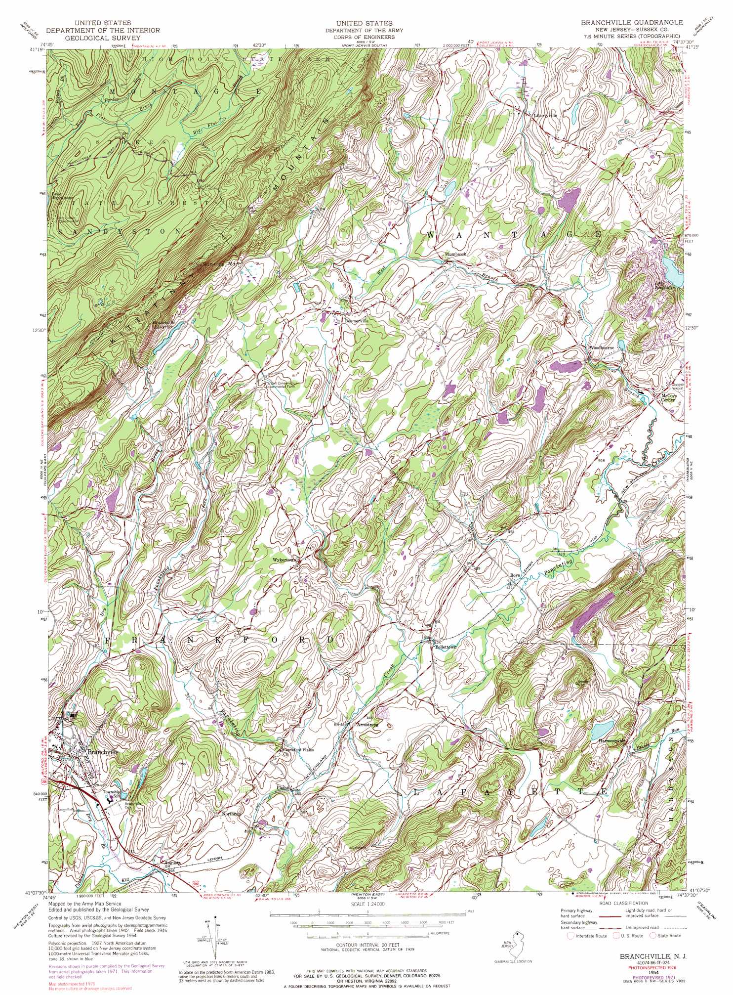
USGS Topo Quad 41074b6 - 1:24,000 scale
| Topo Map Name: | Branchville |
| USGS Topo Quad ID: | 41074b6 |
| Print Size: | ca. 21 1/4" wide x 27" high |
| Southeast Coordinates: | 41.125° N latitude / 74.625° W longitude |
| Map Center Coordinates: | 41.1875° N latitude / 74.6875° W longitude |
| U.S. State: | NJ |
| Filename: | o41074b6.jpg |
| Download Map JPG Image: | Branchville topo map 1:24,000 scale |
| Map Type: | Topographic |
| Topo Series: | 7.5´ |
| Map Scale: | 1:24,000 |
| Source of Map Images: | United States Geological Survey (USGS) |
| Alternate Map Versions: |
Branchville NJ 1954, updated 1955 Download PDF Buy paper map Branchville NJ 1954, updated 1962 Download PDF Buy paper map Branchville NJ 1954, updated 1965 Download PDF Buy paper map Branchville NJ 1954, updated 1974 Download PDF Buy paper map Branchville NJ 1954, updated 1977 Download PDF Buy paper map Branchville NJ 1954, updated 1989 Download PDF Buy paper map Branchville NJ 1995, updated 1999 Download PDF Buy paper map Branchville NJ 2011 Download PDF Buy paper map Branchville NJ 2014 Download PDF Buy paper map Branchville NJ 2016 Download PDF Buy paper map |
1:24,000 Topo Quads surrounding Branchville
Shohola |
Pond Eddy |
Port Jervis North |
Otisville |
Middletown |
Edgemere |
Milford |
Port Jervis South |
Unionville |
Pine Island |
Lake Maskenozha |
Culvers Gap |
Branchville |
Hamburg |
Wawayanda |
Flatbrookville |
Newton West |
Newton East |
Franklin |
Newfoundland |
Blairstown |
Tranquility |
Stanhope |
Dover |
Boonton |
> Back to 41074a1 at 1:100,000 scale
> Back to 41074a1 at 1:250,000 scale
> Back to U.S. Topo Maps home
Branchville topo map: Gazetteer
Branchville: Airports
Tamarack Flyers Heliport elevation 198m 649′TGP-325 Heliport elevation 266m 872′
Branchville: Dams
Branchville Reservoir Dam elevation 339m 1112′Lake Neepaulin Dam elevation 154m 505′
Lake Windsor Dam elevation 157m 515′
Branchville: Lakes
Lake Neepaulin elevation 154m 505′Branchville: Populated Places
Armstrong elevation 141m 462′Augusta elevation 151m 495′
Beemerville elevation 231m 757′
Harmonyvale elevation 169m 554′
Hopkins Corner elevation 171m 561′
Libertyville elevation 220m 721′
McCoys Corner elevation 127m 416′
Northrup elevation 164m 538′
Pellettown elevation 134m 439′
Plains elevation 141m 462′
Plumbsock elevation 199m 652′
Roys elevation 126m 413′
Woodbourne elevation 165m 541′
Wykertown elevation 213m 698′
Branchville: Reservoirs
Branchville Reservoir elevation 339m 1112′Lake Windsor elevation 157m 515′
Branchville: Streams
Culvers Creek elevation 156m 511′Dry Brook elevation 151m 495′
Forked Brook elevation 244m 800′
Parker Brook elevation 241m 790′
West Branch Papakating Creek elevation 122m 400′
Branchville: Summits
Sunrise Mountain elevation 503m 1650′Branchville digital topo map on disk
Buy this Branchville topo map showing relief, roads, GPS coordinates and other geographical features, as a high-resolution digital map file on DVD:
New York, Vermont, Connecticut & Western Massachusetts
Buy digital topo maps: New York, Vermont, Connecticut & Western Massachusetts