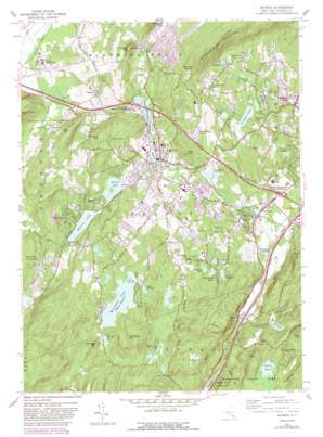
Monroe Topo Map New York
To zoom in, hover over the map of Monroe
USGS Topo Quad 41074c2 - 1:24,000 scale
| Topo Map Name: | Monroe |
| USGS Topo Quad ID: | 41074c2 |
| Print Size: | ca. 21 1/4" wide x 27" high |
| Southeast Coordinates: | 41.25° N latitude / 74.125° W longitude |
| Map Center Coordinates: | 41.3125° N latitude / 74.1875° W longitude |
| U.S. State: | NY |
| Filename: | o41074c2.jpg |
| Download Map JPG Image: | Monroe topo map 1:24,000 scale |
| Map Type: | Topographic |
| Topo Series: | 7.5´ |
| Map Scale: | 1:24,000 |
| Source of Map Images: | United States Geological Survey (USGS) |
| Alternate Map Versions: |
Monroe NY 1957, updated 1959 Download PDF Buy paper map Monroe NY 1957, updated 1965 Download PDF Buy paper map Monroe NY 1957, updated 1973 Download PDF Buy paper map Monroe NY 1957, updated 1981 Download PDF Buy paper map Monroe NY 1957, updated 1988 Download PDF Buy paper map Monroe NY 2010 Download PDF Buy paper map Monroe NY 2013 Download PDF Buy paper map Monroe NY 2016 Download PDF Buy paper map |
1:24,000 Topo Quads surrounding Monroe
> Back to 41074a1 at 1:100,000 scale
> Back to 41074a1 at 1:250,000 scale
> Back to U.S. Topo Maps home
Monroe topo map: Gazetteer
Monroe: Airports
Doms Heliport elevation 131m 429′Monroe: Lakes
Amdur Park Lake elevation 259m 849′Blendale Lake elevation 246m 807′
Blythea Lake elevation 267m 875′
Cromwell Lake elevation 229m 751′
Forest Road Lake elevation 191m 626′
Hillside Lake elevation 234m 767′
Island Pond elevation 295m 967′
Kloibers Pond elevation 299m 980′
Lake Sapphire elevation 261m 856′
Lake Winape elevation 249m 816′
Little Dam Lake elevation 219m 718′
Merriewold Lake elevation 145m 475′
Monroe Ponds elevation 187m 613′
Mountain Lakes elevation 174m 570′
Orange-Rockland Lake elevation 177m 580′
Placid Pond elevation 211m 692′
Round Lake elevation 203m 666′
Saltzmans Lake elevation 235m 770′
Shadow Lake elevation 260m 853′
Shadowmere Lake elevation 266m 872′
Monroe: Parks
Crane Park elevation 187m 613′Earl Reservoir Park elevation 257m 843′
Mary H Harriman Memorial Park elevation 164m 538′
Smith Clove Park elevation 183m 600′
Monroe: Populated Places
Arden elevation 156m 511′Bull Mine elevation 170m 557′
Harriman elevation 164m 538′
Highland Lake Estates elevation 254m 833′
Highland Mills elevation 155m 508′
Hillside Plaza elevation 191m 626′
Indian Hill elevation 264m 866′
Kiryas Joel elevation 209m 685′
Lebanon elevation 255m 836′
Marycrest elevation 269m 882′
Monroe elevation 196m 643′
Mountain House elevation 302m 990′
Newburgh Junction elevation 158m 518′
Overlook Estates elevation 208m 682′
Oxford elevation 158m 518′
Silver Maples elevation 189m 620′
Smiths Clove elevation 190m 623′
South Blooming Grove elevation 163m 534′
Walton Park elevation 257m 843′
Woodbury Meadows elevation 243m 797′
Worley Heights elevation 220m 721′
Monroe: Reservoirs
Coronet Lake elevation 216m 708′Earl Reservoir elevation 248m 813′
Echo Lake elevation 215m 705′
Lebanon Lake elevation 256m 839′
Mombasha Lake elevation 260m 853′
Walton Lake elevation 215m 705′
Monroe: Streams
Arden Brook elevation 216m 708′Stahahe Brook elevation 152m 498′
Youngs Brook elevation 131m 429′
Monroe: Summits
Adria Hill elevation 306m 1003′Bald Hill elevation 266m 872′
Bellvale Mountain elevation 258m 846′
Buchanan Mountain elevation 347m 1138′
Bull Mine Mountain elevation 267m 875′
Durland Hill elevation 257m 843′
Echo Mountain elevation 387m 1269′
Island Pond Mountain elevation 399m 1309′
Lazy Hill elevation 255m 836′
Prospect Mountain elevation 348m 1141′
Surebridge Mountain elevation 391m 1282′
Monroe digital topo map on disk
Buy this Monroe topo map showing relief, roads, GPS coordinates and other geographical features, as a high-resolution digital map file on DVD:
New York, Vermont, Connecticut & Western Massachusetts
Buy digital topo maps: New York, Vermont, Connecticut & Western Massachusetts


