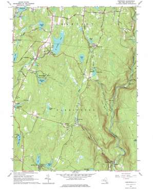
Hartwood Topo Map New York
To zoom in, hover over the map of Hartwood
USGS Topo Quad 41074e6 - 1:24,000 scale
| Topo Map Name: | Hartwood |
| USGS Topo Quad ID: | 41074e6 |
| Print Size: | ca. 21 1/4" wide x 27" high |
| Southeast Coordinates: | 41.5° N latitude / 74.625° W longitude |
| Map Center Coordinates: | 41.5625° N latitude / 74.6875° W longitude |
| U.S. State: | NY |
| Filename: | o41074e6.jpg |
| Download Map JPG Image: | Hartwood topo map 1:24,000 scale |
| Map Type: | Topographic |
| Topo Series: | 7.5´ |
| Map Scale: | 1:24,000 |
| Source of Map Images: | United States Geological Survey (USGS) |
| Alternate Map Versions: |
Hartwood NY 1966, updated 1967 Download PDF Buy paper map Hartwood NY 1966, updated 1976 Download PDF Buy paper map Hartwood NY 2010 Download PDF Buy paper map Hartwood NY 2013 Download PDF Buy paper map Hartwood NY 2016 Download PDF Buy paper map |
1:24,000 Topo Quads surrounding Hartwood
> Back to 41074e1 at 1:100,000 scale
> Back to 41074a1 at 1:250,000 scale
> Back to U.S. Topo Maps home
Hartwood topo map: Gazetteer
Hartwood: Airports
Monticello Airport elevation 470m 1541′Hartwood: Falls
Denton Falls elevation 285m 935′High Falls elevation 262m 859′
Hartwood: Lakes
Burnt Hope Lake elevation 376m 1233′Echo Lake elevation 401m 1315′
Forestburg Pond elevation 368m 1207′
Hemlock Lake elevation 394m 1292′
Melody Lake elevation 433m 1420′
Panther Pond elevation 449m 1473′
Ruddick Pond elevation 393m 1289′
Trout Lake elevation 445m 1459′
Trout Pond elevation 382m 1253′
Wildwood Lake elevation 433m 1420′
Hartwood: Populated Places
Hartwood elevation 419m 1374′Hartwood Club elevation 397m 1302′
Melody Lake elevation 451m 1479′
Merriewold Park elevation 424m 1391′
Oakland Valley elevation 234m 767′
Philwold elevation 419m 1374′
Saint Josephs elevation 440m 1443′
Squirrels Corners elevation 431m 1414′
Hartwood: Reservoirs
Crane Pond elevation 384m 1259′Gillman Pond elevation 417m 1368′
Merriewold Lake elevation 414m 1358′
Saint Josephs Lake elevation 436m 1430′
Hartwood: Streams
Bush Kill elevation 201m 659′Eden Brook elevation 244m 800′
Little Eden Brook elevation 241m 790′
Mercer Brook elevation 311m 1020′
Mullet Brook elevation 288m 944′
Turner Brook elevation 419m 1374′
Hartwood digital topo map on disk
Buy this Hartwood topo map showing relief, roads, GPS coordinates and other geographical features, as a high-resolution digital map file on DVD:
New York, Vermont, Connecticut & Western Massachusetts
Buy digital topo maps: New York, Vermont, Connecticut & Western Massachusetts


