Woodridge Topo Map New York
To zoom in, hover over the map of Woodridge
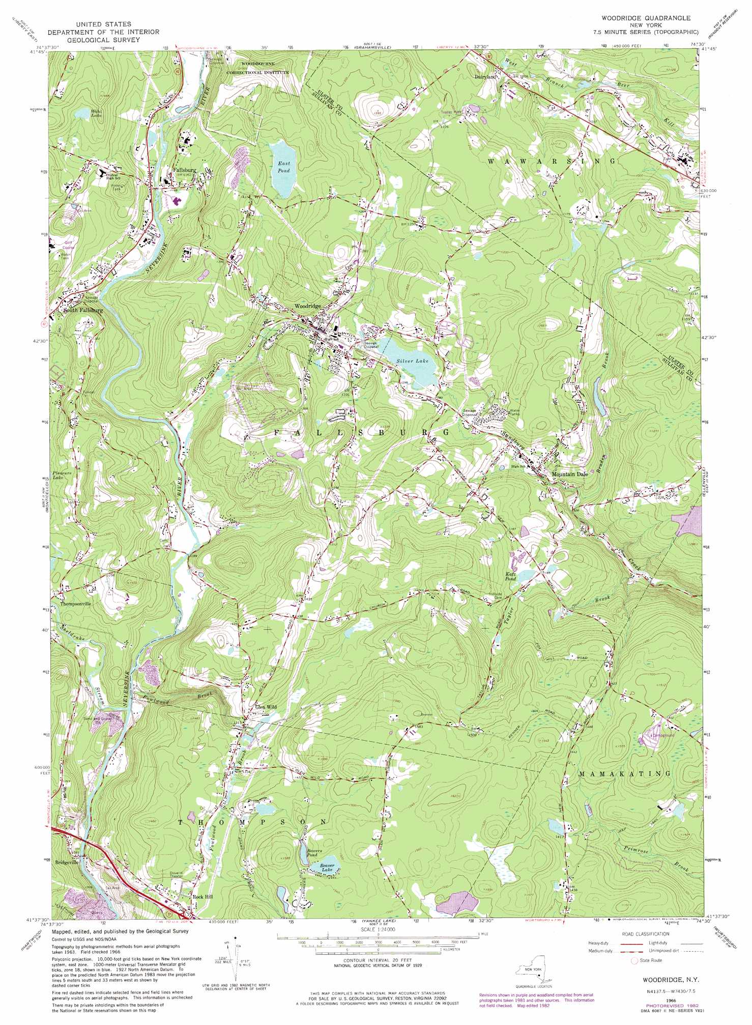
USGS Topo Quad 41074f5 - 1:24,000 scale
| Topo Map Name: | Woodridge |
| USGS Topo Quad ID: | 41074f5 |
| Print Size: | ca. 21 1/4" wide x 27" high |
| Southeast Coordinates: | 41.625° N latitude / 74.5° W longitude |
| Map Center Coordinates: | 41.6875° N latitude / 74.5625° W longitude |
| U.S. State: | NY |
| Filename: | o41074f5.jpg |
| Download Map JPG Image: | Woodridge topo map 1:24,000 scale |
| Map Type: | Topographic |
| Topo Series: | 7.5´ |
| Map Scale: | 1:24,000 |
| Source of Map Images: | United States Geological Survey (USGS) |
| Alternate Map Versions: |
Woodridge NY 1966, updated 1968 Download PDF Buy paper map Woodridge NY 1966, updated 1982 Download PDF Buy paper map Woodridge NY 2010 Download PDF Buy paper map Woodridge NY 2013 Download PDF Buy paper map Woodridge NY 2016 Download PDF Buy paper map |
1:24,000 Topo Quads surrounding Woodridge
Livingston Manor |
Willowemoc |
Claryville |
Peekamoose Mountain |
West Shokan |
Liberty West |
Liberty East |
Grahamsville |
Rondout Reservoir |
Kerhonkson |
White Lake |
Monticello |
Woodridge |
Ellenville |
Napanoch |
Highland Lake |
Hartwood |
Yankee Lake |
Wurtsboro |
Pine Bush |
Pond Eddy |
Port Jervis North |
Otisville |
Middletown |
Goshen |
> Back to 41074e1 at 1:100,000 scale
> Back to 41074a1 at 1:250,000 scale
> Back to U.S. Topo Maps home
Woodridge topo map: Gazetteer
Woodridge: Airports
Sullivan Correctional Facility Heliport elevation 412m 1351′Woodridge: Lakes
Beaver Lake elevation 459m 1505′Bowers Pond elevation 457m 1499′
East Pond elevation 420m 1377′
Katz Pond elevation 363m 1190′
Wohl Lake elevation 411m 1348′
Woodridge: Populated Places
Bridgeville elevation 318m 1043′Dairyland elevation 319m 1046′
Fallsburg elevation 368m 1207′
Glen Wild elevation 403m 1322′
Mountain Dale elevation 308m 1010′
Rock Hill elevation 420m 1377′
Woodridge elevation 354m 1161′
Woodridge: Reservoirs
Silver Lake elevation 326m 1069′Woodridge: Streams
Braden Brook elevation 285m 935′Fowlwood Brook elevation 323m 1059′
Sheldrake Stream elevation 323m 1059′
Taylor Brook elevation 256m 839′
Woodridge digital topo map on disk
Buy this Woodridge topo map showing relief, roads, GPS coordinates and other geographical features, as a high-resolution digital map file on DVD:
New York, Vermont, Connecticut & Western Massachusetts
Buy digital topo maps: New York, Vermont, Connecticut & Western Massachusetts