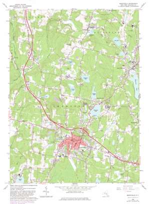
Monticello Topo Map New York
To zoom in, hover over the map of Monticello
USGS Topo Quad 41074f6 - 1:24,000 scale
| Topo Map Name: | Monticello |
| USGS Topo Quad ID: | 41074f6 |
| Print Size: | ca. 21 1/4" wide x 27" high |
| Southeast Coordinates: | 41.625° N latitude / 74.625° W longitude |
| Map Center Coordinates: | 41.6875° N latitude / 74.6875° W longitude |
| U.S. State: | NY |
| Filename: | o41074f6.jpg |
| Download Map JPG Image: | Monticello topo map 1:24,000 scale |
| Map Type: | Topographic |
| Topo Series: | 7.5´ |
| Map Scale: | 1:24,000 |
| Source of Map Images: | United States Geological Survey (USGS) |
| Alternate Map Versions: |
Monticello NY 1966, updated 1968 Download PDF Buy paper map Monticello NY 1966, updated 1983 Download PDF Buy paper map Monticello NY 1966, updated 1983 Download PDF Buy paper map Monticello NY 2010 Download PDF Buy paper map Monticello NY 2013 Download PDF Buy paper map Monticello NY 2016 Download PDF Buy paper map |
1:24,000 Topo Quads surrounding Monticello
> Back to 41074e1 at 1:100,000 scale
> Back to 41074a1 at 1:250,000 scale
> Back to U.S. Topo Maps home
Monticello topo map: Gazetteer
Monticello: Airports
Community General Hospital Heliport elevation 360m 1181′Scher Heliport elevation 471m 1545′
Wyde Heliport elevation 380m 1246′
Monticello: Lakes
Alta Lake elevation 385m 1263′Anawana Lake elevation 439m 1440′
Baileys Lake elevation 431m 1414′
Kiamesha Lake elevation 422m 1384′
Sackett Lake elevation 405m 1328′
Monticello: Parks
de Hoyos Memorial Park elevation 482m 1581′Monticello Amusement Park (historical) elevation 443m 1453′
Monticello: Populated Places
Bushville elevation 363m 1190′Harris elevation 360m 1181′
Hurleyville elevation 402m 1318′
Kiamesha Lake elevation 432m 1417′
Maplewood elevation 378m 1240′
Monticello elevation 461m 1512′
South Fallsburg elevation 386m 1266′
Thompsonville elevation 356m 1167′
Monticello: Reservoirs
Morningside Lake elevation 423m 1387′Pleasure Lake elevation 369m 1210′
Monticello: Streams
East Mongaup River elevation 341m 1118′Kiamesha Creek elevation 348m 1141′
Middle Mongaup River elevation 341m 1118′
Spring Brook elevation 347m 1138′
Tannery Brook elevation 408m 1338′
Monticello digital topo map on disk
Buy this Monticello topo map showing relief, roads, GPS coordinates and other geographical features, as a high-resolution digital map file on DVD:
New York, Vermont, Connecticut & Western Massachusetts
Buy digital topo maps: New York, Vermont, Connecticut & Western Massachusetts


