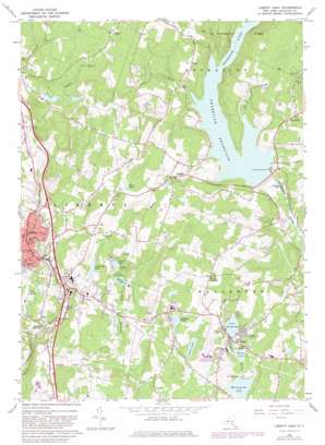
Liberty East Topo Map New York
To zoom in, hover over the map of Liberty East
USGS Topo Quad 41074g6 - 1:24,000 scale
| Topo Map Name: | Liberty East |
| USGS Topo Quad ID: | 41074g6 |
| Print Size: | ca. 21 1/4" wide x 27" high |
| Southeast Coordinates: | 41.75° N latitude / 74.625° W longitude |
| Map Center Coordinates: | 41.8125° N latitude / 74.6875° W longitude |
| U.S. State: | NY |
| Filename: | o41074g6.jpg |
| Download Map JPG Image: | Liberty East topo map 1:24,000 scale |
| Map Type: | Topographic |
| Topo Series: | 7.5´ |
| Map Scale: | 1:24,000 |
| Source of Map Images: | United States Geological Survey (USGS) |
| Alternate Map Versions: |
Liberty East NY 1966, updated 1968 Download PDF Buy paper map Liberty East NY 1966, updated 1983 Download PDF Buy paper map Liberty East NY 2010 Download PDF Buy paper map Liberty East NY 2013 Download PDF Buy paper map Liberty East NY 2016 Download PDF Buy paper map |
1:24,000 Topo Quads surrounding Liberty East
> Back to 41074e1 at 1:100,000 scale
> Back to 41074a1 at 1:250,000 scale
> Back to U.S. Topo Maps home
Liberty East topo map: Gazetteer
Liberty East: Bays
Theodore Gordon Cove elevation 439m 1440′Liberty East: Lakes
Dixie Lake elevation 439m 1440′Evens Lake elevation 424m 1391′
Grossingers Lake elevation 436m 1430′
Hilldale Pond elevation 438m 1437′
Kees Lake elevation 503m 1650′
Loch Sheldrake elevation 444m 1456′
Luzon Lake elevation 420m 1377′
Sunset Lake elevation 448m 1469′
Liberty East: Parks
Liberty Municipal Park elevation 447m 1466′Morningside Park elevation 423m 1387′
Liberty East: Populated Places
Aden elevation 516m 1692′Bradley elevation 477m 1564′
Cooley elevation 590m 1935′
Divine Corners elevation 481m 1578′
Ferndale elevation 410m 1345′
Liberty elevation 459m 1505′
Loch Sheldrake elevation 444m 1456′
Liberty East: Reservoirs
Lake Ophelia elevation 492m 1614′Neversink Reservoir elevation 438m 1437′
Liberty East: Streams
Aden Brook elevation 439m 1440′Conklin Brook elevation 439m 1440′
Hollow Brook elevation 441m 1446′
Theodore Gordon Brook elevation 439m 1440′
Trout Brook elevation 420m 1377′
Liberty East digital topo map on disk
Buy this Liberty East topo map showing relief, roads, GPS coordinates and other geographical features, as a high-resolution digital map file on DVD:
New York, Vermont, Connecticut & Western Massachusetts
Buy digital topo maps: New York, Vermont, Connecticut & Western Massachusetts


